


Ann Arbor Adds Notches to Eligible Greenbelt
At its Dec. 5, 2011 meeting, the Ann Arbor city council gave final approval to a change in the boundaries for the city’s greenbelt program – an open space preservation effort funded by a 0.5 mill tax approved by voters in 2003.
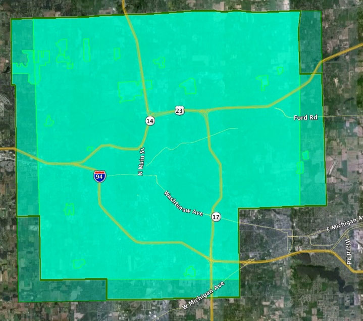
The area in and around Ann Arbor eligible for land preservation under the greenbelt program is defined in Chapter 42 of the Ann Arbor city code. The council has expanded the boundaries once before, in 2007. The current proposal is essentially to square-off the area by adding a mile to the southwest in Lodi Township, and one mile to the northeast in Salem Township. [.jpg of map by The Chronicle showing original boundaries, the 2007 expansion and the currently proposed expansion]
As part of the amendment to Chapter 42, the council approved a change that allows a parcel of land adjacent to the greenbelt boundary to be eligible for protection, if it is also adjacent to a parcel under the same ownership within the greenbelt boundary. The greenbelt advisory commission had voted to recommend the ordinance changes at its Sept. 14, 2011 meeting. The council gave the changes initial approval at its Nov. 21, 2011 meeting.
Since the start of the greenbelt program, roughly $18 million has been invested by the city of Ann Arbor in protecting open space. That has been matched by roughly $19 million from other sources, including the federal Farm and Ranch Land Protection Program, surrounding townships, Washtenaw County and landowner donations. That funding has protected roughly 3,200 acres in 27 separate transactions.
This brief was filed from the city council’s chambers on the second floor of city hall, located at 301 E. Huron. A more detailed report will follow: [link]