Recommendations Set for Downtown Zoning
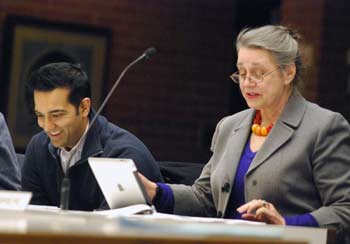
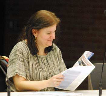
Ann Arbor planning commission meeting (Dec. 3, 2013): Following months of public input and review by a consultant hired by the city, Ann Arbor planning commissioners finalized a set of recommendations to revise parts of the city’s downtown zoning. Those recommendations will now be forwarded to the city council, possibly at its Jan. 20 meeting.
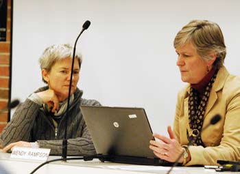
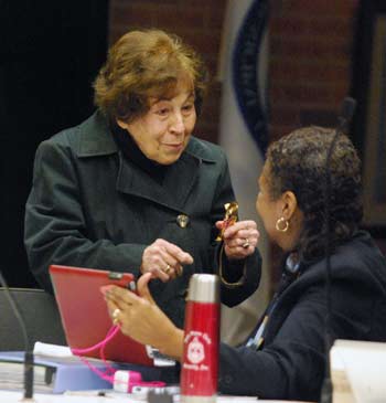
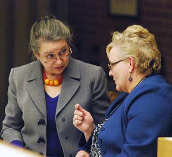
From left: Ann Arbor planning commissioner Bonnie Bona talks with city planning manager Wendy Rampson before the start of the commission’s Dec. 3, 2013 meeting. Bona was successful in advocating for the downzoning of a parcel at the southeast corner of Main and William. (Photos by the writer.)
In general, the recommendations aim to create more of a buffer between downtown development and adjacent or nearby residential neighborhoods.
Three of the recommendations relate to specific parcels: (1) Rezone the parcel located at 336 E. Ann from D1 (downtown core) to D2 (downtown interface); (2) Reduce the maximum height in the East Huron 1 Character District (on the north side of Huron, between Division and State) to 120 feet. Include a tower diagonal maximum and consider a step-back requirement to reduce the shading of residential properties to the north; (3) Rezone the parcel at 425 S. Main, at the southeast corner of Main and William, from D1 (downtown core) to D2 (downtown interface) and establish a maximum height of 60 feet for D2 zoning in the Main Street Character District.
Several other recommendations focused on the issue of “premiums” – certain features that a developer can provide in exchange for additional square footage. Those recommendations are: (1) Revise the premium conditions to require mandatory compliance with core design guidelines for a project to receive any premium in the D1 or D2 districts; (2) Reduce the residential premium with the goal of encouraging the use of other existing or proposed premiums to compensate for this reduction, such as increased energy efficiency certification, open space with landscape, active ground floor use, balconies and workforce housing; (3) Review options in D1 and D2 districts, with the housing and humans services advisory board (HHSAB), for providing additional affordable housing within mixed income projects or through other funding mechanisms; (4) Eliminate the affordable housing 900% FAR (floor area ratio) “super premium”; and (5) Evaluate the downtown real estate market to determine the effectiveness of premium incentives every 2-5 years.
On Dec. 3, commissioners heard from three people during the public hearing – all three of them addressing the issue of zoning at 425 S. Main, including one of the property owners, Andy Klein. Speaking on behalf of the owners was Scott Bonney of Neumann/Smith Architecture, who suggested a third option to consider: Keep the D1 zoning on that site, but reduce the maximum height to 122 feet and add a tower diagonal maximum of 50% of the maximum diagonal dimension of the site. Ted Annis, who lives near that location, called for D2 zoning there.
Bonnie Bona, who’d been involved in the original A2D2 zoning process that’s now being partially reviewed, advocated for downzoning the entire site at 425 S. Main, to provide a buffer between D1 zoning and the nearby residential neighborhood. Some commissioners, including chair Kirk Westphal, wanted more density in the downtown, and noted that the site has allowed for denser development since the 1960s. The final vote on the recommendation for that site was 5-4, with support from Bona, Eleanore Adenekan, Sabra Briere, Jeremy Peters and Wendy Woods. Voting against it were Westphal, Ken Clein, Diane Giannola and Paras Parekh.
Also, because of feedback received from the city’s design review board, commissioners revisited a recommendation that they’d previously settled regarding compliance with design guidelines. They unanimously voted to change the recommendation – so that it would require mandatory compliance with some of the design guidelines. The intent is to develop a process that will clarify the design compliance that will be required in order to receive premiums.
The vote on the full resolution with all of the recommendations, as amended, passed unanimously.
The next step is for the council to review the recommendations and give direction back to the commission about which recommendations to implement. At that point, the commission’s ordinance revisions committee would work with city planning staff to craft actual ordinance language. Any specific ordinance changes would be reviewed by the full planning commission and ultimately would require city council approval before taking effect. That process would include additional opportunities for public input.
Also on Dec. 3, commissioners reviewed the 2015-2020 capital improvements plan (CIP). After about an hour of discussion – touching on street lights, sidewalks, the rail station, public engagement, and other issues – they voted unanimously to adopt the updated CIP as a supporting document for the city’s master plan, and to recommend that the city council base its FY 2015 capital budget on the CIP.
The CIP includes a list of major capital projects, both those that are funded and those for which funding hasn’t yet been identified. [.pdf of staff memo and CIP for FY 2015-2020] Most of the updates relate to FY 2015, which begins on July 1, 2014. This year reflects the first-time inclusion of projects undertaken by the Ann Arbor Downtown Development Authority and the Ann Arbor housing commission.
Downtown Zoning Review
The downtown zoning evaluation began earlier this year, following a city council directive to the planning commission on April 1, 2o13 that was prompted in part by the controversial 413 E. Huron development, at the northeast corner of Huron and Division. The council’s direction was for the planning commission to make recommendations to the city council by Oct. 1.
Planning consultant ENP & Associates was hired to gather public input and evaluate certain aspects of downtown zoning known as A2D2 (Ann Arbor Discovering Downtown), which was adopted in 2009. ENP’s Erin Perdu took the lead on this project.
Her report had been originally presented at the commission’s Oct. 8, 2013 working session. [.pdf of consultant's downtown zoning report] [.pdf of Appendix A: city council resolution regarding zoning review] [.pdf Appendix B: list of downtown development projects since 2000] [.pdf of Appendix C: public input results]
Commissioners held a public hearing on the consultant’s recommendations that began on Oct. 15, 2013, and continued at their Nov. 6, 2013 meeting. They also discussed the recommendations at a Nov. 12 working session. Based on that discussion, planning manager Wendy Rampson made revisions to Perdu’s original set of recommendations. Rampson drafted a memo and resolution containing these revised recommendations, which served as the basis for the Nov. 19 discussion. [.pdf of Nov. 19 memo and draft resolution]
The commission continued the public hearing and debated most of these recommendations at its Nov. 19, 2013 meeting, which adjourned at about 12:30 a.m. The group did not tackle the most controversial item that night: Possible changes to the parcel at 425 S. Main, at the southeast corner of Main and William.
On Dec. 3, commissioners picked up the topic and heard from three people during the ongoing public hearing – all three of them addressing the issue of zoning at 425 S. Main. Following that, the commission’s discussion focused on 425 S. Main, as well as revisiting a recommendation related to the design guidelines.
For additional background on this process, see Chronicle coverage: “Feedback on Downtown Zoning Continues“; “Downtown Zoning Review Nears Final Phase“; “Priorities Emerge in Downtown Zoning Review”; ”Downtown Zoning Review Moves Forward” and “Downtown Zoning Review to Wrap Up Soon.”
Downtown Zoning Review: Public Hearing
Ted Annis told commissioners that he lived across the street from the property at 425 S. Main. He’d been following the commission’s recommendations and had been glad to see that – at their Nov. 12 working session – they had agreed that the parcel should be zoned D2 and not D1. He supported that decision.
He read aloud from an email he sent out to his neighborhood group and other neighborhood groups after that meeting. In the email, he stated that the planning commission had agreed to change the zoning to D2 rather than the D1 zoning that had been recommended by the consultant. [The commission didn't formally vote on any of the recommendations at that working session, though they did discuss the recommendations and indicated some support for downzoning.]
Annis called the D2 zoning “more logical and aesthetically pleasing” for building heights downtown. He thought that the outcome would be accepted by the downtown community, with the exception of one or two property owners. “Unless there is a last minute flip-flop by planning commission, city council should be spared the agony of the downtown zoning fight,” he said.
Referring to a proposal from the owners of 425 S. Main for a modified D1 zoning, Annis told commissioners that he didn’t agree with that. “I think D2 makes sense for that parcel, and most of the downtown citizens that I work with agree to that,” he concluded.
Andy Klein spoke next, introducing himself as one of the owners of 425 S. Main. Noting that he’d spoken to the commission on previous occasions, Klein said this site was developed 30 years ago and it’s a valuable asset to the community. The real question is the future, he said. They have a tenant with a long-term lease, but in the long-term, the question is whether they’ll be able to build a landmark building there. Obviously, they’d want to develop something that has value and that’s important to the community, he said.
The change from D1 to D2 would represent a 70% reduction in allowable height, Klein noted. “That’s not urban planning. That’s just a knee-jerk reaction to reduce height because people have been unhappy with other developments.” He pointed out that the consultant, Erin Perdu, had recommended a 150 feet height limit on the site. Klein then introduced Scott Bonney of Neumann/Smith Architecture, who had been hired to come up with a “reasonable solution” for the site. Klein noted that Neumann/Smith had designed Zaragon West, a building that he described as successful for this community. [The apartment building, with retail on the first floor, is located at the southeast corner of Thompson and William.]
Scott Bonney told commissioners that his firm designed Zaragon Place before A2D2 was enacted. [That apartment complex, also with retail on the ground floor, is on East University between Willard and South University.] He said the city “sort of wrote the ordinance around that, what we did at Zaragon Place.” After that, he added, Zaragon West was the “poster child for D1.”
Bonney reviewed some slides that showed an alternative zoning for the 425 S. Main site, as well as what could be built given the current zoning in that area. [.pdf of Bonney's slides] D1 zoning allows a height of 180 feet, while D2 areas have a height of 60 feet. The alternative proposal put forward by Bonney would match the height of Ashley Mews, which is located on the opposite side of Main Street from the 425 S. Main site. The suggestion was to put a 122-foot height limit on the property as a compromise, as well as keeping a diagonal restriction. [Diagonals are a method of controlling shape, and typically allow for taller but less massive buildings.]
Bonney said that a 122-foot building is lower than what is allowed nearby under D1 zoning, and that a diagonal requirement would result in slender buildings. He urged commissioners to consider this alternative zoning.
Downtown Zoning Review: Commission Discussion – Main & William Site
Kirk Westphal began the discussion by asking planning manager Wendy Rampson to review the history of the 425 S. Main site.
Rampson described the area’s zoning prior to the adoption of A2D2 in 2009. The site was previously zoned C2BR, based on zoning categories established in 1963. What’s now called the core downtown was zoned C2A, with the fringe downtown zoned C2B. That zoning didn’t allow for residential use in the downtown core, so subsequently zones were created (C2AR, C2BR) where residential use was permitted. After several high-rises were built – including Campus Inn, Tower Plaza and University Towers – the city commissioned a study of the downtown zoning, conducted by JJR.
Until 2009, there were no height limits in the C2A, C2AR, C2B and C2BR zoning districts. For parcels zoned C2BR – including 425 S. Main – there was a 300% by-right floor-area ratio (FAR) and up to 600% FAR with premiums. [FAR, a measure of density, is the ratio of the square footage of a building divided by the size of the lot. A one-story structure built lot-line-to-lot-line with no setbacks corresponds to a FAR of 100%. A similar structure built two-stories tall would result in a FAR of 200%.]
When the premiums were revised in the 1990s, that FAR for C2BR districts increased to 660%. The D1 zoning on the 425 S. Main site now is fairly similar to the previous zoning, Rampson said, aside from the height limit and change in premiums.
Sabra Briere asked Rampson to explain why there was an increase in the use of PUDs (planned unit developments) between 1985 and 2005. Rampson said the increase was due primarily to limitations on FAR. One North Main and 305 E. Liberty were PUDs, for example, because the buildings exceeded the 600% FAR. The PUDs were one way to get bigger buildings in terms of floor area, not necessarily height, she said.
Westphal asked whether the 425 S. Main site had been discussed during the A2D2 process. Had the D1 zoning been called into question?
All of the “edge” parcels were discussed during A2D2, Rampson replied. Any of the properties that abutted residential or that were constrained by the floodplain were debated. The areas along the north side of East Huron as well as along some parts of South University were “hotly debated,” she recalled. The 425 S. Main site had been discussed, she said, “but not at the same level.”
In order to lessen the impact of D1 in some areas, the height limit was reduced for certain character overlay districts – including on East Huron and South University. [.pdf of character overlay district maps]
Bonnie Bona provided additional historical context regarding the A2D2 process. The council had created several committees to tackle specific aspects of the project, like design guidelines, historic districts and zoning. Bona served on the committee that looked at zoning. That group decided that the entire D1 core should be surrounded by D2, she said – and that was the recommendation that the zoning committee sent to an A2D2 steering committee. The steering committee changed that recommendation, however. The discussion centered around whether a block should be split into different zoning districts, Bona recalled.
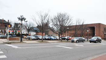
Looking east at 425 S. Main, on the southeast corner of Main and William. The northern half of the site is a surface parking lot, with a building that houses DTE offices on the southern half. Nearby residential houses are visible to the east of the property.
On East Huron, for example, the zoning committee had recommended placing D2 between residential areas and D1 districts. The exception was on parcels adjacent to the University of Michigan, because the university can build whatever it wants, Bona said, so there was no need for a transition zone.
So why did the D2 recommendation get changed? Some people felt that when you’re driving along East Huron, Bona explained, “the buildings should be the same on both sides.” The problem is that it’s a very shallow site between parcels on the north side of East Huron and the Old Fourth Ward, she noted. So the zoning committee had recommended D2 for the north side of East Huron. The steering committee wanted the same zoning on both sides instead.
The 425 S. Main site probably got changed from D2 to D1 because of its history, Bona said, and because of the desire to have the same zoning on both sides of Main Street. “I don’t agree with that,” she added. “I think the world is much more interesting when it’s not so completely obvious and literal.” There were a lot of changes during the A2D2 process, she noted. “It wasn’t quite horse trading, but it kind of felt like that. What it felt like was ‘What hill am I going to die on, and what am I going to let go?’ – for everyone on the planning commission, and everyone on the council. Everybody kind of had their favorite spot that they wanted to protect, and had to compromise on others.”
Westphal asked Rampson to review the zoning of parcels surrounding the 425 S. Main site. She explained that adjacent parcels along William – including where the Beer Depot is located – are zoned D2, with residential zoning (R4C) further south on Fourth Avenue. Responding to a query from Sabra Briere, Rampson said that the parcels along the south side of William, east of the alley that separates the Beer Depot site from the 425 S. Main site – are in the East William historic District. [.pdf of East William historic district map]
Rampson explained that parcels in a historic district can’t use premiums. So sites that are zoned D2 would be limited to 200% FAR. Bona noted that if a 200% FAR building filled the entire site of a parcel located in an historic district, the building could not be 60 feet tall, because of the FAR limitations.
Overall, the idea of the A2D2 process was to reduce the density in some areas with D2 zoning, Rampson explained. The 425 S. Main site was zoned D1 – with a height limit of 180 feet – because it was considered to be part of the Main Street character district.
Commissioners also discussed the possibility of using split zoning on the site – the northern half toward William as D1, and the southern half toward Packard as D2. Diane Giannola wondered whether that would mean that a tower could be built on the northern half, but not on the southern half. That’s right, Rampson replied.
Jeremy Peters wondered about the height of the Bethlehem United Church of Christ on South Fourth. It seemed taller than nearby residential structures, he said. That’s true, Rampson said, but she didn’t know how tall it was.

Slide by architect Scott Bonney showing potential structures on and around 425 S. Main. In the foreground is planning commission chair Kirk Westphal.
Bona said that to her, the entire 425 S. Main site should be zoned D2. If split zoning were used, she’d only support D1 zoning on the very north end, next to the Beer Depot – “and that’s hardly worth doing.” Sixty feet height limits are still a big transition to residential areas, she said, and anything higher than that “would be unfortunate.”
Westphal clarified with Rampson that if the site had split zoning, only two residential parcels would directly abut the D1 portion. He felt that’s why the split-zoning proposal is compelling.
Bona expressed concern about affecting even those two residential properties. “Those houses are just as important to not overpower as a whole row of them,” she said.
Diane Giannola liked the idea of split zoning, saying that it would look better visually. With D2, she’s worried about getting a long, 60-foot-high building on the entire site. “I’d rather have taller, more compact buildings,” she said, not a huge, massive apartment building. She thought the city could get a better building with D1 zoning and a 120-foot height limit on the northern part of the site.
Briere described the site as massive. With D2 – a 200% FAR – you could build quite a large building, she said, even without premiums. She suggested considering whether there should be mandatory open space, so that the entire FAR couldn’t be used. “I’m really frustrated at talking about this,” she said, because it’s not clear how to go about getting the right design. “So much of it depends on the quality of the developer.”
Bona suggested that the issue of blocky versus slender buildings could be addressed by using diagonals, rather than split zoning.
Bona also clarified with Rampson that if the site were rezoned to D2, the owners could still seek a PUD (planned unit development) to build more square footage in exchange for community benefits. Westphal followed up by asking whether PUDs are something that the city wants to encourage. “No,” Rampson replied. One of the stated goals of the A2D2 process was to eliminate a trend of using PUDs to develop downtown sites.
Ken Clein reviewed the zoning of D1 – with by-right FAR of 400%, and more FAR with premiums – compared to D2, with by-right FAR of 200%, and up to 400% with premiums.
Westphal pointed to the city’s master plan and the issue of density, and the notion that denser development should be located downtown, near public transit. It’s compelling to him to have opportunities for people to live without relying on cars. If the parcel were downzoned, that could potentially eliminate housing for 100 or 200 people, he said. The master plan also talks about protecting residential areas, so that’s why he’s struggling with this site.
This is the most challenging parcel of those that the council directed the commission to look at, Clein said. The site is so large that you could probably put two or three buildings on it that are the size of Zaragon West. The process that the commission and city council have to go through is to balance the rights of property owners with the ability to develop downtown property to support the tax base, Clein said, and to protect the rights of the nearby neighbors. “It’s a compromise, no matter what,” he said.
Personally, as an architect, Clein said, he’d be very comfortable with zoning the entire site as D2. However, it was instructive to hear about the site’s history, he added, and to know that the property has been zoned something similar to D1 since the mid-1960s. You could say that the owners had their chance to develop it, but didn’t – so “too bad,” Clein said. Or you could say to the neighbors that development could have happened at any time over the past few decades. “There’s validity in both of those points,” he said.
Split zoning would offer a compromise to greater density and height, Clein added. Alternatively, one option would be to change the maximum height of the Main Street character district, and to add a diagonal requirement, he said. Given the site’s history, he’d be willing to support a compromise that would leave part of the site D1, especially at the corner.
Bona added another piece of historical context, referring to the downtown plan that was written in 1988. It was the first time that the concept of “interface zones” between downtown and residential neighborhoods was introduced. When the A2D2 process took place nearly 20 years later, none of the recommendations for interface zones had been enacted, she said. “So this isn’t a new issue that came up now,” she said. “The neighborhoods around downtown have been fighting for an interface zone since 1988 – and probably before that.”
Commissioners continued discussing the option of split zoning, along with some combination of step-backs and diagonals, to limit the impact on the residential neighborhood.
Bona said she personally didn’t like the character overlay zoning, finding it “overly detailed.” If the commission wants to recommend step-backs or diagonals, they should do it for the entire downtown, she said, not just this site. Noting that commissioners seemed to be stuck, Bona formally put forward a recommendation: To rezone the entire site D2, and to establish a maximum height of 60 feet for D2 in the Main Street character district.
Westphal asked Rampson to review the height limits in D2 districts. She explained that height is determined by character district, and there is no current D2 zoning in the Main Street character district. For D2 sites in all other character districts, however, the height limit is 60 feet.
Clein floated the possibility of having two different heights on the site, even if the entire site were zoned D2. Briere clarified with Rampson that there’s a two-story minimum height in D2 districts. The by-right FAR is 200%, and up to 400% with premiums.
Westphal noted that by downzoning the site to D2, it would go from a possible 900% FAR (with premiums) to 400% (with premiums). In terms of affecting the property’s value, he said, it’s a challenge to rezone the entire site as D2. Bona replied that from a density perspective, 400% FAR is still a lot – and it’s a lot more density than the R4C zoning. Also, 60 feet is a tall building that belongs downtown, not in the neighborhoods, she said.
Concerns about massiveness are important, she said, and it’s something that the design guidelines attempted to address. She suggested revisiting the design guidelines as the best way to handle those concerns, noting that it’s a problem everywhere, not just at this site. Development of the Brown Block – currently a surface parking lot bounded by Huron, Ashley, Washington and First streets – is “a scary thought,” Bona said. The idea of using diagonals or step-backs for one site almost creates spot zoning, she said, which isn’t a desired approach.
After additional back-and-forth, commissioners voted on Bona’s proposed recommendation:
Rezone the parcel at 425 S. Main from D1 (downtown core) to D2 (downtown interface) and establish a maximum height of 60 feet for D2 zoning in the Main Street character district.
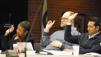
Outcome: Commissioners approved the recommendation on a 5-4 vote, with support from Bonnie Bona, Eleanore Adenekan, Sabra Briere, Jeremy Peters and Wendy Woods. Voting against it were Kirk Westphal, Ken Clein, Diane Giannola and Paras Parekh.
Downtown Zoning Review: Commission Discussion – Design Review
During her update to the commission, planning manager Wendy Rampson reported that she’d met with the design review board in November to go over the commission’s draft recommendations. Board members had expressed some concern, she said, for the recommendation that they felt would make the board the “sole gatekeeper” for premiums. The design guidelines were drafted to be flexible, they said, and weren’t intended to be structured for decision-making. “They were worried that they’d be placed in a position of having some pretty subjective standards to apply to a project, and saying yea or nay to whether a project can obtain premiums,” Rampson said.
In general, the design review board members felt there was value for the board to being involved in the discussion about premiums, Rampson said. They thought it would make sense to have a joint meeting with the planning commission to flesh out some of these issues, she said.
Rampson noted that at this point, there are no items on the agenda for the commission’s Jan. 7 meeting, so it might be possible to schedule a joint meeting then. Another possibility would be the Jan. 14 working session.
Bonnie Bona said that based on this feedback, she’d like to discuss the recommendation that commissioners had previously voted on at their Nov. 19, 2013 meeting. That recommendation stated:
Revise the premium conditions to require compliance with Design Review Board recommendations for a project to receive any premium in the D1 or D2 districts.
Bona noted that when A2D2 was being developed, the planning commission and city council had considered making the design review guidelines mandatory. “So it’s not like we haven’t had this discussion before,” she said, adding that she thought it would be good to discuss the option of making some guidelines mandatory.
Jeremy Peters didn’t think the commission needed to button down details at this point. The recommendation didn’t call for mandated compliance, he said. The commission was just recommending that the council consider requiring compliance, he said.
Ken Clein agreed with Peters, and was in favor of leaving the recommendation unchanged. Bona noted that the language of the resolution stated that the commission was making a set of recommendations, and the recommendation for this item was to require compliance. “We’re not recommending to consider requiring compliance,” she said. “We’re recommending requiring compliance.”
If the commission feels, based on feedback from the design review board, that they should “tread carefully around that and get more input,” she said, “I think we might make this more of a consideration rather than a requirement.”
Wendy Woods expressed concern that if the recommendation is changed, it will end up with what is currently in place – that a developer can consider input from the design review board, but not actually make changes to the design. She wasn’t in favor of changing the recommendation, but supported having a conversation with the design review board.
Ken Clein noted that there seemed to be some confusion over the word “consider.” There’s a difference between asking council to consider a recommendation, compared to recommending that a developer consider input from the design review board. So in the planning commission’s recommendations to council, he said, commissioners should be very clear about their intent.
Bona indicated that Woods had interpreted her suggestion in a completely different way than what she had intended, so it hadn’t been clear.
Sabra Briere said she’d be happy if the planning commission could use input from the design review board as a tool to determine whether a project has met all the requirements of the ordinance – without making the design review board more powerful than it was created to be. It was designed to be a voluntary board that gives advice, she said, but not as a board to make recommendations about whether to approve a project. She’d like to include the board’s input as part of the approval process regarding premiums, “rather than the design review board handing us a fait accompli, and we feel our hands are tied then.”
As a way to incorporate Briere’s comments, Peters suggested a possible alternative recommendation: “Revise the premium conditions to allow the planning commission to use design review board recommendations for a project to receive any premium in the D1 or D2 districts.”
Clein agreed that he didn’t want to put a new burden on the design review board, or hamstring the planning commission or city council. However, members of the community as well as developers have both indicated that they want the city to “Tell us what you want,” he said. So he’s reluctant to do anything that will make it less clear to developers what’s required in order to secure premiums.
Bona noted that when it was decided that the design guidelines would be voluntary, the guidelines were written in a different way than if they had been mandatory. Not every design guideline should be mandatory, she added. On the other hand, there were things that didn’t become mandatory in 2009 that should perhaps now be revisited, Bona said. She wanted to recommend a mandatory requirement for some of the design guidelines. If the council agrees, then the commission and others can look at which guidelines should be mandatory versus voluntary.
Another thing to be determined is which body – the design review board, planning commission or council – determines whether those mandatory requirements have been met, Bona said.
Diane Giannola interpreted the commission’s original recommendation as simply requiring compliance with the design review board’s report on a project, not requiring compliance with all of the design guidelines.
Bona then made another suggestion for revision: “Revise the premium conditions to consider requiring mandatory compliance with some design guidelines for a project to receive any premium in the D1 or D2 districts.”
Clein suggested replacing the word “some” with “core” – to indicate that it will be a subset of the overall guidelines. Bona agreed to that change.
Woods said she’d support this, but expressed concern that the recommendation was in danger losing the essence of its original intent. “It’s starting to feel a little watered down from where it started,” she said.
Westphal wanted to eliminate the word “consider.” Bona said she’d be in favor of that, noting that she’d included the word as a reflection of the concerns cited by the design review board. Westphal thought that using “design guidelines” rather than “design review board” addressed that concern.
Rampson noted the design review board had mentioned another initiative that the council had started, but that hasn’t moved ahead: A review of the design guidelines. [A task force was established through council action on March 4, 2013 to review the downtown design guidelines, but that group has not yet met. Westphal had served on the original design guidelines task force in 2010, but had asked to be removed from the group when it was reconstituted earlier this year.] The expectation was that these two efforts – a review of downtown zoning, and a review of the design guidelines – would go hand-in-hand, Rampson said.
Rampson characterized the current guidelines, which were adopted by the council in 2011, as “fairly subjective and qualitative.” [.pdf of design guidelines]
Briere said she’d ask mayor John Hieftje if the design guidelines review could move ahead.
Woods expressed some concern about whether the commission would be taking on a much bigger task – if their recommendation opened the door for a broader review of design guidelines. The term “design guidelines” seemed nebulous, she said, and she wondered if it referred to “a list of things that everybody learns in Landscape 101 or urban planning? What is that? What really are we saying?”
Bona replied, saying there might be some changes recommended to the city’s existing design guidelines, based on the task force review. “There is no magic book of design guidelines,” she added. “It’s whatever we want to put in there, and we think we can figure out a way to get.”
Eleanore Adenekan weighed in, saying she wanted to make sure the word “consider” had been removed from the revised recommendation.
Bona described the review of design guidelines as a project, and she didn’t think the guidelines would be nebulous after that project is completed. The end result should be a clear set of mandatory design requirements and voluntary guidelines.
The final revised recommendation states:
Revise the premium conditions to require mandatory compliance with core design guidelines for a project to receive any premium in the D1 or D2 districts.
Outcome: Commissioners unanimously approved this recommendation.
Downtown Zoning Review: Commission Discussion – Main Street Character District
Sabra Briere indicated that she had some concerns about height in the Main Street character district. The community has not absorbed the fact that four buildings on Main Street could be demolished and replaced with 180-foot buildings as infill. There are two buildings now that are empty – the former Middle Kingdom restaurant, and the former house where an ice cream parlor was located. Planning manager Wendy Rampson reported that those sites are in the Main Street historic district, so the heights would be limited. [.pdf of Main Street historic district map] Rampson noted that the southern edge of the district has a jagged edge, and there are some properties between Liberty and William that aren’t in the district.
Briere noted that the surface parking lot at the northeast corner of Main and William – next to Palio restaurant – isn’t in the historic district, nor are the buildings directly north of that.
In general, Briere anticipates that there will be problems in this area, but she noted that it’s not part of the council’s current charge to the planning commission. She said she didn’t want mission creep, but it might be appropriate to discuss this issue as part of a review of the design guidelines.
Outcome: There was no formal recommendation on this item.
Downtown Zoning Review: Commission Discussion – Main Motion
The final set of recommendations, as amended, are:
- Rezone the parcel located at 336 E. Ann from D1 (downtown core) to D2 (downtown interface).
- Reduce the maximum height in the East Huron 1 Character District (on the north side of Huron, between Division and State) to 120 feet. Include a tower diagonal maximum and consider a step-back requirement to reduce the shading of residential properties to the north.
- Rezone the parcel at 425 S. Main, at the southeast corner of Main and William, from D1 (downtown core) to D2 (downtown interface) and establish a maximum height of 60 feet for D2 zoning in the Main Street Character District.
- Revise the premium conditions to require mandatory compliance with core design guidelines for a project to receive any premium in the D1 or D2 districts.
- Reduce the residential premium with the goal of encouraging the use of other existing or proposed premiums to compensate for this reduction, such as increased energy efficiency certification, open space with landscape, active ground floor use, balconies and workforce housing.
- Review options in D1 and D2 districts, with the housing and humans services advisory board (HHSAB), for providing additional affordable housing within mixed income projects or through other funding mechanisms.
- Eliminate the affordable housing 900% FAR (floor area ratio) “super premium.”
- Evaluate the downtown real estate market to determine the effectiveness of premium incentives every 2-5 years.
Outcome: Commissioners unanimously approved these recommendations, which will now be forwarded to the city council for consideration.
Rampson told commissioners that unless the recommendations move forward in an expedited way, it’s likely that they’ll be included at the council’s second meeting in January – on Jan. 20, 2014.
Capital Improvements Plan 2015-2020
The Dec. 3 agenda included a resolution to approve the city of Ann Arbor’s capital improvements plan (CIP) for 2015-2020.
The CIP provides a roadmap for investments in a wide variety of infrastructure projects. It is prepared by city staff and is the basis for budget decisions made by the city council, but the council does not approve the CIP. That’s the purview of the planning commission.
Required by state statute, the CIP must be developed and updated each year, looking ahead at a six-year period, to help with financial planning for major projects – permanent infrastructure like buildings, utilities, transportation and parks. It’s intended to reflect the city’s priorities and needs, and serves as a guide to discern what projects are on the horizon. Major updates are conducted every two years. This year is considered an “off” year with only minor adjustments.
The updated plan covers the fiscal years 2015-2020, but most of the updates relate to FY 2015, which begins on July 1, 2014. It includes a list of major capital projects, both those that are funded and those for which funding hasn’t yet been identified. [.pdf of staff memo and CIP for FY 2015-2020] The plan indicates changes in scheduling compared to the previous CIP, as well as funding adjustments and new projects. In the report, new projects are indicated with gray shading. This year the gray shading primarily reflects first-time inclusion of projects undertaken by the Ann Arbor Downtown Development Authority and the Ann Arbor housing commission.
The DDA’s projects are included this year due in part to an ordinance change approved by the city council on Nov. 18, 2013 which added, among other language: “The authority shall submit their capital budgets to incorporate them into the city’s capital improvement plan (CIP).”
The CIP contains over 300 projects in 13 different asset categories. Of those, 127 projects require funding in FY 2014 – the current fiscal year, which began on July 1, 2013 – or in FY 2015. Funding needed in FY 2015 totals $62.253 million. That’s $11,881,800 (23.59%) more in FY 2015 than was included in last year’s CIP. But most of that increase is due to the addition of the DDA and housing projects. If those projects weren’t included, funding needs for FY 2015 would have dropped by 27.55%, That’s because many FY 2015 street construction projects were pushed back to FY 2016 or later to allow time to develop a pavement asset management program.
The housing commission projects primarily relate to an effort to renovate and redevelop the city’s public housing properties. [See Chronicle coverage: "Work Progresses on Public Housing Overhaul."]
Highlights of FY 2015 projects by the DDA include $2.5 million for elevators in the Fourth and William parking structure, $600,000 for a first-floor build-out of the Fourth and William parking structure, $250,000 for a South University streetscape project, $50,000 for vehicle charging stations, and $30,000 for crosswalk repairs in the DDA district.
Deb Gosselin, who oversees the CIP process, was on hand to give an overview of the document and to field questions from commissioners. The planning commission’s meeting also included a public hearing on the CIP, but no one spoke.
CIP 2015-2020: Commission Discussion – Street Lights, Signals
Sabra Briere asked about the funding line for lights on Main Street, scheduled in FY 2015. It’s not clear what entity is providing that funding, she said. Deb Gosselin replied that the report provided to commissioners didn’t include that information, but it’s available in the online database.
From left: Ann Arbor planning commissioner and city councilmember Sabra Briere talks with Deb Gosselin.
The line item in the 2015-2020 CIP that Briere referred to was $588,000 in FY 2015 for “TR-OT-14-01 S Main St Street Light Poles, William to Huron.” By way of background, the CIP for 2014-2019 that the planning commission approved on Dec. 18, 2012 included the same line time, but at $600,000 for FY 2014. [.pdf of 2014-2019 CIP as approved by the planning commission on Dec. 18, 2012] A separate document that shows the funding sources for CIP items in 2014-2019 lists the funding source for that line item as “Operating Transfer from 0003″ – the Ann Arbor Downtown Development Authority’s tax increment financing (TIF) fund – but the document indicated that no funding had yet been authorized.
In fact, the issue of which entity would for the Main Street light pole replacement – the city or the DDA – has been a point of contention. The question was answered the day after the planning commission meeting, on Dec. 4, when the DDA board voted to allocate $280,000 to the project. That amount, added to a previously approved $300,000 from the DDA, covers the entire cost of the replacement. For details of the history of this dispute, see Chronicle coverage: “DDA Ponies Up for Main Street Light Poles.”
At the planning commission’s Dec. 3 meeting, Briere noted that councilmembers have been talking about adding improved street light options for several locations around town, including Dhu Varren, Pontiac Trail, Stone School Road and others. But she didn’t see a subsection in the CIP for lighting, so she wondered where such projects would be listed. Gosselin replied that there’s not a separate category for street lighting. Also, only projects costing more than $100,000 are included in the CIP, so it’s possible that individual street light projects fall below that threshold.
Briere wondered if items like flashing beacons or HAWK signals would also fall below the $100,000 threshold. Gosselin explained that often those items are bundled with street construction projects, and that funding typically comes from federal or state sources. Briere said that given the conversation that occurred at the Dec. 3 city council meeting, “I have a feeling that we’re going to need to be able to pull that information out.” [Briere was alluding to a debate over proposed changes to the city's crosswalk ordinance.] Gosselin agreed, saying that the recently formed pedestrian safety task force would likely want that kind of information, too.
CIP 2015-2020: Commission Discussion – Streets, Sidewalks
Briere referred to an organization that grades the streets in Michigan each year, saying “it never makes the city look good.” Gosselin noted that SEMCOG (the Southeast Michigan Council of Governments) does street ratings, using a system called PASER [Pavement Surface Evaluation and Rating]. Ann Arbor uses a Pavement Condition Index. [.xls spreadsheet of PCI for 2001-2010]
Gosselin reported that the city has hired a firm to do a sign inventory, and that same firm might be hired to a PCI rating for all of the city’s streets as well. It would be the first time that the city has PCI ratings of all of its streets during the same timeframe. The city is looking at possibly doing a full-scale rating every three years, she said.
Briere said she knew that city staff takes an inventory of streets every spring and fall. In the spring, they look at what has deteriorated over the winter. In the fall, they try to anticipate the needs for the following spring. “But spring is always a surprise,” she said. People living on a street have no “visceral memory, that’s connected to a calendar, of when that street was last in good condition,” Briere said. So when the staff prepares a list of street projects, it would be helpful to include information about when it was last resurfaced and the current condition, she said.
Eleanore Adenekan asked about sidewalk gap projects. Gosselin reported that the city council has funded development of a sidewalk gap strategic plan. [In May 2013, when the council adopted the city's budget for the current fiscal year, which began on July 1, 2013, it included a $75,000 allocation for a study of sidewalk gaps, so that they can be prioritized.] Gosselin said the scope recently expanded to include a pedestrian safety plan. But that study isn’t completed, she added, so it hasn’t generated any projects in the CIP yet. “I certainly anticipate that it will,” she said.
In addition to an inventory of sidewalk gaps, the staff will be building a prioritization tool specifically for sidewalks, with points awarded for different elements like how far the sidewalk would be from a school, for example. There will be a lot of public engagement on this project, Gosselin said. In addition, the city will be exploring potential funding sources. To fill every sidewalk gap, the city has estimated it would cost between $25 million to $50 million, she said. So it won’t happen all at once.
Briere noted that the city is trying to roll sidewalk gap construction into broader road projects. For example, Newport Road from M-14 to the city limit is going to be resurfaced in FY 2014. Residents have been contacted about a possible sidewalk plan and there will be a community meeting on Jan. 2. A sidewalk is needed from Riverwood to Wines Elementary School, she said. “It’s an important thing for a community that was built to rely on a [school] bus, and who no longer has access to a school bus.” The project has taken over two years to get this far, she noted, and will be another year before it’s completed.
CIP 2015-2020: Commission Discussion – Rail Station
Kirk Westphal asked if a future reconstructed rail station is part of the CIP. Yes, Gosselin replied. She noted that the project has “started and stopped a number of times,” and she indicated that the outcome will depend on available funding as well as “community values at the time.” [The project is listed under the "Alternative Transportation" category. Line items include $2.6 million for final design in FY 2016 and $44.5 million for construction, also in FY 2016. The project would require city council approval to move forward.] Gosselin noted that the staff listed construction in FY 2016 as a placeholder, but “it’s not going to stay in 2016, because – it’s just not,” she said.
The project is included in the CIP so that “the need is memorialized,” Gosselin said, and as each stage gets funded “it will keep moving along.”
Westphal asked whether the station would be considered a city asset. When Gosselin hesitated, Briere said the determination hasn’t been made. The current station is built on Amtrak-owned property and is an Amtrak building, Briere noted. If another station is built, “where it’s built would determine who owns it,” she said, “as much as what funding is used to build it.”
The project is a city project that’s 80% federally funded for the current stage, Briere said. The location hasn’t been determined, she noted. At this point it’s a city project, she added – that’s why it’s in the CIP. She pointed out that the connector study is listed in the CIP as well, even though much of that project won’t end up being an asset that the city owns.
CIP 2015-2020: Commission Discussion – Housing Commission
Wendy Woods asked about changes at the Ann Arbor housing commission (AAHC). Her understanding was that the commission is getting a federal grant to improve some of the city’s public housing. [Woods is married to Ronald Woods, who serves as president of the housing commission.]
By way of background, in January 2013 the housing commission board selected Norstar as a co-developer for a major overhaul to the city’s public housing. AAHC is using low-income housing tax credits from the state of Michigan as the primary funding source for renovating its properties. It’s part of a broader effort to help AAHC convert Ann Arbor’s public housing units into public/private partnerships through a new rental assistance demonstration program, known as RAD, offered by the U.S. Dept. of Housing and Urban Development (HUD). AAHC was accepted into the program late last year. The goal is to allow AAHC to use private financing for capital improvements in its existing housing stock, which is decades-old and in need of major upgrades.
Housing commission projects included in the 2015-2020 CIP total $21.23 million, including renovations at Baker Commons ($4.195 million), Green Baxter Court ($6.325 million), Miller Manor ($4.8 million) and Maple Meadows ($4.544 million).
Gosselin replied that some of these projects are approved, while others are still in the pipeline. She noted that the projects include energy efficiency and other improvements.
CIP 2015-2020: Commission Discussion – University Collaboration
Woods wondered what happens when the city finds out about a big project that the University of Michigan is doing. She referred to the large graduate student complex that was announced earlier this year. [The project is for a 370,000-square-foot, eight-story building on the north side of East Madison Street between South Division and Thompson streets, where Blimpy Burger was formerly located. The anticipated opening date is fall 2015.] Woods asked how the city handled unexpected projects like that, which could affect the city’s infrastructure.
“With the university, I would say it’s an ever-evolving relationship,” Gosselin replied. Part of the challenge that the university has is with the board of regents approval process, she added. “My perception is that it’s difficult for staff to share as much as I would like or that city staff would like to have more lead time on knowing what’s coming. They’re reluctant to state ‘We’re doing this’ until the board [of regents] has blessed it.”
If the university creates a new need – for example, with a project that might require a new water main – then the city treats them like a private developer, Gosselin said. That means asking UM to pay for up-sizing the main. “We’re trying to do that with the university. There are times in the past when they’ve participated with street costs, but we can’t compel them to.” Ideally, it could be a smoother process, she added, “but we work with it the best that we can.”
CIP 2015-2020: Commission Discussion – Parks
Paras Parekh asked about the $60 million total listed in the line item for ”Open Space and Park Acquisitions.” Was that amount merely a budget, but with no expectation that there would be that much land to acquire? [The line item indicates that $26 million had been spent in previous years, with $2 million in revenues listed each year from FY 2015 through 2019, then $24 million listed in FY 2020.]
Gosselin replied that the $2 million was the annual amount of revenue from the city’s open space and park preservation millage. It’s not necessarily the amount that might be spent, she explained.
By way of background, in 2003 Ann Arbor voters passed a 30-year 0.5 mill tax called the open space and parkland preservation millage. It appears on the summer tax bill as the line item CITY PARK ACQ. The city’s policy has been to allocate one-third of the millage for parks land acquisition and two-thirds for the greenbelt program.
To get money upfront for land acquisition, the city took out a $20 million bond in fiscal year 2006. That bond is being paid back with revenue from the millage. Debt service on that bond in FY 2013 year totaled $1.227 million. [.pdf of fiscal 2013 activity report] [.pdf of FY 2013 financial statements]
In FY 2013, which ended June 30, 2013, $2.141 million in revenue came from millage proceeds. Responding to a follow-up query from The Chronicle, Colin Smith – manager of parks and recreation for the city – explained that the $24 million listed in FY 2020 represents the remainder of the millage funds through 2033, at an estimated $2 million per year.
Parekh asked what happens to the money if it’s not spent? It’s kept in a fund balance, Gosselin explained. [As of June 30, 2013, the fund balance for the millage stood at $8.856 million, with about equal amounts designated for the greenbelt ($4.413 million) and park acquisitions ($4.442 million).]
CIP 2015-2020: Commission Discussion – Asset Management
Bonnie Bona asked how the staff assesses the totality of the city’s assets, and makes sure infrastructure doesn’t crumble before it’s repaired or replaced.
No community will say that they’re exactly where they want to be in that regard, Gosselin replied, including Ann Arbor. The CIP is a short-term planning tool, she added. “Six years is not a long time, when it comes to infrastructure.” The city is doing long-term asset plans for several of the 13 asset groups, she said. There’s a water asset management plan that’s underway, for example, that includes prioritization related to the consequences if a particular water main fails. Another project focuses on pavement asset management, looking at options beyond repaving or resurfacing. A stormwater asset management plan is also in the works.
Gosselin said the water asset management is probably the most challenging financially, because a lot of water mains were installed at about the same time during the building boom of the 1960s. The cast iron used during that era has been relatively problematic, she said, and there’s a lot of work being done so that the city can be proactive.

Planning commissioners Wendy Woods and Jeremy Peters listen to Deb Gosselin (foreground) talk about the city’s capital improvements plan.
Regarding roads, Gosselin said that Ann Arbor’s street millage “is such a privilege.” She’s worked in other communities that didn’t have that revenue source. A millage is a much more stable funding source, she said.
Kirk Westphal asked how the city staff assesses the impact of a large development on the city’s infrastructure, and how it’s determined whether a developer must pay for an upgrade.
City planning manager Wendy Rampson said that it’s done in a variety of ways. Generally, if a development is going to impact the sanitary sewer system, for example, the developers aer required to upsize the capacity before they build. The Landmark apartment complex on South University is one example where the developers had to upsize the sanitary sewer, she said, and they shouldered the whole cost for that. In other cases, like traffic intersection improvements, the city determines a “fair share” contribution based on the amount of traffic that a project is expected to generate, she said, and that’s included in a development agreement. Those contributions are often used to match federal or state funding sources to complete a project. The Plymouth/Green intersection is an example of that.
In response to a query from Westphal, Rampson said that the city is not proactively upsizing infrastructure in order to support future growth, although that’s an approach that some communities take, she said.
Ken Clein asked how the prioritization model works. Gosselin explained that prioritization works within each asset group – that is, the city doesn’t pit a water project against a road project. Within an asset category, each project gets ranked by a team of people, which results in an overall ranking. The lower the number, the higher the priority. Then the staff looks at funding and programming. The next step is done in a very old-fashioned way, she reported – by listing projects on a board and seeing how much money is available, and how many projects can be funded from that pot of funding.
Westphal wanted to know if the prioritization model is being tweaked. Gosselin replied that it’s been five years since it’s been revised in any significant way. The one change that was made last year was to incorporate the city’s new sustainability framework – by asking how many of the city’s 16 sustainability goals a project is contributing to. This winter, she’s planning to do a detailed evaluation of the prioritization criteria, she said. “I don’t anticipate big changes, but there will be some.”
Westphal asked about the typical percentage of expenditures on a city’s asset base, benchmarked against other communities. Does Ann Arbor spend more or less on road maintenance, for example, than other cities? Rampson elaborated on the question, asking if there are best practices for the amount spent on maintenance of infrastructure.
Gosselin said the city hasn’t done a benchmarking study. The city’s prioritization model is considered cutting edge, she noted, with staff from other cities frequently calling to ask about it. She said that it’s difficult to make comparisons, because so much of the work depends on the availability of funding sources. For example, Ann Arbor probably looks like it’s spending way more on roads compared to other communities, because the city has a street millage.
CIP 2015-2020: Commission Discussion – 415 W. Washington
Clein asked about the 415 W. Washington project, which is listed in the CIP with $300,000 in FY 2015. Gosselin replied that she was torn about what dollar amount to attach to the project. The council commissioned a study of the site, which is in the hands of the city administrator, she said. It’s unclear what the council will decide to do when they’re presented with a variety of options. The $300,000 figure is “basic,” she said.
CIP 2015-2020: Commission Discussion – Public Engagement
Bonnie Bona asked how projects end up on the CIP. Gosselin replied that there are several ways that projects get added. Often the city staff will identify a need, but sometimes a project is recommended by an advisory body – like the planning commission or the park advisory commission – or from the city council. Other projects are driven by needs identified in the city’s master plan, or are spearheaded by citizens, like the skatepark that’s under construction at Veterans Memorial Park, or the sidewalk construction along Scio Church Road. She estimated that about 75% of projects are generated from staff input.
Jeremy Peters said he appreciated Gosselin’s responsiveness to questions and openness to input from the public. Planning manager Wendy Rampson pointed out that it’s been a challenge getting public input – she noted that no one had attended the public hearing on the CIP that night, for example. She told commissioners that if they’re able to tap their networks for input and bring suggestions back to the staff, that helps staff members understand the needs of residents.
Paras Parekh noted that the CIP lists so many great things that are planned – in parks, for example. How does the public find out pro-actively what’s been completed? “I think people are proud of the city, and I think if they knew more about all these great things that are happening,” he said, “I think there’d be more people here tonight and there’d just be more of an engaged citizenry around what we should be doing and taking pride in where we’re headed.”
Gosselin said she’d like to develop ward-by-ward maps of projects. There was a pilot attempt to do that last year, but it didn’t work out. The staff is continuing to work on it, with information available on the CIP page. In addition, the city website is being redesigned to make it easier to navigate, she said.
Gosselin also reported that the city’s new communications specialist, Robert Kellar, is very enthusiastic about exploring different ways to improve communications. Parekh encouraged the use of social media like Pinterest, Instagram, Facebook and Twitter. “That’s where people are,” he said. Wendy Rampson pointed out that “it’s easier to promote an Argo Cascades than it is a new sewer.”
Rampson noted that during the construction of East Stadium Bridges, the city set up a bridge cam and promoted that through social media.
Outcome: Commissioners voted unanimously to approve the 2015-2020 CIP.
Present: Eleanore Adenekan, Sabra Briere, Bonnie Bona, Ken Clein, Diane Giannola, Paras Parekh, Jeremy Peters, Kirk Westphal, Wendy Woods. Also: City planning manager Wendy Rampson.
Next regular meeting: Tuesday, Dec. 17, 2013 at 7 p.m. in the second-floor council chambers at city hall, 301 E. Huron St., Ann Arbor. [Check Chronicle event listings to confirm date]
The Chronicle survives in part through regular voluntary subscriptions to support our coverage of publicly-funded entities like the city’s planning commission. If you’re already supporting The Chronicle, please encourage your friends, neighbors and coworkers to do the same. Click this link for details: Subscribe to The Chronicle.


