Stories indexed with the term ‘open space’

Council OKs Federal Application for Greenbelt

At its May 19 meeting, the city council approved an application to the federal Agricultural Land Easement (ALE) program to protect 260 acres of farmland located in Superior Township. The ALE program now includes what was previously known as the Farm and Ranchland Protection Program (FRPP).

The farm parcels consist of property on either side of Vreeland Road, which is currently in agriculture production. Additional properties under the same ownership, adjacent to the farmland parcels, are also being considered for inclusion in the city’s greenbelt program, and the Vreeland Road properties are near other properties already protected as part of the greenbelt – the Meyer Preserve, the Jack R. Smiley Preserve and the Schultz conservation easement. Cherry Hill Nature Preserve is … [Full Story]

Downtown Parks Group Seeks More Input

The subcommittee of Ann Arbor’s park advisory commission, which has been working on recommendations for a possible new downtown park, will hold a public forum on Monday, Sept. 9 to get additional input. The forum runs from 7-8:30 p.m. at the lower level multi-purpose room of the downtown library at 343 S. Fifth Ave.

At a subcommittee meeting on Sept. 3, members discussed the presentation and format for the Sept. 9 forum, which will include a review of responses from an online survey conducted this summer. [.pdf of survey responses, a 110-page document] [.pdf of slide presentation showing survey results]

Highlights from the survey, which received about 1,600 responses, include:

  • 76.2% of respondents believe Ann Arbor would benefit from more downtown … [Full Story]

“Connecting William” To Be Resource Plan

Ann Arbor planning commission meeting (March 5, 2013): Despite protests by members of the Library Green Conservancy and hesitation by some commissioners, the city planning commission voted unanimously to add the Connecting William Street plan to its list of resource documents that support the city’s master plan. After the vote, Wendy Woods tried to reopen the item for reconsideration, but she was unsuccessful in garnering support from the majority of commissioners, so the initial decision stands.
Sabra Briere, Jack Eaton, Ann Arbor planning commission, The Ann Arbor Chronicle

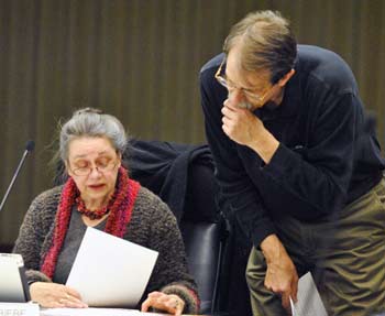
Jack Eaton talks with Sabra Briere before the start of the Ann Arbor planning commission’s March 5, 2013 meeting. Briere serves on the commission as the representative from city council. Eaton spoke during a public hearing on the Connecting William Street plan.

The Connecting William Street project was undertaken by the Ann Arbor Downtown Development Authority at the behest of the city council. It focuses on recommendations for coordinated development of five city-own sites in the William Street area, on the south side of downtown. By becoming a resource document, the CWS plan carries less weight than it would if it were part of the city’s master plan.

Amber Miller of the DDA gave a presentation during the March 5 commission meeting, similar to those previously given to the council and the DDA board.

Much of the discussion among commissioners focused on the issue of open space. Miller noted that recommendations on that issue have been deferred to a committee of the city’s park advisory commission. That downtown parks committee is in the early stages of its work – it was scheduled to meet earlier in the day on March 5, but that meeting was canceled.

Commentary during a public hearing on the CWS plan also focused on open space, with several members of the Library Green Conservancy advocating for a centrally located park atop the Library Lane underground parking structure. They criticized the DDA’s process for developing the plan, and felt the planning commission had not adequately publicized the fact that a public hearing on Connecting William Street would be held that evening.

Additional public commentary came after the commission’s vote. Woods said her decision to ask for reconsideration of the item was prompted by concerns raised during this final public commentary. She felt it wouldn’t hurt to wait two weeks until the commission’s next meeting, so that more people could have the chance to weigh in, if they wanted.

Sabra Briere, who had expressed strong reservations before casting her original yes vote, said she supported Woods in her effort to reconsider the item, suggesting that postponement would be appropriate. She expressed concern that the commission was deciding to use the CWS plan as a future planning document – which would be referenced when the planning staff and commission make their recommendations to the city council on site plans and other planning and development actions. Given that importance, Briere – who also serves on city council – wanted to be absolutely certain before accepting it.

Other commissioners disagreed. Kirk Westphal, the planning commission’s chair, also served on a DDA leadership outreach committee (LOC) that helped craft the Connecting William Street plan. He said he felt extremely comfortable with the public process that had led to these recommendations. Eric Mahler also argued against reopening the item for another vote, saying the commission needed to bring closure to this long process. He was satisfied that sufficient public notice had been provided.

It’s unclear whether the city council will take any action on the Connecting William Street plan. As to what happens next, Susan Pollay, the DDA’s executive director, told planning commissioners that the DDA will be following the council’s guidance. Councilmembers have already taken a first step related to one of the five parcels – the former YMCA lot. At their meeting on March 4, 2013, councilmembers voted to direct the city administrator to prepare an RFP (request for proposals) for brokerage services to sell the lot. A $3.5 million balloon payment on the property is due at the end of 2013. [Full Story]

PAC: Downtown Park, More Input Needed

Ann Arbor park advisory commission meeting (Sept. 18, 2012): Reprising issues they discussed in August, commissioners heard from several residents about the need for: (1) more downtown green/open space; and (2) one or more centrally located dog parks.

Eric Lipson, Mary Hathaway

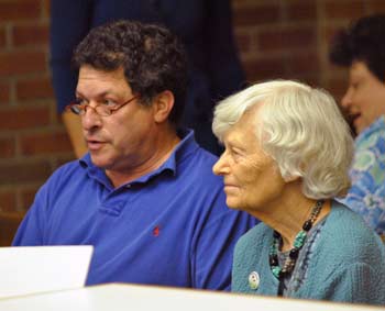
Eric Lipson and Mary Hathaway attended the Sept. 18, 2012 Ann Arbor park advisory commission meeting to advocate for more green space in the downtown area, specifically on top of the Library Lane parking structure. (Photos by the writer.)

PAC took action on one of those topics, passing a resolution to give formal input on the Connecting William Street project. That effort, led by the Ann Arbor Downtown Development Authority, is process to examine five city-owned parcels for possible redevelopment. All but one of the sites are now used as surface parking lots.

PAC did not advocate that a particular site be turned into a park. Rather, the resolution recommends that the Ann Arbor city council seek additional evaluation of locations for a downtown park, the best mix of amenities for the population expected to use a downtown park, and the costs of developing and maintaining a new addition to the parks system. PAC also recommends that the council refrain from adopting plans for the five city-owned lots before resolving the question about open space in the Connecting William Street area. [.pdf of final Connecting William Street resolution]

At the start of the meeting, three members of the Library Green Conservancy – advocates of creating a commons on top of the Library Lane underground parking structure – spoke during public commentary. [The Library Lane site is one of the five properties included in the Connecting William Street project.] They urged commissioners to support their plan for a park at that location, adjacent to the library. The underground structure was built with a foundation to support a high-rise building on the site, in addition to a plaza area. PAC’s recommendation to the city council did not highlight that particular site.

Also during the meeting, commissioners heard from two speakers during public commentary who supported the creation of more dog parks. One speaker noted that despite potential problems – such as dog fights and the fact that ”pooping can occasionally go unnoticed” – a dog park poses no greater liability than a skatepark, pool or “even simply sidewalks.”

Colin Smith, the parks and recreation manager, told commissioners that staff did not support an unfenced option, but indicated that they’re exploring possible locations for one or more fenced-in dog parks. One possible site: A parcel on the east side of West Park, near the entrance off of Chapin.

PAC also was briefed on plans for rain gardens and other biodetention measures at Miller Nature Area and Garden Homes Park, in connection with a major reconstruction of Miller Avenue next year.

Smith also updated commissioners on letters of objection that had been submitted to the Michigan Dept. of Environmental Quality (MDEQ) regarding plans to build a section of whitewater in the Huron River, near the Argo Cascades. A permit is needed from the MDEQ before the project can move forward. For a full report on this issue, see Chronicle coverage: “EPA, Others Object to Whitewater Project.”

It was the last meeting for commissioner Doug Chapman, whose term ended on Sept. 30. At the city council’s Oct. 1 meeting, his replacement was confirmed: Melissa Stults, a doctoral student at the University of Michigan’s Taubman College of Architecture and Urban Planning. [Full Story]

Prices to Get Tweaked as Parking Deck Opens

Ann Arbor Downtown Development Authority board meeting (May 2, 2012): The one action item on the board’s agenda was a resolution directing its operations committee to start applying demand-management principles to the pricing for permits in Ann Arbor’s public parking system. The resolution, which passed unanimously, notes that the goal of the pricing strategy is to attract patrons to those structures that are located farther away from the University of Michigan campus.

Roger Hewitt and Keith Orr

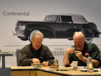
Ann Arbor Downtown Development Authority board members Roger Hewitt (left) and Keith Orr. They're examining a Girl Scout badge created for assisting in the Downtown Blooms event. The car on the wall in the background is a mockup of the planned wayfinding system for the levels of the new underground parking structure, anticipated to open by mid-July. (Photos by the writer.)

One of those structures farther west of the campus is the new underground parking garage on South Fifth Avenue, which is nearing completion. The garage, which the DDA is currently calling the “Library Lane” parking structure, is now expected to open by the time the art fairs begin, which this year fall on July 18–21. South Fifth Avenue between Liberty and William is expected to re-open by Memorial Day.

A characterization of that timing as “on schedule” was disputed during public commentary by Ali Ramlawi, owner of the Jerusalem Garden restaurant. Jerusalem Garden is adjacent to the construction site. Ramlawi noted that the structure was originally due to be completed by August 2011.

The future use of the top of the underground garage was the subject of public commentary from advocates who’d like to see it used as a green plaza. That suggestion was met with remarks from mayor John Hieftje, who sits on the DDA board, with a description of his expectation that three major parcels would soon be incorporated into the city’s park system – 721 N. Main, 415 W. Washington, and the MichCon property (located between the Amtrak rail station and the Huron River near the Broadway bridges). Hieftje’s point was that the additional financial burden for the maintenance of those parcels as parks might impact the city’s ability to add a downtown green plaza to the park system.

Requests for better information about the parking system and suggestions for disseminating information about the availability of open parking spaces were topics of additional public commentary.

Although it was not an action item, the board discussed a draft policy on supporting “brownfield” projects – a policy prompted by discussions at the board’s partnerships committee over the last few months. [.pdf of draft DDA brownfield policy]

The committee has been discussing a proposal by Dan Ketelaar for support of a proposed development at 618 S. Main, which received a positive recommendation from the Ann Arbor planning commission on Jan. 19, 2012. If the project moves forward, the 7-story building would include 190 units for 231 bedrooms, plus two levels of parking for 121 vehicles. Ketelaar has estimated that the tax on the increment between the current valuation of the property and the final built project would yield around $250,000 a year in TIF (tax increment finance) revenue to the DDA. If adopted as it’s currently worded in the draft, the formula in the policy would translate into up to $625,000 of support for 618 S. Main.

The board also received updates on the third-quarter financial statements for the DDA, as well as an update on the Connection William Street planning project.  [Full Story]

Greenbelt Gets Mid-Year Financial Review

Ann Arbor Greenbelt Advisory Commission meeting (Feb. 9, 2011): The main event of the commission’s Wednesday meeting was a review of the second-quarter financial picture. The review was presented  by Ginny Trocchio, who works for The Conservation Fund, a consultant the city employs to assist with administering the greenbelt millage. Highlights of the presentation included the calculation of administrative overhead costs – including The Conservation Fund’s work – which are well below the legal maximum of 6%.

Ann Arbor Greenbelt Map, boundaries and property

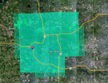
Blobs inside the squarish boundaries represent properties or development rights acquired with greenbelt millage funds. The darker squarish area is the original area where millage funds could be spent. The lighter strips to the east, south, and west were added in 2007. (Image links to higher resolution file.)

Though not included explicitly in the millage language, the city approaches the administration of the millage as a one-third/two-thirds split between a portion for parks and a portion for the greenbelt program. So as part of the financial review, commissioners also looked at current fund balances as analyzed based on the one-third/two-third split between parks and greenbelt projects. Noting that the greenbelt fund balance might be on track to be drawn down before the parks portion is exhausted, commissioners seemed to agree that now is a good time to begin mulling what should happen if that scenario played out. The group discussed holding a joint meeting between the park and greenbelt advisory commissions – their last joint session was held in April 2010.

Also discussed on Wednesday was the scheduling of a first meeting of a commission subcommittee that will look at the question of changing greenbelt boundaries. The boundaries define the region where land or development rights on land might be acquired by the greenbelt program. Any change to those boundaries would ultimately require approval from the Ann Arbor city council. [Full Story]

Ann Arbor Applies for Greenbelt Matches

At its Feb. 7, 2011 meeting, the Ann Arbor city council voted to approve applications to the U.S. Dept. of Agriculture’s Farm and Ranch Lands Protection Program (FRLPP) for matching grant funds for the purchase of development rights on two properties: 110 acres on the Lindemann-Weidmayer farm in Lodi Township, and 92 acres on the Grosshans farm in Superior Township.

The city’s cost would be paid out of the greenbelt millage funds. The federal match would be up to 50% of the appraised fair market value of the development rights, up to a maximum of $5,000 per acre. The greenbelt advisory commission recommended at its Dec. 8, 2010 meeting that the city make the applications to the FRLPP.

This brief was filed from the boardroom in the Washtenaw County administration building, where the council is meeting due to renovations in the city hall building. A more detailed report will follow: [link] [Full Story]

Greenbelt Gets Equestrian Request

Ann Arbor greenbelt advisory commission meeting (Jan. 12, 2011): The owners of Cobblestone Farms in Webster Township – Jim and Darlyn Daratony – have applied to the greenbelt program for a parcel adjacent to their business.

Jim Daratony

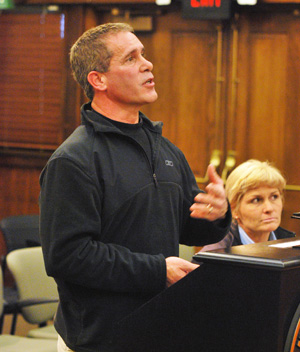
Jim Daratony, owner of Cobblestone Farms in Webster Township, made a presentation at the Jan. 12 meeting of the Ann Arbor greenbelt advisory commission. To the right is Jennifer Merrick-Brooks, an equestrian trainer and coach. (Photos by the writer.)

It’s the first equestrian-related property to be considered for the greenbelt, so they came to commissioners to make their case for including it. The land is used for a sport called “eventing,” which includes a cross-country component. Jim Daratony said the eventing competitions that they’ve held so far on the property have drawn people from as far away as Texas – he stated that it’s having a positive economic impact on this area.

Commissioners also heard from John Satarino, one of the original advocates of the greenbelt program, who spoke during public commentary. He urged them to consider making more outright acquisitions of property, which could then be open to the public. Much of the land protected by the greenbelt is done through the purchase of development rights, with the land remaining private property.

In her staff update, Ginny Trocchio reported that in 2010, the greenbelt program had protected just over 1,000 acres of land, bringing the total of greenbelt land to nearly 3,000 acres. [Full Story]

Column: A Broadside for Barn Preservation

Editor’s note: The Chronicle’s regular coverage of civic affairs includes many meetings of Ann Arbor’s greenbelt advisory commission (GAC) as well as the city’s historic district commission (HDC). The GAC oversees the spending of revenues from a millage dedicated to the preservation of open space – much of it in the countryside around Ann Arbor. Inside the city, the HDC is charged with reviewing requests for modifications to structures that are preserved in Ann Arbor’s 14 historic districts.

In following The Chronicle’s coverage of these issues, local architect Chuck Bultman has been wrestling with the notion of where old barns fit into this preservation picture.

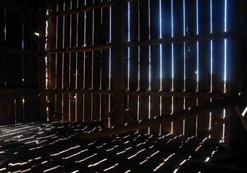
Every architect remembers that first time they went into a barn – the vastness of the space, the hewn beams, the light streaming through all of those gaps. For me it was in southwest Virginia, in the country going to college. I was captivated by the light and space. Outside, the farmyard also made its statement. The large red barn, along with the out-buildings made a room with a silo in it, not so much unlike a piazza with a campanile.

Barns have an interesting place in the built world. They are icons in the landscape, and as such it is easy for us all to assume a familiarity, bordering on ownership. After all, they have been there for as long as you can remember and you expect them to be there long after you are gone. We think of barns not as in the landscape. Instead, like rivers or mountains, they seem part of it – an inseparable part of the countryside that surrounds towns and cities across the country, coloring the landscape with distinct personalities. They are variously described as timeless, strong, permanent, and historic.

But barns are not part of the landscape, nor are they timeless, permanent, or historic – at least as we might commonly apply the word “historic” to an achievement, for example. [Full Story]