Stories indexed with the term ‘public land’

Housing Commission Rezoning Moves Ahead

Final approval to the rezoning of three Ann Arbor Housing Commission properties, and initial approval for rezoning of a fourth property, has been given by the Ann Arbor city council.

The planning commission had recommended the three rezonings at its May 6, 2014 meeting. Initial city council action came on June 2, 2014. And final action by the council came at its July 7, 2014 meeting.

The current PL (public land) zoning for some of the properties is a vestige of the AAHC properties’ status as city-owned land. The city council approved the transfer of deeds to the AAHC at its June 2, 2013 meeting. The three sites given final rezoning approval on July 7 are part of the housing commission’s … [Full Story]

Rezoning for Stapp Nature Donation Gets Final OK

Final approval has been given for the rezoning of land that’s been donated to the city by developer Bill Martin, founder of First Martin Corp. The 2.2-acre parcel at 3301 Traverwood Drive is being added to the adjacent Stapp Nature Area, near the Leslie Park golf course.

Land to be donated by Bill Martin to the city of Ann Arbor indicated in red outline. Land donated by Bill Martin to the city of Ann Arbor indicated in red … [Full Story]

Planning Bylaws Clarify Council Interactions

Ann Arbor planning commission meeting (Feb. 20, 2014): Wrapping up a process that began last year, planning commissioners voted to revise their bylaws related to two issues: how city councilmembers interact with the commission; and public hearings.

Eleanore Adenekan, Diane Giannola, Bonnie Bona, Ann Arbor planning commission, The Ann Arbor Chronicle

From left: Ann Arbor planning commissioners Eleanore Adenekan, Diane Giannola and Bonnie Bona. (Photos by the writer.)

Commissioners had debated the proposed revisions at a Feb. 4, 2014 working session. Some of the same issues were raised during the Feb. 20 discussion, which was relatively brief.

One revision clarifies the limitations on a city councilmember’s interaction with the commission. The revised section states: “A member of the City Council shall not be heard before the Commission during the Councilmember’s term in office.” The intent is to prevent undue influence on the commission, and to avoid the possibility of legal action against the city.

Other revisions affect speaking turns at public hearings. The intent is to clarify how many turns the same person can speak at a public hearing, and how public hearings are continued if an item is postponed.

In other action, commissioners recommended rezoning a parcel on the city’s north side to public land (PL). The 2.2-acre site at 3301 Traverwood Drive, donated to the city by developer Bill Martin, is being added to the adjacent Stapp Nature Area, near the Leslie Park golf course. It was originally zoned R4D (multi-family dwelling) and had been part of a larger site that’s being developed with an apartment complex.

During communications, Kirk Westphal reported on a project that the environmental commission is working on: a neighborhood mini-grant program. Volunteers would coordinate a competitive grant program for community groups, who could apply to fund projects that address one of the city’s goals in its sustainability framework. That’s in the planning stages, he said.

Westphal also distributed a copy of a resolution recently passed by the city’s energy commission. It supports a recommendation to hire a full-time employee to focus on projects that help achieve goals in the city’s climate action plan. Westphal indicated that the planning commission’s executive committee would be discussing it. The energy commission would like a supporting resolution from the planning commission.

Commissioners also heard from two Skyline High School students, who spoke during public commentary as part of a class assignment. They talked about the importance of the Huron River and of the Huron River Watershed Council‘s River Up project. The planning commission’s work plan includes looking at how to implement recommendations from city’s North Main Huron River corridor task force. [Full Story]

Donated Land Rezoned for Nature Area

Land that’s been donated to the city by developer Bill Martin is in the process of being rezoned as public land, following action at the Feb. 20, 2014 meeting of the Ann Arbor planning commission. The 2.2-acre parcel is being added to the adjacent Stapp Nature Area, near the Leslie Park golf course.

Land to be donated by Bill Martin to the city of Ann Arbor indicated in red outline.

Land donated by Bill Martin to the city of Ann Arbor indicated in red outline, south of Stapp Nature Area.

Based on advice … [Full Story]

Planning Group: No Duplex on Packard

Ann Arbor planning commission meeting (Aug. 7, 2013): A light agenda for the planning commission led to two straightforward decisions on rezoning requests for parcels outside the downtown, well away from the area that has generated ongoing controversy. The decisions were both unanimous, with opposite outcomes.

Zoning Map City of Ann Arbor

The red circles indicate the general locations of the parcels that the Ann Arbor planning commission was asked to consider for rezoning at its Aug. 7, 2013 meeting. Other colors designate various zoning categories. (Data from the city of Ann Arbor mapped in Google Earth.)

The planning commission heard a request to rezone 3325 Packard from R1C (single-family dwelling) to R2A (two-family dwelling) – and voted unanimously to deny that request. A house had burned on the lot, which sits at the corner of Fernwood and Packard. The economics of rebuilding a single-family house and trying to sell or rent it out weren’t realistic, owner Steve Weaver told the commission.

A duplex, Weaver argued, could help stem the commercial creep coming from the west at Packard and Platt, and provide a “thumb in the dike” to preserve the residential character of that stretch.

But planning commissioner Bonnie Bona reflected the view of commissioners and planning staff that the decision was a “no-brainer” in the context of the city’s master plan, which clearly designates the area for single-family houses. They were reluctant to engage in “spot zoning.”

In voting unanimously to deny the rezoning request, commissioners encouraged Weaver to work with neighboring property owners with the idea of bringing forward a request to rezone an entire blockface.

Weaver has said he will exercise his option to make his rezoning request directly to the city council, even without the planning commission’s support.

The other rezoning request on the commission’s Aug. 7 agenda was to designate some city-owned property on 3875 E. Huron River Drive as PL (public land). The move was characterized as a housekeeping step for the planning commission. During the public hearing on the question, one person addressed the commission indicating support, but with some concern about the range of activities that would be promoted there.

One idea mentioned at the meeting was the possibility that the parcel – sold to the city in 2010 by former U.S. Congressman Wes Vivian – could become the headquarters for the city’s natural area preservation program (NAP). Commissioners encouraged nearby residents to work with the park advisory commission (PAC) as that group helps decide the parcel’s eventual use within the park system.

The commission also heard remarks from the representative of a neighbor opposed to a requested land division on Traver Street. But the decision on that item will be made by planning staff, not the planning commission or the city council. [Full Story]

Rezoning OK’d for City-Owned Property

Ann Arbor planning commissioners have recommended approval to rezone city-owned property at 3875 E. Huron River Drive from R1A (single-family dwelling) to PL (public land). The site, which is adjacent to the city’s South Pond park, will be used as parkland.

3875 E. Huron River Drive, Ann Arbor planning commission, The Ann Arbor Chronicle

Aerial view of 3875 E. Huron River Drive.

The property was acquired by the city in 2010, but a “life estate” was in place until earlier this year, according to a staff memo. The two-acre site – located on the north side of E. Huron River Drive and west of west of Thorn Oaks Drive – includes a … [Full Story]

Speedway Rezoning Gets Final Approval

The final step to rezone a small portion of a parcel at North Maple and Miller – essentially a formality associated with development of a Speedway gas station at that location – has been given final approval. The final vote to change the zoning from PL (public land) to C3 (fringe commercial) came at the city council’s Oct. 1, 2012 meeting.

The portion of the parcel that’s subject to the rezoning has an easement requiring public access; that easement will remain. The project is located at 1300 N. Maple on a 1.39-acre site. The portion of the parcel that’s subject to the rezoning request is a path that circles the property along the east and north sides. [.jpg of drawing showing ... [Full Story]

Old Y Lot Gets No Action from Council, Yet

A planning effort by the Ann Arbor Downtown Development Authority, Connecting William Street, got an implicit expression of support from the city council at its Aug. 20, 2012 meeting, when it voted down a resolution directing the city administrator to proceed independently of that effort. [See also Chronicle coverage: "Planning Group Briefed on William Street Project"]

The resolution would have directed city administrator Steve Powers to evaluate the parcel at 350 S. Fifth for possible public or corporate use; and if none was found, to report back to the city council with a timeline for the disposition of the property – based on state and city laws and policies. That parcel is more commonly known as the Fifth and William parking … [Full Story]

Eden Court Rezoning Gets Initial OK

Nearly a year ago, at its Sept. 6, 2011 meeting, the Ann Arbor city council voted to appropriate $82,500 from its open space and parkland preservation millage to acquire the property at 5 W. Eden Court. The Eden Court property is immediately adjacent to the city’s Bryant Community Center.

And at its Aug. 20, 2012 meeting, the council took another step toward conversion of the land to city property – by giving initial approval to zone the property as PL (public land). Because a rezoning is a change to the city’s ordinances, the change will require a second council vote after a public hearing at a future meeting.

The 2011 taxes on the property were estimated at $1,400, which will be eliminated from the … [Full Story]

Land Rezoned for Bryant Community Center

The Ann Arbor planning commission has unanimously recommended rezoning a 0.2-acre site at 5 W. Eden Court from R1C (single-family dwelling) to PL (public land). The vote came at the commission’s June 5, 2012 meeting.

This land was recently purchased for $82,500 using funds from the city’s open space and parkland preservation millage – a purchase approved by the Ann Arbor city council at its Sept. 6, 2011 meeting. It’s located next to the city’s Bryant Community Center.

The recommendation will be forwarded to the city council for its consideration.

This brief was filed from the second-floor council chambers of city hall at 301 E. Huron, where planning commission meetings are held. A more detailed report will follow: [link]

Speedway Gas Station Site Plan Postponed

Following a planning staff recommendation, the site plan for a Speedway gas station was postponed by the Ann Arbor planning commission at its June 5, 2012 meeting. The project is located at the 1.39-acre site on the northeast corner of Miller and North Maple roads. Also postponed was a request to rezone a portion of the site at 1300 North Maple from PL (public land) to C3 (fringe commercial).

The plan calls for demolishing an existing 1,500-square-foot vacant service station building and constructing a new 3,968-square-foot, single-story gas station and convenience store with five pumps. The gasoline pumps will be covered by a 28-foot by 121-foot canopy. Fourteen parking spaces will be provided next to the convenience store, and six bicycle … [Full Story]

Prices to Get Tweaked as Parking Deck Opens

Ann Arbor Downtown Development Authority board meeting (May 2, 2012): The one action item on the board’s agenda was a resolution directing its operations committee to start applying demand-management principles to the pricing for permits in Ann Arbor’s public parking system. The resolution, which passed unanimously, notes that the goal of the pricing strategy is to attract patrons to those structures that are located farther away from the University of Michigan campus.

Roger Hewitt and Keith Orr

Ann Arbor Downtown Development Authority board members Roger Hewitt (left) and Keith Orr. They're examining a Girl Scout badge created for assisting in the Downtown Blooms event. The car on the wall in the background is a mockup of the planned wayfinding system for the levels of the new underground parking structure, anticipated to open by mid-July. (Photos by the writer.)

One of those structures farther west of the campus is the new underground parking garage on South Fifth Avenue, which is nearing completion. The garage, which the DDA is currently calling the “Library Lane” parking structure, is now expected to open by the time the art fairs begin, which this year fall on July 18–21. South Fifth Avenue between Liberty and William is expected to re-open by Memorial Day.

A characterization of that timing as “on schedule” was disputed during public commentary by Ali Ramlawi, owner of the Jerusalem Garden restaurant. Jerusalem Garden is adjacent to the construction site. Ramlawi noted that the structure was originally due to be completed by August 2011.

The future use of the top of the underground garage was the subject of public commentary from advocates who’d like to see it used as a green plaza. That suggestion was met with remarks from mayor John Hieftje, who sits on the DDA board, with a description of his expectation that three major parcels would soon be incorporated into the city’s park system – 721 N. Main, 415 W. Washington, and the MichCon property (located between the Amtrak rail station and the Huron River near the Broadway bridges). Hieftje’s point was that the additional financial burden for the maintenance of those parcels as parks might impact the city’s ability to add a downtown green plaza to the park system.

Requests for better information about the parking system and suggestions for disseminating information about the availability of open parking spaces were topics of additional public commentary.

Although it was not an action item, the board discussed a draft policy on supporting “brownfield” projects – a policy prompted by discussions at the board’s partnerships committee over the last few months. [.pdf of draft DDA brownfield policy]

The committee has been discussing a proposal by Dan Ketelaar for support of a proposed development at 618 S. Main, which received a positive recommendation from the Ann Arbor planning commission on Jan. 19, 2012. If the project moves forward, the 7-story building would include 190 units for 231 bedrooms, plus two levels of parking for 121 vehicles. Ketelaar has estimated that the tax on the increment between the current valuation of the property and the final built project would yield around $250,000 a year in TIF (tax increment finance) revenue to the DDA. If adopted as it’s currently worded in the draft, the formula in the policy would translate into up to $625,000 of support for 618 S. Main.

The board also received updates on the third-quarter financial statements for the DDA, as well as an update on the Connection William Street planning project.  [Full Story]

Ann Arbor Council Focuses on Land Issues

Ann Arbor City Council meeting (Dec. 6, 2010): Five different presentations, plus a full roster of public commentary, meant that two and a half hours into their meeting the Ann Arbor city council had not transacted any business – except for adopting its rules for the next year.

smith-afscme-rapundalo-rosencrans

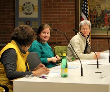
Before the meeting started, Scott Rosencrans, right, knocks on wood in conversation with Stephen Rapundalo (Ward 2). Behind them are Sandi Smith (Ward 1) and Nicholas Nightwine, president of the city's AFSCME union Local 369. Nightwine was there to oppose the outsourcing of city composting operations. Rosencrans, former chair of the park advisory commission, attended as part of a presentation made by the Ann Arbor Skatepark. (Photos by the writer.)

Council rules factored prominently later in the meeting, when a motion to suspend them failed. Had the rules been suspended, it would have cleared the way for the council to reconsider their previous decision to reject a residential planned unit development (PUD) on Fifth Avenue – Heritage Row. The project, which began as a conditional rezoning proposal three years ago, went through iterations since 2007 that included a brownstone-style PUD and a matter-of-right proposal called City Place, which eventually did win approval from the council.

After their previous council meeting, which featured water as a prominent theme, the council focused much of its attention on land-related issues like Heritage Row. In another land-use related item, the council approved revisions to the city’s area, height and placement (AHP) zoning provisions in the city code. But amendments to the AHP resolution were substantive enough that the approval process was reset to the initial, first-reading step. The AHP changes – which, as amended, provide that height limits do not apply in so-called “employment districts,” unless they abut residential areas – will need approval at a second reading in order to be enacted.

A land-use item that was intended mostly as administrative housekeeping – several park areas previously designated as residential, office, and business districts were rezoned with the public land (PL) designation – generated substantial public commentary and council deliberations. Several public commenters expressed concern about whether the PL designations, which the council approved, afforded adequate protection for the continued use of the land as parks.

Although not strictly a land-use issue in a zoning sense, a proposed contract with WeCare Organics to operate the city’s compost facility was linked to terra firma by acreage owned by the city where the facility is located, plus the fact that it processes yard waste generated from residents’ property. The council approved the WeCare contract after extended questioning of city staff and a representative from WeCare.

Also tangentially related to land use was an item that introduced a licensing scheme for medical marijuana dispensaries and cultivation facilities in the city. After questioning the city attorney about several provisions of his proposed licensing requirements, councilmembers decided to postpone the issue until their Jan. 3, 2011 meeting. The new zoning regulations regarding where medical marijuana dispensaries and cultivation facilities can be located, which were scheduled to be heard at second reading on Dec. 20, were rescheduled for Jan. 18.

A land travel-related agenda item the adoption of the Michigan Vehicle Code (MVC) as part of the city’s traffic ordinances. Two years ago, the city had adopted the MVC but excluded portions of that state law relating to the setting of speed limits. The adoption of the full MVC came in response to a possible class-action lawsuit against the city.

As heavily land-centric as the agenda was, Ann Arbor city council also dealt with $9 million worth of water issues. It approved petitions of the Washtenaw County Water Resources Commissioner (WCWRC) office for five different projects in drainage districts that lie at least partly inside the city of Ann Arbor. The total cost of all the projects, including the non-city share, is a bit over $9 million. They qualify for low-interest state-revolving fund loans, up to 50% of which may be forgiven by the state. The payments on the loans will come from the city’s stormwater fund. [Full Story]

Heritage Row Likely to Need Super-Majority

Ann Arbor City Council meeting (June 7, 2010): Speculation that the vote on the Heritage Row project would be delayed was borne out on Monday night. Without discussion, the council postponed votes on the development’s rezoning and site plan until June 21.

petition-sig-count-pud

Left in the frame, scanning through the protest petition documents, is Scott Munzel, legal counsel for Alex de Parry, developer of the Heritage Row project. De Parry is seated in the row behind with his arms resting on the bench back. In the foreground is Bradley Moore, architect for Heritage Row. (Photos by the writer.)

Councilmembers were also informed that a protest petition had been filed on Heritage Row Monday afternoon, which – once validated – would bump the requirement for approval from a simple six-vote majority to eight out of 11 council votes. Petition filers have calculated that they’ve collected signatures from 51% of adjoining property owners, weighted by land area. That exceeds the 20% required for a successful petition, but as of late Wednesday, the city had not completed its verification process for the signatures. [Update: Early Thursday afternoon, the city confirmed the 20% threshold had been met.]

In other business, the council approved increases in water and sewer rates and gave initial approval to changes in the city code language on the placement of recycling carts.

A wording change in the list of permissible uses for public land was also given initial approval, but not without discussion. Thematically related to land use was a presentation during the meeting’s concluding public commentary in response to a request for proposals (RFP) for the privatization of the city-owned Huron Hills golf course.

Also receiving discussion was an item pulled out of the consent agenda that authorized $75,000 for Ann Arbor SPARK, for economic development.

Criticism during public commentary on the appointment and nomination process used by the mayor to fill seats on boards and commissions stirred mayor John Hieftje to defend shielding individual members of those bodies from public demands.

Public commentary also elicited from Stephen Rapundalo (Ward 1) an update on the development of the Library Lot – he chairs the committee charged with overseeing the RFP process. [Full Story]

Better Deal Desired for Fuller Road Station

Two city commissions on Tuesday addressed two very different actions related to Fuller Road Station, a joint city of Ann Arbor/University of Michigan project that initially will entail a large parking structure and bus station, with possibly a train station for commuter rail years down the road.

Gwen Nystuen, David Barrett, Doug Chapman

Park advisory commissioners Gwen Nystuen, David Barrett and Doug Chapman at Tuesday's meeting of PAC's land acquisition committee, held at Cobblestone Farm. Nystuen has been pushing for more input into the Fuller Road Station project. (Photos by the writer.)

Spurred by concerns that Ann Arbor parks are being shortchanged, members of the city’s park advisory commission (PAC) discussed a resolution on Tuesday that would urge city council not to proceed with plans for Fuller Road Station at its proposed site on city-owned land that’s designated as parkland.

The draft resolution also states that if the city council does continue with the project, the city should renegotiate the deal to get additional revenues from the University of Michigan, with those funds being allocated to city parks. The resolution calls for an annual payment of $127,500 from the university – under the current agreement, UM would pay $19,379 per year, starting in 2012.

Park commissioners didn’t take any action, and plan to discuss the draft resolution further at their May 18 meeting.

But Tuesday evening, the city’s planning commission did take action related to Fuller Road Station. They voted unanimously to amend the list of permitted principal uses of public land – specifically, changing a “municipal airports” use to “transportation facilities.” During a public hearing on the issue, several speakers – including park commissioner Gwen Nystuen – objected to the change.

It’s expected that the project – located on the south side of Fuller Road, just east of East Medical Center Drive – will be submitted by the design team on May 17 for review by planning staff. It will likely come before the planning commission at its first meeting in July. A public meeting on the project is set for Thursday, May 6 at 7 p.m. in the second-floor city council chambers, 100 N. Fifth Ave. [Full Story]

Unscripted Deliberations on Library Lot

Ann Arbor City Council meeting (July 6, 2009): The word “public” covered much of the ground of this past Monday’s meeting: public art, public land, public input.

closeup of printout of Anglin's amendment with edits by Briere

Mike Anglin’s (Ward 5) amendment with edits made by Sabra Briere (Ward 1) at the council table.

The council got an annual report from the Public Art Commission highlighted by a reminder that Herbert Dreiseitl will be visiting Ann Arbor on July 20 to introduce plans for the storm water art he’s been commissioned to design for the new municipal center. The designs have not yet been accepted.

The council also heard a report from the Greenbelt Advisory Commission on a slight strategy shift in the use of $10 million of public money so far to protect 1,321 acres of land. The  council also approved a resolution to preserve the First & William parking lot as public land.

The discussion of another parcel of public land, the library lot, led to long deliberations on the wording of a resolution to establish an RFP (request for proposals) process for development of the site – below which an underground parking structure is planned. At issue was the timing of the RFP and the explicit inclusion of a public participation component in the process. The deliberations provided some insight into how councilmembers work together when the outcome of their conversations at the table is not scripted or pre-planned. [Full Story]