South State Corridor Gets Closer Look
As one of Ann Arbor’s primary north-south corridors, South State Street is being studied with an eye toward improving what some see as a congested, unwelcoming gateway to the city. City planning staff are seeking input and developing recommendations for changes along that 2.5-mile stretch, from Stimson at the north end – where The Produce Station is located – all the way south to Ellsworth.
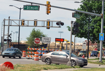
The intersection of South State and Stimson, looking north. A study of the South State corridor runs south from Stimson to Ellsworth. (Photos by the writer.)
A diverse range of land uses can be found between those two points, including small commercial enterprises, a large apartment complex, University of Michigan sports facilities, an auto dealership, high-rise office buildings, Briarwood Mall, the snarled I-94 exchange, sprawling research and industrial parks, and the soon-to-open Costco at the southern end, in Pittsfield Township.
The city held a forum recently to update the public about plans for improving South State and to seek input for possible changes. And the Ann Arbor planning commission’s retreat last week focused on the corridor, and included a van tour of the area.
This report covers both of those meetings.
Observations made by planning commissioners about the South State Street corridor at their retreat included: a lack of cohesion; a negative environment for pedestrians and bicyclists; and a sense that the corridor doesn’t reflect the character of Ann Arbor. Several commissioners noted that the stretch is just plain ugly – not an area that evokes the street as a major gateway into Ann Arbor. Suggestions ranged from improved landscaping and wayfinding signs to updating the city’s master plan, reflecting land use goals more in line with the city’s current priorities and sustainability efforts.
This isn’t the only corridor that’s getting attention – efforts to take a strategic look at North Main and Washtenaw Avenue are also underway.
For the South State study, the planning staff expects to develop draft recommendations by the end of this year, with additional public meetings, review by the planning commission, and consideration by the city council. If approved by the council, city staff would begin implementing recommendations.
Background: Corridor Studies
An interest in looking more closely at the South State corridor – from Stimson to the north, down to Ellsworth – has been on the city’s To Do list for several years. It was discussed by planning commissioners two years ago at their April 2010 retreat, in the context of setting priorities for projects that the commission hoped to tackle. It’s viewed as part of a broader effort to look at all of the city’s major gateway corridors, including Washtenaw Avenue to the east, Plymouth Road to the northeast, and North Main Street.
The Ann Arbor city council appointed members to a new North Main/Huron River corridor task force just this week, at its June 4 meeting. And the Washtenaw Avenue corridor project is well underway. Called Reimagine Washtenaw, the effort is more complex because the corridor crosses four jurisdictions: the city of Ann Arbor, Pittsfield Township, Ypsilanti Township, and the city of Ypsilanti.
A State Street corridor study has gotten off to a slower start. About a year ago – at an April 2011 work session – planning commissioners and staff talked about issuing a request for proposals (RFP) for a consultant to take on the work. The draft RFP reviewed by commissioners laid out specific tasks for the project [.pdf file of 2011 draft State Street corridor study RFP]:
1. Data Inventory and Analysis: A large amount of preliminary data on the corridor has been collected by staff, and includes information on related planning efforts, existing conditions for land use, transportation, natural features, and infrastructure, and issues and opportunities related to these conditions. A database of building parcel information, and a large number of GIS maps specific to existing conditions have also been collected. The consultant will utilize existing data and identify additional data requirements, and collect that data.
2. Market Analysis: A market analysis to identify market demand and redevelopment potential will be undertaken by the consultant. The analysis may include, but is not limited to, examination of existing conditions, identification of trends affecting demand for various land uses, identification of market and non-market based forces affecting the corridor, future market demand, and/or other relevant market information.
3. Identification of Goals, Issues, and Opportunities: Upon completion of market analyses and data collection, the selected consultant should analyze the data and work closely with the public, as well as business and institutional stakeholders, to complete a full SWOT (strengths, weaknesses, opportunities, threats) analysis for the corridor. This analysis will be used to craft a preferred vision of future land use in the corridor.
4. Identification of Alternatives and Priorities: The consultant will work closely with staff and the Planning Commission, considering public input, to identify alternative scenarios that could be implemented over time as the corridor develops/redevelops.
5. Preparation of Plan Concepts and Selection of Preferred Scenario(s):Using the alternatives and priorities identified via the ongoing public process, corridor plan concepts will be developed that address the priorities and needs identified. The consultant will work with staff and the Planning Commission to recommend and select the preferred future land use scenario(s).
6. Identification of Action Strategies, Plans, Policies, and Best Practices: The consultant will work with staff and the Planning Commission to identify action steps and strategies needed for successful implementation of the preferred future land use scenario(s). This could include outlining methods to work with City leaders, local, regional, and state planning agencies, business groups, and members of the community at large to best implement the corridor plans, preserve the desired current aspects of the corridor, and to embrace future anticipated growth.
7. Development of Final Corridor Plan Report: Deliverables expected from the selected firm will include a final corridor plan report, in a format suitable for publication, including intermediate studies which were used in the planning process, such as future development scenarios, alternative scenarios, and market analyses.
About $150,000 had been set aside for that a consultant’s study. However, when the project moved to the city council for approval, a majority of councilmembers were reluctant to make the expenditure, and the funding was not approved.
City planning staff later took up the effort themselves, with Jill Thacher initially taking the lead. Planning commissioners were briefed again at an October 2011 work session, when they were told that Thacher and an intern would be interviewing stakeholders along the corridor, including business and property owners, residents of Hidden Valley Club Apartments and other residential properties, the Ann Arbor airport, Ann Arbor Public Schools (its administration building is located on South State), and the University of Michigan, which has a large athletic complex on South State. Pittsfield Township, the adjacent jurisdiction to the south, is another major stakeholder in that area.
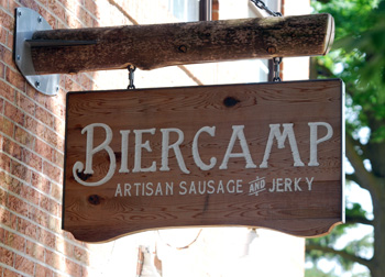
Sign for Biercamp Artisan Sausage & Jerky on South State. A rezoning request for the property, adjacent to Produce Station, was denied by the city council earlier this year.
Thacher subsequently took family leave, so the point person’s role on the project has been taken up by Kristin Baja of the city’s systems planning staff.
Zoning is one of the drivers for studying the South State corridor. The need for a comprehensive study was raised in the context of two rezoning requests that were both denied within the past year: (1) a request to rezone property at 1712 S. State – now used by Treecity Health Collective, a medical marijuana dispensary – from O (office) to C1 (local business); and (2) a request to rezone the parcel where Biercamp Artisan Sausage & Jerky is located from TWP (township district) to C3 (fringe commercial district). That property is at 1643 and 1645 S. State St., south of Stimson and next to the Produce Station.
The State Street corridor project was part of the discussion during the Biercamp rezoning request, at the city council’s Feb. 21, 2012 meeting. From The Chronicle’s report of that discussion:
At mayor John Hieftje’s request, [planning manager Wendy] Rampson explained the next steps for the Biercamp owners if they wanted to expand. Rampson said that if the council did not approve the rezoning, she’d ask council to direct the planning staff to initiate the process of putting appropriate zoning in place. If two years pass after the annexation from the township and no zoning is applied by the city, the parcel becomes “unzoned” and anything could happen, Rampson said.
So the staff would want to put an M1 placeholder zoning on the parcel. In the meantime, the State Street corridor discussion would be going on, Rampson said, and clearly Biercamp is a stakeholder in the corridor now and would be able to advocate for itself in the context of that discussion. At the conclusion of the corridor study, the staff would likely come up with a “package” that Rampson felt would probably include a rezoning of that parcel, among other recommendations.
Sandi Smith (Ward 1) noted that immediately to the north is a property zoned C3, where the Produce Station is located. Rampson explained that the property was originally zoned M1 – it was a warehouse. The entire area was developed on an industrial-type footprint, she said. Smith ventured that context might eliminate the possibility that rezoning the Biercamp parcel would constitute a “spot zoning.”
Rampson indicated that the objection to the rezoning is not that it would amount to spot zoning. Instead, the objection is based on the fact that the city’s master plan talks about putting a boundary on the commercial district. The Produce Station is the edge, she said. Without having a further understanding of how retail would work beyond that boundary, the planning staff weren’t comfortable letting it go farther south.
The intent of the South State corridor study is to develop that further understanding, extending all along the stretch from Stimson to Ellsworth. Issues being explored include zoning alternatives, transportation options and infrastructure improvements, specifically as they relate to current and future land uses. Ultimately, a plan for the corridor would be used to guide future development. [.pdf of current zoning along South State]
South State Public Forum
On the evening of May 23, 2012, the city’s planning staff held a public forum to give an update on the corridor project and get input from residents, business owners and others with an interest in that area. The event, held at the Malletts Creek library branch, drew about two dozen people.
The people who attended had varying stakes in the corridor. One of the most unique perspectives came from Carol and Dave Diephuis, who own the residential property where Carol was raised. Located on about three acres north of the Wintermeyer office complex, it’s the family home she moved to in the early 1960s. It would be an understatement to say a lot has changed since then, she said.
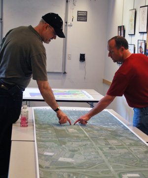
Architect Brad Moore, left, and Tracy Wintermeyer, owner of the Wintermeyer office complex on South State, look at a large map of the South State corridor. They were among about two dozen people who attended a May 23 public forum on the city's corridor project, held at the Malletts Creek library branch.
The meeting began with project director Kristin Baja giving an overview of the work to date, noting that recommendations for the 2.5-mile corridor had most recently been incorporated into the city’s master plan in 1990. Land use patterns have changed over the past two decades, which has prompted the need to revisit this area.
Starting in the 1950s, the city has focused on developing office, research and light industrial businesses along State Street, Baja said. The University of Michigan also owns a considerable amount of land there: Its south athletic campus – on the west side of South State, south of the UM golf course – includes tennis, wrestling and soccer facilities. UM also owns property along the corridor that remains undeveloped.
The corridor has about 900,000 square feet of office space and 580,000 square feet of industrial and light manufacturing facilities – more than any other section of the city, Baja said.
She went on to describe how the study so far has divided the corridor into three distinct sections. Area 1 runs from Stimson at the north end of the corridor to Eisenhower, and contains a mix of commercial, office and industrial properties, including a large Edwards Brothers book manufacturing plant. The UM facilities are also in this area. Zoning is primarily for office and light industrial.
Area 2 starts at Eisenhower and runs south to I-94. It’s dominated by Briarwood Mall to the west, and hotels and offices to the east. Although there aren’t any industrial uses here, much of the area is zoned for light industrial use.
Area 3 is the stretch between the I-94 interchange and Ellsworth. Only the land on the east side of State is in the city, and it primarily includes the Ann Arbor Research Park and Ann Arbor Industrial Park. Zoning is primarily for research, office and light industrial uses. The west side of State, south of I-94, is under the jurisdiction of Pittsfield Township, and includes the Airport Plaza area where several Zingerman’s businesses – including the bakehouse, creamery and coffee company – are located.
Baja described how city staff had conducted interviews with people from nearly 30 organizations or stakeholder groups, including local residents, UM, businesses, other local governments, the Ann Arbor Public Schools and others. From those interviews, a set of priorities emerged, she said:
High priority: Improve aesthetics, pedestrian and bicycling access, signs and lighting; create an attractive entrance to the city; focus on sustainability and efficiency.
Medium priority: Install crosswalks and improve sidewalks; improve traffic flow from I-94 to Eisenhower; brand the corridor and give it an “Ann Arbor feel”; improve building facades and landscaping; add mixed-use residential to the corridor.
Lower priority: Improve stormwater management; increase sanitary capacity throughout the corridor; develop trails and natural areas; get more local amenities; improve access to and from Briarwood Mall.
The priorities reflect the comments and concerns of stakeholders who were interviewed, Baja said, but doesn’t yet mean that those will be the changes implemented by the city.
Baja also noted that the city’s sustainability goals – assuming those are approved by the city council, to be incorporated into the city’s master plan – could also inform any changes to the South State corridor. [.pdf of sustainability goals] [The planning commission subsequently recommended approval of those goals, at its June 5 meeting.]
South State Public Forum: Questions, Comments
A portion of the May 23 forum was spent discussing the South State corridor in small groups. Before that, Baja and other city staff fielded questions from people attending the event. Most of the questions related to transportation issues.
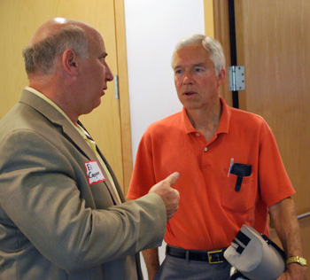
From left: Eli Cooper, the city of Ann Arbor's transportation program manager, talks with Larry Deck of the Washtenaw Bicycling and Walking Coalition.
Brad Moore, a local architect, asked whether there’s any intent to convert South State from four lanes of traffic to three – a “road diet” that’s already scheduled for the Jackson/Huron corridor on the city’s west side. Eli Cooper, the city’s transportation program manager, replied that such changes are considered based on traffic volumes or turning patterns. But the South State corridor is not a candidate for conversion to three lanes, he said.
Larry Deck, a board member of the Washtenaw Bicycling and Walking Coalition, noted that plans are in the works to expand South State to four lanes in Pittsfield Township, south of Ellsworth. Is that process being coordinated with the city? Baja reported that city planning staff have met with township representatives about the corridor project, and they’ll touch base again. Planning manager Wendy Rampson noted that the most recent city-township collaboration has related to construction of a roundabout at the State and Ellsworth intersection. That’s driven in part by a traffic impact statement done for the new Costco store being built in the township, north of Ellsworth and west of State.
Cooper added that the city coordinates with Pittsfield through WATS (the Washtenaw Area Transportation Study), as well as through the Ann Arbor Transportation Authority’s efforts to create a countywide transit system. There’s also been some interest in extending a public transit corridor into Pittsfield, he said – the current focus of that transit project has been on a stretch from the city’s north side, down Plymouth Road, through the downtown area to South State.
Moore also asked if there’s any potential for another east-west road to connect South State to South Main, north of Eisenhower. Planning manager Wendy Rampson noted that Oakbrook serves that purpose between South State and Boardwalk, on the east side of South State. The city’s master plan calls for extending Oakbrook from South State to South Main. But after that extension was put into the master plan, the University of Michigan bought the property that would be needed for the cut-through. UM has no interest in putting a road there, she said, ”but that is still on the books as a master planning item.”
Deck ventured that at least a bicycling and pedestrian cut-through could be built between South Main and South State. It’s possible, Rampson replied, but only if UM agrees.
Tony Derezinski, a Ward 2 city councilmember who also serves on the planning commission, asked if there are plans to resurface South State. Rampson indicated she wasn’t aware of any major capital improvements for the road, aside from interest by the Michigan Dept. of Transportation in improving the I-94 interchange.
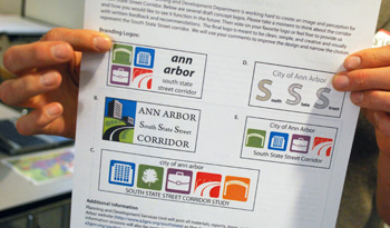
Possible branding logos for the South State corridor. Participants at a May 23 public forum were asked to vote on their favorites.
Responding to a question about the corridor study’s timeframe, Baja said they hope to have draft recommendations by late fall. After draft recommendations are developed, the city’s planning commission will give feedback. A second community meeting also will be held, and a final draft of the corridor plan will be made. That plan will be reviewed again by the planning commission, which will hold a public hearing on it. The plan, along with the planning commission’s recommendation, will be forwarded to the city council for another public hearing and vote. If approved, city staff would work to implement the plan’s recommendations.
More materials related to the South State corridor study are also available on the city’s website.
Planning Commission Retreat
A few days after the public forum, the Ann Arbor planning commission and staff held a five-hour retreat that focused in part on the South State corridor. The May 29 session – which The Chronicle attended – convened at the Kensington Court hotel near Briarwood Mall, then launched into a van tour of the corridor, with several stops along the way. After the tour, the remainder of the retreat included a discussion of the State Street area, and a review of the planning staff’s work plan and activities.
Planning Commission Retreat: Tour
The intent of the tour was to get an up-close view of South State Street and provide a context for discussing the corridor study. Here are highlights of some stops along the way.
Stimson and State on the northern end of the corridor. The Produce Station and Salvation Army store are anchors for that end on the east side of State, leading south to the adjacent Biercamp Artisan Sausage & Jerky and other small businesses. A rezoning request from owners of the Biercamp property had been rejected by the city council earlier this year, on a recommendation by the planning commissioners, as had a rezoning request from a medical marijuana dispensary across the street. At the time, several commissioners had cited the need to hold off on rezoning until the city took a broader review of the corridor’s zoning. During the van tour, some commissioners joked that they weren’t sure how they’d be received if they dropped by the Biercamp store on their tour – it was a moot point, as the shop was closed that day.
University of Michigan south athletic campus. Though tucked mostly out of site from traffic on South State, this complex just north of the Edwards Brothers book manufacturing plant and south of the UM golf course includes large facilities for soccer, tennis and wrestling. The university also owns a considerable amount of undeveloped land in this area, which it intends for future expansion. Rampson said one of UM’s major concerns for the corridor is the need for more sanitary sewer capacity to accommodate its development. A private road runs from the complex behind Edwards Brothers, exiting into a large park-and-ride lot that’s south of the site, with an entrance/exit onto South State.
South State and Eisenhower intersection. This major intersection includes a complex of offices, shops and restaurants anchored by the Michigan Commerce Bank building on the northwest corner, across the street from the high-rise Eisenhower Plaza (known as the 777 Building) on the northeast corner. Another large office building, UM’s Wolverine Tower, is on the southeast corner. Briarwood Mall and surrounding restaurants and offices are southwest of that intersection.
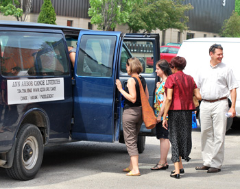
Ann Arbor planning commissioners board a canoe livery van on their tour of the South State Street corridor. From left: Erica Briggs, Diane Giannola, Eleanore Adenekan, and Evan Pratt.
Airport Plaza development. This complex of warehouses and industrial buildings in Pittsfield Township is home to an eclectic mix of businesses. Several of the Zingerman’s Community of Businesses are located there, including the bakehouse, creamery, candy “manufactory,” and coffee company. In addition to production facilities, these businesses also have small retail shops. Though outside of the city of Ann Arbor’s jurisdiction, planning manager Wendy Rampson included this complex in the tour in part because of its proximity to the new Costco store that’s expected to open later this summer, north of Ellsworth and west of State.
South State and Ellsworth. This is another major intersection on the corridor, and is expected to see an increase in traffic after Costco opens. Plans to build a roundabout here are underway, in coordination with the Washtenaw County road commission. The roundabout was discussed by planning commissioners at their March 6, 2012 meeting in conjunction with a Tim Horton’s site plan near the northeast corner of that intersection. A Jimmy John’s shop is expected to submit plans to build near the Tim Horton’s site.
Ann Arbor Research Park. The 33-acre Ann Arbor Research Park was originally conceived to be the city’s answer to Silicon Valley – a place for technology and research businesses – but it remains largely underdeveloped. A wide boulevard runs through the complex, though there’s little traffic. Several automotive research operations and a charter school are located in the complex. An adjacent industrial/office park to the east, with an entrance off of Ellsworth, includes the massive, vacant headquarters of the now-defunct Borders Group, near a large warehouse for the Zingerman’s mail order business.
Planning Commission Retreat: Discussion
After the van tour, planning commissioners and staff returned to a conference room in the Kensington Court hotel and began their discussion by giving impressions of the South State corridor, based on what they’d seen. The meeting later included a discussion of commission/staff work priorities for the coming year. This report focuses on the South State corridor portion of the retreat, and organizes the discussion thematically.
Planning Commission Retreat: Discussion – Traffic, Transportation
Traffic congestion was a major concern, both in volume and flow. Several people cited the danger of vehicles exiting eastbound I-94 onto South State, where drivers must merge with traffic heading northbound on State that’s not required to stop. You need to have eyes in the back of your head to negotiate that turn, Eric Mahler said. “That’s a problem.”
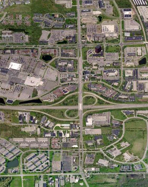
State Street runs north-south. Ellsworth, which runs east-west, is at the bottom of the frame. The large paved area northwest of the I-94/State Street interchange is Briarwood Mall. The area of study extends farther north to Stimson. (Image links to Bing Map.)
The traffic situation is expected to worsen when Costco opens later this summer. There are also spikes in traffic – on Saturdays for University of Michigan football games, for example, or on weekends at Briarwood Mall.
Bonnie Bona wondered whether there are opportunities for more park-and-ride lots south of the I-94 interchange. Planning manager Wendy Rampson reported that according to AATA staff, it’s counterintuitive for people to use park-and-ride lots that are located in the opposite direction of their destination. Diane Giannola also questioned whether there was adequate bus service south of I-94, to serve people going into town.
Several commissioners mentioned the unfriendly climate for pedestrians and bicyclists. There are few crosswalks across State, and making turns or navigating the stretch across I-94 on a bicycle is difficult, Erica Briggs said. On the upside, Mahler noted, there are tremendous opportunities for improvements in alternative transportation there.
Kirk Westphal recalled the walk that some of the commissioners had taken back to the hotel, walking south on State from the intersection of State and Eisenhower. Although there was a sidewalk, there was no buffer between the sidewalk and the street and its fast-moving, heavy traffic. Part of the sidewalk was overgrown with bushes and weeds. It’s worse than he had imagined, Westphal said, and not an environment meant for pedestrians.
Eleanore Adenekan contrasted that experience with the situation on Eisenhower, where she said it’s actually pleasant to walk between State and Main. The sidewalks are wide, there are trees and landscaping, and a buffer between the sidewalk and the street. She used to walk along that stretch during lunch hours with a few colleagues, “and some of us even lost weight!” she joked.
Planning Commission Retreat: Discussion – Aesthetics
While there are some areas that commissioners pointed to as examples of well-kept, aesthetically pleasing properties – the stretch of hotels along Boardwalk, for example, and for some the fountain at the northwest corner of State and Eisenhower – generally, the corridor’s aesthetics weren’t seen as a positive. Tony Derezinski described it as a “less-than-adequate welcome to the city.”
Evan Pratt said the corridor definitely needs a gateway. Bonnie Bona noted that the fountain and retaining wall at the northwest corner of State and Eisenhower – in front of the Michigan Commerce Bank building – was intended to serve that purpose, but “it’s just the completely wrong solution.” And the right-of-way does nothing to build cohesiveness along the corridor, she noted.
The corridor doesn’t really become welcoming until near Stimson, around the Produce Station, said Erica Briggs.
Commissioners pointed to overgrown or non-existent landscaping, barren stretches with concrete medians near I-94, and a general lack of cohesiveness along the entire corridor. Briggs said it seems like the vision for State Street “just didn’t work.” That prompted planning manager Wendy Rampson to quip, “You assume there is a vision!”
It’s time to try a different idea, Briggs said. It would be great to have an off-road connection from the State Street area to downtown Ann Arbor, she suggested – perhaps along the railroad track. It’s a long-term vision, she noted, but something to work toward.
Pratt observed that suggestions for a greenway in Ann Arbor typically end at Stadium Boulevard, but a greenway could really come much further south.
Things change very slowly, Bona said, whether it’s the Reimagine Washtenaw corridor project or efforts to bring more density to downtown. She hoped the city could figure out a way to make some incremental change that would have the biggest impact. One idea is to look at changing the right-of-way, she said. Someone once told her that you couldn’t tell why Ann Arbor is known as Tree City, Bona noted. To change that, she suggested, “let’s plant a million trees!” Rampson quipped that some business owners might just cut down any trees that blocked their signs – a reference to unapproved tree-cutting that occurred at the Red Robin restaurant site on South State.
Matt Kowalski, a city planner, observed that the South State corridor has a much more suburban feel than any of the other major entryways into the city. It’s truly generic, he said – there’s no real sense of the character of Ann Arbor until you get to the Produce Station near Stimson.
Pratt agreed, referring to it as “Anywhere USA.” Landscaping might help, he said. Even if it remains generic, it would at least look better.
Diane Giannola suggested starting with aesthetic improvements – lightpoles, banners, landscaping. Pratt noted that because the corridor is located within the city, it would be easier to create a corridor improvement authority (CIA) to help fund improvements. That’s in contrast with Washtenaw Avenue, which crosses four governmental jurisdictions. [For background on corridor improvement authorities, see Chronicle coverage: "What Does Washtenaw Corridor Need?"]
Kirk Westphal asked whether there seemed to be interest on the part of property owners for a CIA or perhaps a business improvement zone, like one created in downtown Ann Arbor. Kristin Baja reported that Ann Arbor SPARK and the Oxford Company, which manages several properties in that area, have expressed interest in somehow coordinating with the city for improvements like landscaping. She said a meeting is scheduled for later in June to talk about options.
Planning Commission Retreat: Discussion – Zoning
There was some discussion about the possibility of “upzoning” parts of the corridor, to allow for greater density or commercial use. Evan Pratt felt that zoning changes might motivate some property owners, like First Martin Corp., to redevelop sites along the corridor.
Tony Derezinski wondered how many requests have been made that reflect that the zoning is inadequate or out of date. Planning manager Wendy Rampson pointed to the C3 zoning at the corner of State and Ellsworth as an example. That zoning allowed for Tim Horton’s to be located there – the planning commission approved that fast food chain’s site plan in March of 2012. Is that what the city wants to see anchoring that location? she asked.
By way of background, rezoning requests discussed earlier in this article for 1712 S. State – now used by Treecity Health Collective, a medical marijuana dispensary – and for 1643 and 1645 S. State St., where Biercamp Artisan Sausage & Jerky is located, have been part of the commission’s ongoing conversation about the need to make a comprehensive review of zoning along the corridor. Several other areas along the corridor – such as the Ann Arbor Research Park – have been discussed as places where the city’s master plan might need to be updated, with respect to land use. [.pdf of current zoning along South State]
Planning Commission Retreat: Discussion – A Few Positives
During the retreat, commissioners pointed to a few positive attributes of the South State corridor. Some commissioners cited sections that were more aesthetically pleasing, like the stretch of Boardwalk where several hotels are located. Evan Pratt liked the fact that the hotels and some fast food restaurants were tucked back off of South State, but planning manager Wendy Rampson noted that the hotel representatives in particular aren’t thrilled about that. They’re concerned because it’s difficult for people to find the hotels, she said. Several commissioners indicated that there’s a need for wayfinding signs all along the corridor.
Related to signs, city planner Alexis DiLeo noted that there aren’t many “horrendous” signs on the South State corridor, in contrast to Washtenaw Avenue or Jackson Road. It’s somewhat subdued, she said. There also aren’t as many overhead utility lines along the State corridor, which she said was a positive.
The Produce Station on the north end of the corridor, near Stimson, was seen as a vibrant location. Pratt wondered how the city could encourage more businesses like that.
Erica Briggs noted that she can bike from downtown to the area south of Eisenhower, and it’s fairly easy and comfortable.
Planning Commission Retreat: Discussion – What to Include?
Wendy Rampson told commissioners that the planning staff hasn’t included Briarwood Mall in its study at this point, and she asked for feedback about whether that was the right approach. She noted that the mall owners don’t own the outlying lots that encircle the shopping complex. Those are owned by other businesses and the university, which operates several medical offices on the north side of the road encircling the mall.
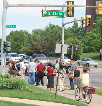
Planning commissioners and staff at the intersection of South State and Eisenhower. The woman on the bicycle was just passing through.
Tony Derezinski observed that it’s a huge development with a major impact on South State. Evan Pratt felt that it should be included, though he said he’d hate to end up in an adversarial position if the overall corridor plan conflicts with the mall’s interests.
Kristin Baja reported that representatives of Briarwood are hoping to close one of the exits onto South State, across from Victors Way. They’d also like to put up larger signs indicating the mall’s location, as well as better landscaping along State, she said. Rampson noted that one of the mall representatives hopes to see more development along the mall’s “ring road” – the idea is that if more businesses are located there, that will draw more customers to the mall area in general, she said. The Twelve Oaks mall in Novi is an example of that.
Rampson noted that it seemed like commissioners were interested in including Briarwood in the study. What about the industrial park that’s located east of the Ann Arbor Research Park, she asked – where the former Borders headquarters is located? Derezinski said it would be hard to ignore, in part because of how it affects traffic patterns leading into the Ellsworth/State corridor.
Industrial parks tend to provide more flexibility and cheaper space for businesses, Rampson said. She pointed to the diversity of businesses in the Airport Plaza complex in Pittsfield Township, where businesses range from Zingerman’s to Maker Works and other quirky enterprises.
Erica Briggs observed that there’s an opportunity to engage the arts community, which might be interested in the cheaper, more flexible space that these areas provide. Derezinski offered to raise the issue with the Ann Arbor public art commission. In addition to his positions on city council and the planning commission, Derezinski also serves on AAPAC.
Rampson said the staff could explore what types of zoning would allow for things like theaters or other arts ventures.
Next Steps
The city’s planning staff will continue to work on draft recommendations, which they hope to complete by the fall. After draft recommendations are developed, the city’s planning commission will give feedback, and a second community meeting will be held.
A final draft of the corridor plan will be made at that point, to be reviewed again by the planning commission, which will hold a public hearing on it. The plan, along with the planning commission’s recommendation, will be forwarded to the city council for another public hearing and vote. If approved, city staff would work to implement the plan’s recommendations.
Commissioners present: Eleanore Adenekan, Bonnie Bona, Erica Briggs, Tony Derezinski, Diane Giannola, Eric Mahler, Evan Pratt, Kirk Westphal, Wendy Woods. Also planning manager Wendy Rampson, Kristen Baja of the systems planning unit, and city planners Chris Cheng, Alexis DiLeo, Jeff Kahan, and Matt Kowalski.
The Chronicle relies in part on regular voluntary subscriptions to support our coverage of public bodies like the city planning commission. If you’re already supporting The Chronicle, please encourage your friends, neighbors and coworkers to plan on doing the same. Click this link for details: Subscribe to The Chronicle.


This area is close to the Ann Arbor Railroad tracks. Old railbeds are often severely contaminated with chemicals from pre-environmental times when tank and bulk rail cars leaked like sieves and chemicals were so cheap that it was not worthwhile to fix them. The plans should include an environmental audit.
It seems like the priorities are opposite what would be best to spend tax dollars on. Why not do the infrastructure improvements first, storm water, sanitary, trails and sidewalk, etc, if needed, then worry about the aesthetics, signage, lighting at the end? Plus the signs we end up, like the whole city signage system, are expensive, not that helpful, and frankly sort of overworked and ugly.
I travel through this area at least every other week and it isn’t a welcoming experience. (I am usually going to Zingerman’s for bread.) As a beginning courtesy to the community, why not have a flagman stationed at the only remaining exit from Airport Plaza onto Ellsworth road? It’s very chancy to make a left turn onto Ellsworth from the Airport Plaza exit. I’ve given up and have made a right turn, going out of my way, to avoid the hazard. The city could request Costco to accommodate their future customers by making this travel easier on everybody.
Sorry, but spare me the trees and signs and “gateway” features. Aesthetics–regardless of whose–are nowhere near as important as infrastructure improvements. The “State Street Corridor” will only ever be as welcoming as the actual surface of State Street. Instead of planting a tree, maybe upgrade traffic signals to reduce congestion. In a related curmudgeonly opinion, pedestrians and cyclists can lump it in this part of town. The “fast moving, heavy traffic” is people going to and from work, the freeway, or the mall (or soon Costco). Nobody bikes to Costco.
Plenty of people bike to work up South State on bikes. I do it often and see others every day.
One of the nicest things you could do to improve bike commuting in the area, IMO, would be to build the portion of the greenway along the tracks from Main Street to Stimson. it would be even better if that continued on along the tracks past the Produce station and hooked into the top of Boardwalk. The second bit would really help avoid the hill if you don’t need to go up it to get over to the Georgetown area.
Whoa! Let’s not go anywhere with that Corridor Improvement Authority idea unless there is a strongly perceived need. That would cream property taxes from new development into a TIFA authority not directly accountable to citizens. We don’t need a “State Street DDA”.
What is the purpose of developing State Street? Presumably to make a better city. But also we have an interest in increasing the tax base to provide services across the city. This is no time to start redirecting taxes into an entity that might simply exist to promote development for its own sake (and private profit).
I work near the corner of State and Eisenhower and bike every day. I have very little faith in the City’s ability to improve this corridor. The more money they spend the worse it gets. For me personally, I hope they just leave it alone.
@Vivienne: I don’t know all the different methods for structuring TIF districts, but do you think that all ways would be a net negative for the overall city economy? I’d imagine it would be quite a battle these days to convince city council to invest in one particular area (like State St.) to the exclusion of firefighters, the potholes on everyone’s block, etc. Not a direct comparison, but do you think our current DDA is a net positive or negative?
Please work on improving the biking experience across State St. over I-94.