Kerrytown Place Praised, Despite Parking
Ann Arbor planning commission meeting (May 21, 2013): A proposed condominium project on North Main and North Fourth Avenue – called Kerrytown Place – won planning commission approval, though some commissioners expressed disappointment with the amount of surface parking on the site.
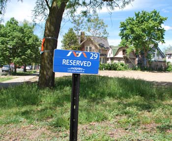
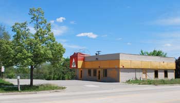
A reserved parking spot on the site of the future Kerrytown Place development. The view is looking north toward an empty lot where the St. Nicholas Church was formerly located. Cars along Main Street are seen on the left. (Photos by the writer.)
The development covers four parcels – at 402, 408 and 414 N. Main and 401 N. Fourth, with the Main Street parcels separated from the North Fourth site by a public alley, which runs north-south. The vacant St. Nicholas Church had been located on the North Main property, but was demolished last year.
McKinley Inc.’s headquarters is south of the site on North Main, and the firm holds a permanent easement for 57 parking spaces on the Kerrytown Place land. Those spaces will be provided on the development’s surface parking lots. Developer Tom Fitzsimmons told commissioners that finding a way to accommodate those parking requirements into the design had been “challenging.”
The North Main site will include 16 townhouse units in a building with a central courtyard. A 3-story structure with 8 units will front Main Street, and a 4-story structure on the east side of the parcel will have 8 additional units facing the courtyard. There will be an underground garage, and additional parking in 12 carport spots and 24 surface spaces.
On the North Fourth site – now a surface parking lot, with an entrance across from the Ann Arbor farmers market – the plan calls for constructing a duplex with a 2-car garage for each unit and a 21-space parking lot behind the building, accessed from the alley. Each unit of the duplex would face North Fourth.
The project includes a rezoning request and modifications to the city’s landscaping and setback requirements. Commissioners praised the development, but Bonnie Bona in particular was critical of the surface parking. She was reluctant to compromise on the developer’s request to decrease a 15-foot minimum setback, saying that “when I’m giving up front yard for more asphalt, I’m just not as happy.”
City planning staff pointed out that the parking easement “runs with the land,” meaning that any development would need to accommodate those parking spaces. Ultimately, commissioners unanimously approved all requests related to the project, which will now be forwarded to the city council for consideration.
In other action at the May 21 meeting, commissioners held a public hearing on suggestions related to the city’s master plan, but postponed action until their June 18 meeting. A review is required by the planning commission’s bylaws to be done annually. The hearing drew six speakers on a range of topics, including development in Lowertown, a park in downtown Ann Arbor, and adequate sidewalks, cleared of vegetation, so that kids can walk to school safely.
There is also a list of resource documents that are used to support the master plan. [.pdf of resource document list] Commissioners spent a fair amount of time discussing why the Calthorpe report isn’t included on the list. The commission appeared to reach consensus that it would be worth reviewing the entire list of resource documents.
Also on May 21, the commission held a public hearing to get input on the South State Street corridor plan, as a possible addition to the city’s master plan. Commissioners and staff have been working on this project for more than two years. No one spoke at the hearing, and commissioners voted to add the South State Street corridor plan to the city’s master plan, as an amendment to the plan’s land use element. The city council will also need to vote on this item.
One request that commissioners rejected was rezoning for 2271 S. State St., where owners would like to sell cars. The vote was 1-8, drawing support only from Eric Mahler. Some commissioners had leaned toward approval, saying it would be good to have some kind of use on the long-vacant site, where Pilar’s restaurant had once been located. But others expressed concern that it didn’t fit with the goals of the South State corridor, and that it could set a precedent for other rezoning requests. It would be possible for the owner, Capital Investments, to bring the rezoning request to the city council, even though it did not receive a recommendation of approval by the planning commission.
During public commentary, commissioners heard from three people expressing concerns about development and city services in southeast Ann Arbor, along the Ellsworth corridor. They asked for a moratorium on any zoning changes or high-density housing there, until the area can be further studied. Residents have formed a task force to pursue the issue.
Kerrytown Place
A proposed residential development spanning North Main to North Fourth – on the site of the former St. Nicholas Church – was on the planning commission’s May 21 agenda.
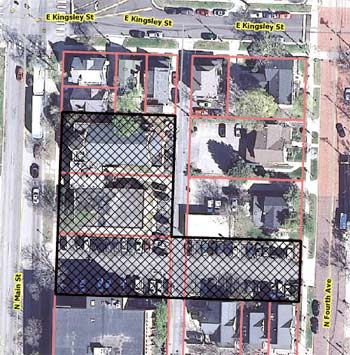
Aerial view showing location of Kerrytown Place development, located between North Main and North Fourth Avenue.
Commissioners were asked to recommend approval of several items for the Kerrytown Place project: (1) rezoning the sites at 414, 408 and 402 N. Main and 401 N. Fourth Ave. to D2 (downtown interface), with a “secondary street” building frontage designation; (2) modifying the city’s landscape ordinance to allow interior landscape islands outside of the perimeter of the “vehicular use” area; and (3) approving site plans and development agreements for both sites. Staff had recommended approval for all items.
The Main Street parcels are separated from the North Fourth site by a public alley, which runs north-south. All parcels are currently zoned for The Gallery planned unit development (PUD), a type of customized zoning – for a residential project that was never built. The county treasurer had foreclosed on the property due to unpaid delinquent taxes, and it was sold at auction to the current developer. The long-vacant church was demolished last year.
For the North Main section, developer Tom Fitzsimmons plans to build 16 townhouse units with an underground parking garage, 12 carport parking spaces and 24 surface parking spaces. The townhouse building is designed with two short towers on a base of underground garages. A 3-story structure on the west side, fronting Main Street, will have 8 dwelling units. A 4-story structure on the east side will have 8 additional dwelling units, which will face a central courtyard. An east/west pedestrian walkway will run between North Main and North Fourth, on the north side of a surface parking lot that’s located on the south side of the development.
On the North Fourth site – now a surface parking lot, with an entrance across from the Ann Arbor farmers market – the plan calls for building a duplex with a 2-car garage for each unit and a 21-space parking lot. Each unit of the duplex would face North Fourth, with the parking lot accessed via the public alley.
One major wrinkle of this project is that McKinley Inc. – which owns the property adjacent to the North Main site – holds a permanent easement for 57 parking spaces on the Kerrytown Place site. Those spaces will be provided on the development’s surface parking lots.
The total project is estimated to cost about $11.8 million. According to a planning staff memo, the site layout and architectural design were influenced by the Johnson Street Townhomes in Portland, Oregon and the Wickliffe Place condo development in Ann Arbor’s Kerrytown neighborhood.
The city’s design review board evaluated the project at a Feb. 20, 2013 meeting. [.pdf of design review board report] City planner Alexis DiLeo described the board’s response as “fairly complimentary,” with three points for the developer to consider. Those suggestions were:
Minimize, or eliminate if possible, the street-level garage doors on North Fourth Avenue. Even if the space within the building is used for parking, and not a traditional active space, the streetlevel experience would be better if the doors were minimized and replaced with landscaping.
The buildings, particularly the “Main Street” and “Alley” buildings, are not tall enough to warrant a complete change of materials at the top. The metal-covered penthouses read as if they are screens hiding mechanical units. At minimum, a different (more vibrant, more complimentary to the other materials and colors, less neutral) color of the proposed metal material should be considered.
Emphasize the main entry doors to each dwelling unit on North Fourth Avenue. These doors now take a distant second place to the prominent garage doors on this façade.
DiLeo said the developer responded to each point in some way. In addition, a citizens participation meeting was held on March 13, DiLeo said, with a focus on clarifying questions. [.pdf of citizen participation meeting report]
The city is asking for a $9,920 contribution to the parks system. According to a staff memo, options for spending that money might include “improvements to the basketball courts at Wheeler Park, improving space for vendors along North Fourth Avenue at the Farmers Market, replacing the trash containers at Sculpture Plaza to match the existing furniture, moveable tables and chairs at the Farmers Market and/or Sculpture Plaza.”
DiLeo reviewed several other aspects of the proposal, and concluded by noting that the planning staff has recommended approval.
Kerrytown Place: Public Hearing
The only speaker during the public hearing was the project’s developer, Tom Fitzsimmons.
He told commissioners that he’s a lifelong resident of Ann Arbor, and has been building homes for 24 years. He introduced the project engineer and landscape architect – Chet Hill of the Johnson Hill Land Ethics Studio – as well as the project’s architect, Chris Allen, who were on hand to help answer questions. As a team, Fitzsimmons said, they were very excited to build a project at this location. At the same time, it’s been extremely challenging, he noted, because of the easement requirement to provide 57 parking spaces for an off-site entity.
The team spent a lot of time designing around that parking requirement, to figure out how to fit it with the housing on the site, he said. They came up with several approaches, and met with city planning staff along the way. “We finally narrowed it down to something we feel fits very well in this site within the context of the D2 zoning,” he said.
Fitzsimmons said he personally met with every single neighbor adjacent to the site, as well as business owners and residents in the surrounding neighborhood to get their feedback. “As far as I know, it’s been universally positive,” he said. Comments were incorporated into the design process, as was feedback from the city’s design review board.
He concluded by saying he hoped the project would gain the planning commission’s support.
Kerrytown Place: Commission Discussion
Tony Derezinski began the discussion by saying it was great to see a project like this on the North Main site. He noted that the planning commission recently co-sponsored a symposium on aging. Ann Arbor is a very attractive place for senior citizens and empty nesters, he said, and this project really fits a need for a growing demographic.
Derezinski wondered if the easement with McKinley for parking was permanent. “Yes, it is,” Fitzsimmons replied. His attorneys had looked at the easement language before he bought the site, so he knew he’d have to comply with that. It’s an easement that “runs with the land,” he said.
Eric Mahler wondered where the nearest bus stop was located. [Mahler was recently appointed to the Ann Arbor Transportation Authority board.] City planner Alexis DiLeo reported that there’s a bus stop at the corner of Fourth and Catherine, but she wasn’t sure it was the closest. Mahler said it’s a great project and he’d be giving it his support.
Eleanore Adenekan also voiced support, but said she was concerned about parking on market days. Fitzsimmons replied that he wasn’t exactly sure what would happen on market days. McKinley will still hold the easement to its parking, and the firm has allowed Huron High School to lease out the parking on market days, as a fundraiser. Fitzsimmons didn’t know if that would continue or not. He highlighted the public walkway that’s planned for the site, calling it a public benefit to allow people to walk to the market more easily from Main Street. The parking lot would be less visible from Fourth, which isn’t a bad thing, he noted.
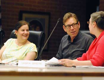
Sabra Briere said she’s heard concern from people about whether the public alley will be blocked during construction. It allows people to access parking at Braun Court. Fitzsimmons said they haven’t started the construction document phase, let alone construction planning, but he isn’t aware that they would have the ability to close off a public alley. Conceptually, the development team has been looking at how to build on this tight site, he said. This is not a skyscraper, he said. It’s stick-frame construction that’s a little more dense than their typical projects, but similar to what he usually builds. He anticipates building it without blocking or inconveniencing anyone.
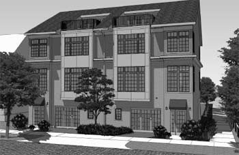
An image of the proposed Kerrytown Place development, included in the planning staff report. This is the building facing North Fourth.
Ken Clein also commended the project, citing its scale, fit within the community, connection to the farmers market, and landscaping. His one concern is the angle of exit from the garage onto Fourth Avenue. His own home’s driveway has a less acute angle, and even then it’s hard to keep an eye out for people when pulling into the street. Chet Hill replied that the design team looked at the turning radius into the garage, and that the dimensions are configured relative to a parking lot.
Clein also wondered where the waste bins and recycling would be located. Hill said that the Fourth Avenue residents will wheel their trash and recycling out of their garage. On Main Street, a dumpster and recycling bins will be located in the northeast corner of the site, off the alley.
Clein’s final question was about the pricing of the units. Were they all market rate? Yes, Fitzsimmons replied. The units will range in size from 1,400 to 2,400 square feet, and would be priced in the mid- to mid-high-end range, he said. Referencing Derezinski’s remarks about the aging demographic, Fitzsimmons said they tried to design a lot of “single-floor living.” He indicated that they’re already getting a lot of interest from potential residents.
Bonnie Bona asked about the request for a “secondary street frontage” designation.
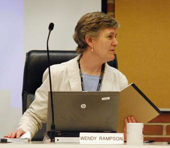
Planning manager Wendy Rampson explained that the D2 front yard setback requirement for the site is a 15 feet minimum, but the developer is requesting a “secondary street” setback, which is between zero to 10 feet. The project’s proposed setback on the Main Street side is 7 feet. There is no setback requirement for the alley, but the proposed design has a setback of 5 feet along the alley. On Fourth Avenue, the building has a setback of 4 feet 2 inches, between the property line and the face of the front door.
Bona also asked for an explanation of the difference between the required landscaping and the modifications that the developer is requesting.
The developer is asking to put in one continuous landscape bed along the entire north side of the surface parking lot, rather than the required interior “landscape islands” that would butt out into the parking lot. DiLeo said the developer isn’t asking for a reduction in the number of trees or in the square footage of required landscaping, “just the shape of it.”
Bona said that considering pedestrians will be walking along that path, the landscaping modification is probably beneficial. It’s nice to have something developed on this site, she said, but “the surface parking lot is really unfortunate.” She would hope that in the downtown, there would be structured parking so that land wouldn’t be used for surface parking.
She asked the developer why the city should grant a modification on the street frontage, allowing for shorter setbacks. It’s one of the city’s first projects in the D2 zone, and “I’m not convinced that we should be compromising on a zoning ordinance that we just wrote.”
Fitzsimmons noted that on the Fourth Avenue side, the buildings on either side are closer to the street than the proposed development. “I know,” Bona replied. “But we just zoned this. We zoned it to be 15 feet, because it’s getting closer to the neighborhood.” The 0-10 foot setback is in a different part of the neighborhood, she noted. A lot of work went into the downtown zoning process, Bona added. For a building that’s accommodating a lot more parking than she’d like to see, “I need a better explanation for why we should compromise on a brand new zoning,” she said.
Hill pointed out that if the project is designated with secondary street frontage, the 0-10 foot setbacks are allowed in D2 districts. Like Fitzsimmons, Hill also mentioned that the setbacks on Fourth Avenue would be identical to the neighboring buildings. On Main Street, there’s only a slight deviation from the setback of adjacent buildings, he noted.
Hill told Bona that “we fully, fully agree with your concerns about surface parking.” But given the easement requirements, there was no other way to accommodate the parking. That has severely restricted what can be done on the site, he said, and necessitated their request regarding setbacks. He noted that the project will be providing more trees and square footage of landscaping than the city requires.
Noting that she too was involved in establishing these frontage requirements, Rampson said the idea was to set the requirements so that a new development wouldn’t alter the street frontage substantially. Now, the site’s parking lot goes up almost to the sidewalk on Fourth Avenue and Main Street. The former Greek Orthodox church had been set back further from the street and had a more residential character, Rampson said, but the residential buildings to the north of this site are set back less than 15 feet. The McKinley building on the south side has zero setback.
A street pattern is established, Rampson said, and she’s not sure why the setbacks call for 15 feet along this stretch. The intent might have been to mirror the west side of Main Street. Given the setbacks of neighboring buildings, a 15-foot setback “is not necessarily going to provide that continuity that you would hope for,” Rampson noted. That’s why the planning staff felt it was appropriate to recommend the secondary street frontage, she said.
Bona replied that because there will be a parking lot between the McKinley building and the new development, it does seem like a separate residential area is being created by Kerrytown Place. “I’m trying to get my arms around that, because I know there was a lot of discussion about scale and appropriateness,” Bona said. She has a harder time accepting compromises with a large surface parking lot there. “When I’m giving up front yard for more asphalt, I’m just not as happy,” Bona said. “So that’s my struggle.”
Wendy Woods said that if the buildings end up looking like the renderings, it will really enhance Main Street. She thanked the developer for not requesting D1 zoning, noting the commission has been whipped about that recently. [Woods' comment – a reference to the controversial 413 E. Huron development, in a D1 zoning district – elicited laughs from other commissioners. D1 zoning allows for the highest amount of density. On Feb. 6, 2013, the commission had voted 5-3 to recommend that city council approve the 413 E. Huron project, which did not meet the six-vote threshold to win a recommendation. Council approval, on a 6-5 vote, came at its May 13, 2013 meeting.]
Woods appreciated that the design takes into account the Kerrytown area, the farmers market and the surrounding neighborhood. It’s a great project, she said.
Kirk Westphal asked for clarification about the pedestrian walkway. DiLeo reported that it won’t become public property, but there will be some sort of formal agreement – possibly an easement – that will allow public use. She likened it to the arrangement at Ashley Mews, but said that the city attorney’s office hasn’t completed the agreement yet. Responsibility for maintenance would remain with the property owner.
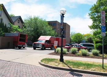
Entrance off of Fourth Avenue into the proposed Kerrytown Place site, facing west. A duplex will be built on this site, eliminating the entrance to the parking lot.
Responding to another query from Westphal, DiLeo said that the parking easement runs with the land and will remain in perpetuity, unless the easement holder – McKinley Inc. – decides to vacate it. Hill noted that stormwater detention for the proposed buildings is located under the parking lot.
Rampson noted that the project is proposed at 127% FAR. [FAR – floor area ratio – is a measure of density. It's the ratio of the square footage of a building divided by the size of the lot. A one-story structure built lot-line-to-lot-line with no setbacks corresponds to a FAR of 100%. A similar structure built two-stories tall would result in a FAR of 200%.]
Rampson explained that 200% would be allowed on that site, or up to 400% if premiums are provided. In a theoretical situation, if the easement holder vacated its rights and the parking area became available, it could still be developed, she noted. So in terms of opportunity costs, it would still be possible to develop that surface parking lot.
Sabra Briere reported that over a year ago, some members of city council sat down with the Washtenaw County treasurer [Catherine McClary] to talk about this parcel. The city was concerned about what might happen to the property. If a property doesn’t sell at auction, it can be offered to the municipality, she said. Learning about the parking easement “was really daunting,” she added.
Briere said she was surprised, in a pleasant way, that a solution was found to develop a project on the site.
Westphal also asked about the garage doors facing Fourth Avenue. Fitzsimmons replied that the design team felt they needed to provide two parking spaces for each unit on Fourth Avenue. The initial design was to have two-door garages facing the street. After feedback from the design review board and city staff, the current design has just one garage door on Fourth Avenue, and another entry into the garage from the parking lot in the back.
Outcome: In one unanimous vote, commissioners recommended approval of all three resolutions related to the Kerrytown Place project. It will be forwarded to the city council for consideration.
Master Plan Review
A public hearing was held on May 21 seeking input on any changes that residents might want to see in the city’s master plan. A review of the master plan is required by the planning commission’s bylaws to be done each May.
There are seven documents that constitute the city’s master plan: (1) sustainability framework, adopted in 2013; (2) parks and recreation open space (PROS) plan, adopted in 2011; (3) land use element, adopted in 2009; (4) downtown plan, adopted in 2009; (5) transportation plan update, adopted in 2009; (6) non-motorized transportation plan, adopted in 2007; and (7) natural features master plan, adopted in 2004.
There is also a list of resource documents that are used to support the master plan. [.pdf of resource document list] The most recent addition to this list was made by the planning commission at its March 5, 2013 meeting, when commissioners added the Connecting William Street report, which had been developed by the Ann Arbor Downtown Development Authority.
Planning staff recommended postponing action on the master plan review, pending discussion of work plan priorities for staff and the commission, as well as to give the commission additional time to consider comments heard during the public hearing. Planning manager Wendy Rampson noted that the resolution on the May 21 agenda regarding this review mentions several items that are in the works related to the master plan, including an update of the city’s non-motorized transportation plan, the Washtenaw Avenue and North Main corridor projects, and the sustainability framework’s action plan.
Rampson recommended that commissioners listen to input from the public hearing, but not to take action on the resolution until their second meeting in June.
Master Plan Review: Public Hearing
The public hearing drew six speakers on a range of topics, including development in Lowertown, a park in downtown Ann Arbor, and adequate sidewalks cleared of vegetation so that kids can walk to school safely.
Jeff Haynor Hayner said he has lived in the Lowertown area since the early 1980s, and that he’s worked in the area since the mid-1990s – first at a now-defunct Internet company at the base of Broadway, as well as across the Huron River along North Main, for the business owned by Wap John. He said he’s familiar with what’s going on in the area. Hayner referenced Chapter 6 of the master plan’s land use element, which focuses on Lowertown. [.pdf of Chapter 6] Some of the information in that document “didn’t seem to fit with what my expectations and my living in Lowertown has been like,” he said.
Hayner noted that some of the developments planned for that area “haven’t worked out so well.” He cited the Nielson Square infill project on Wall Street, saying it seemed to open the door for the University of Michigan to come in and buy up properties along Wall Street. Now, UM is building a large seven-story parking structure there, he said. It’s bad enough to have the 11-story Riverside Condominiums there, he added.
Hayner didn’t agree with the master plan’s description of Lowertown or of the problems the area faces. But his biggest concern was the mention of appropriate development being low-rise (2-4 stories) to mid-rise (5-8 stories). “Just because the U of M is doing it doesn’t mean the city should allow it,” he said. He’d prefer to see the plan for development in that area – as well as all areas of the city – be brought down in height. He thought developers should be required to petition the city for larger projects. It’s a neighborhood, and even though the field that’s now at the site of the former Kroger isn’t the greatest thing, he said, “at least it’s a field, and not derelict buildings.” He urged planning commissioners to change the master plan to make low-rise buildings the maximum allowed. It will be disappointing if it gets built out more than the area already is, he concluded.
Ethel “Eppie” Potts, a former planning commissioner, was very interested in the commission’s list of resource documents. Recently, she noted, the commission added the Connecting William Street report to that list. However, the Calthorpe report is missing – why? she asked. “That’s a report that gets quoted and made use of quite regularly.” It was developed through a major public process, Potts said, and while she doesn’t like everything in it, it’s useful in many ways. She’d like to hear a discussion about the standards that commissioners use to select their resource documents.
Potts noted that the commission has been asked by the city council to take another look at the city’s D1 zoning. She presumed that meant mapping possibilities as well as rewriting city code. What the community has learned in recent weeks is that only parts of the D1 zoning are enforceable, Potts contended. [Her comment alluded to the city council's approval of the 413 E. Huron project.] If the city code is rewritten, she urged that important aspects be included in the portion of the zoning that’s enforceable, and “not just be fluffy words put to the side, as what’s happening in some recent cases.” The overlay district, for example, isn’t enforceable, she said, nor is the descriptive material in the city code.
Public engagement was another topic raised by Potts. If the public doesn’t know the location or time of a meeting, “it’s not an open meeting,” she said. She presumed that the public would be notified of meetings when D1 zoning would be discussed, including subcommittee meetings.
Kathy Griswold focused on the non-motorized transportation plan. She read the plan’s vision statement:
The purpose of the plan is to identify the means to establish a physical and cultural environment that supports and encourages safe, comfortable and convenient ways for pedestrians and bicyclists to travel throughout the City and into the surrounding communities.
Noting that she’s said this in the past, Griswold told commissioners that “we need sidewalks for our children to walk to school.” In many cases, children walk to school in the streets, and there’s a wall of vegetation growing right to the edge of the street so it’s not even possible to walk on the side of the road.
She advocated for enforcing Chapter 40 of the city code, which deals with visibility and vegetation trimming. Chapter 40 also needs to be revised so that it’s similar to the code in the country’s four platinum-level bike-friendly cities, she said. [The designation is awarded by the League of American Bicyclists. The platinum level has been awarded to Portland, Oregon; Fort Collins and Boulder, Colorado; and Davis, California.] Those cities have specific site-distance requirements, she noted, and in most cases, their height limit for vegetation is 30 inches, lower than the 36 inches allowed in Ann Arbor. Acknowledging that it takes time to install sidewalks, she’d like immediate action taken to trim vegetation so that it’s trimmed back at least three feet from the curb.
Alan Haber advocated for a central park or central civic area atop the Library Lane underground parking structure. More broadly, the downtown should not have density everywhere, he said. It should have a civic center – “a place where energy gathers, more than simply the commercial, gourmet expressions along Main Street.” A park is an important element of that, he said. But other civic amenities might include an auditorium, a museum, or an outdoor place to aggregate public art. It could be a place to create a culture of peace and nonviolence for the children of the world, he said – a place that embodies the city’s culture and values. That would be the kind of vision he’d like to see incorporated into the master plan.
Kathy Boris directed her comments to the zoning of a specific lot on the west side of Ann Arbor – the site of the former Barnard Plating factory, on the south side of Jackson Avenue, between Glendale and Burwood. She and other residents would like to see it zoned for single family. Right now, it’s zoned for multi-family use, she said. It’s part of a neighborhood that’s about half single family and half multi-family residences. There’s no reason to tip the scale toward multi-family in their neighborhood, Boris concluded.
Barbara Lucas began by saying she’s not often asked for her opinion about what should happen in Ann Arbor. She didn’t have the chance to read the master plan, but she had a few thoughts. A few years ago, she and her family moved to Ann Arbor to be where they didn’t need to have a car. They live near the Argo canoe livery. It’s not safe to walk around the neighborhood at night, she reported, noting that there have been multiple armed robberies at the party store on Broadway. The more people that live in the area, the safer it will be, so she encouraged commissioners to do anything that will increase residential development there.
Getting groceries is another challenge without a car, Lucas said. It’s difficult to ride a bike up the hill going to Kroger on Plymouth, so she’d like to bring more residents to the neighborhood in order to support a grocery. The owner of the party store told her that he couldn’t sell fresh food there, because not enough customers would buy it. It’s difficult to have affordable housing, “because it’s hard to afford the taxes in Ann Arbor,” she said. It’s important to have more affordable housing, so people who work at the UM hospital can live in the neighborhood and walk to work, rather than needing a place to park.
Lucas also cited the need to slow traffic down in that area. When she rides her bike over the Broadway bridge going into town, nobody stops for pedestrians at the crosswalk because they can’t see it when they come over the hill. She’s afraid to encourage vehicles to stop for her at the crosswalk, because they almost get rear-ended when they do. Any kind of warnings or signs would be helpful, she said.
Master Plan Review: Commission Discussion – Lowertown
Bonnie Bona began the discussion by responding to Jeff Hayner and Alan Haber, who spoke during the public hearing. One of the things she finds fascinating about planning is the interconnectedness of the planning work, she said. Bona encouraged the two men to attend the public meetings of the city’s North Main-Huron River Vision task force, because the DTE site near the Huron River and Broadway bridge is part of that project, in the Lowertown area. The site has the potential for combining public space with private development, she said, and the ideas that Hayner and Haber proposed would be helpful in shaping the future of that area. [Bona serves on the task force, which held its first public forum the following night, on May 22. Another forum is set for May 29 at city hall, 301 E. Huron, from 5-7 p.m.]
Sabra Briere noted that a neighborhood email list had alerted residents to the fact that the master plan item was on the commission’s agenda, and she observed that some people attended the public hearing who hadn’t previously spoken to the commission. She also said she’d received several emails from people who live in the Lowertown area, who felt very strongly that the city should reconsider the planning for the area adjacent to Wall Street/Maiden Lane. There was concern about the appropriate type of encouragement for business and residential development, she noted, as well as concern about the master plan’s recommended height of buildings there. It’s probably time to review that, Briere said.
Following up on Briere’s comments, Ken Clein suggested that it might be a good time for the review since the area isn’t under speculation for a specific development. He also thanked the residents to spoke during the public hearing, saying it was helpful to see the connection between their lives and the things that the planning commission does, which sometimes seem arcane. The end result of zoning regulations and legal concerns is the connection to the community, and the fact that residents get involved is a part of that, he said.
Master Plan Review: Commission Discussion – Resource Document List
Most of the commission’s discussion focused on the issue raised by Eppie Potts during the public hearing, regarding the list of resource documents. Wendy Woods said it hadn’t occurred to her that the Calthorpe report wasn’t included, so she asked if staff or one of the other commissioners could explain why it’s not on the list. She noted that the commission refers to the report frequently.
Bonnie Bona, who noted that she “lived through” the process of developing the Calthorpe report, said it’s probably not on the list because it led to the downtown plan, which is part of the master plan. [.pdf of downtown plan] The downtown design guidelines, which are part of the resource list, also resulted from the Calthorpe process, she explained.
Planning manager Wendy Rampson agreed. The Calthorpe report is woven into the downtown plan, but predates it, she said. The other resource documents are intended to help explain elements of the master plan. Rampson said commissioners could add Calthorpe to the list, if they felt it would be a useful background document.
Woods felt it should be added.
Sabra Briere clarified that the official name of the Calthorpe report is the Downtown Development Strategies Project report. She noted that there are a lot of documents on the resource list that no one she knows ever refers to. However, Calthorpe is in still very much in people’s lexicon, she said. Briere thought that having the report as a resource document for background would be useful, and she wondered whether the entire list should be re-evaluated.
Diane Giannola liked the sense of history that the resource documents provided. She didn’t feel it was a bad thing potentially to duplicate information by adding the Calthorpe report. However, she hoped people would understand that it was a report that led to the downtown plan. There might have been things that were compromised on or changed in the final document.
Ken Clein suggested reviewing the Calthorpe report before deciding whether to include it on the resource list, since there are likely places where it’s in conflict with the master plan. Eric Mahler noted that Calthorpe isn’t an official city document – noting that it was produced by a consultant. It likely conflicts in some ways with the downtown plan, he said. If they only pay attention to parts of the Calthorpe report that simply agree with the downtown plan, there’s no point in including it. Mahler wouldn’t want to add a resource document that would give anyone an excuse to exploit something they don’t like in the master plan. He felt there was a reason why the Calthorpe report hadn’t been included up to now.
Woods acknowledged that she’s not an attorney. [That was likely a reference to Mahler, who is an attorney.] She referred to a description of resource documents that was included in the city’s sustainability framework report. She cited this description:
Council-Approved Plans. Plans designated as “council-approved” refer to plans other than master plan elements that have formal approval by Ann Arbor City Council. These plans may also have approvals from other City of Ann Arbor commissions. These plans are often resource documents that supplement the City Master Plan by providing additional detail for interpretation and implementation of the recommendations. Council-approved plans are typically created through an existing commission or special committee that develops the plan and recommends it to City Council for their approval adoption.
[It's worth noting that some of the plans on the resource document list – such as the Connecting William Street report – are not approved by the council. That category of plan is also described in the sustainability framework report: "Plans categorized as 'commission-approved' do not have formal approval from Ann Arbor city council, but do have approval from one or more of Ann Arbor’s city commissions. Commission-approved plans are typically created through an existing commission or special committee that develops the plan but the plan is either (1) not brought to City Council for further approvals or (2) has been brought to City Council but has not been adopted." The Connecting William Street report was adopted by the planning commission as a resource document, but did not receive any action by the council.]
Woods noted that she served on the council when the Calthorpe report was developed. When people talk about these plans, they talk about the fact that these documents are used to guide decisions, but aren’t etched in stone, she said. Unless the city attorney’s office indicates that it would be a problem, Woods said she’d rather have the Calthorpe report on the resource list so that future planning commissions and city councils can have historical documentation.
Bona said she didn’t have a strong opinion about the Calthorpe report. What’s really important about all of these documents is that most of them are the culmination of public input. Many of them relate to gaps in the master plan, like North Main Street. That area really isn’t covered in the master plan, she said. The flood mitigation plan is another example. Calthorpe might be worth adding because it went through such an extensive public input process, she said.
Another plan that keeps getting mentioned is the Allen Creek Greenway report, Bona said. It had been produced by a task force that the council appointed. She wasn’t sure if it was actually approved by the council or simply accepted, but it might be worth considering whether to add it as a resource.
Responding to Mahler’s concerns, Giannola said she saw it from another angle. Having the Calthorpe report as a resource shows people what wasn’t adopted into the downtown plan. It doesn’t mean that Calthorpe trumps everything, she said. It just provides historical context.
Briere also voiced support for “evolution of thought,” saying that “it helps us understand where we are today.” She didn’t think the fact that a plan was council-approved should be a factor in deciding whether to include it as a resource document. For example, the council approved parts of the Huron River Impoundment Management Plan (HRIMP), but that plan isn’t in the master plan or on the resource list – even though it guides, to some extent, decisions made about the river.
Rampson confirmed that not all documents on the resource list are council-approved. Some of them – like the North Main Street/Huron River Corridor Summary Land Use Policy from 1988 – were previously a part of the master plan, but were removed at some point. All of them are city plans, however – not the work of an outside consultant or nonprofit.
Kirk Westphal said he’d rather be more inclusive than exclusive for documents on the resource list.
Tony Derezinski expressed some concern about adding Calthorpe, saying that the city has perhaps moved “beyond Calthorpe.” It tends to be like scripture, he said – everyone quotes it for their own reasons. Does it assist in understanding the evolution of thought, he asked, or does it bring people back to where they started? That’s important, particularly when there’s a contested issue, he noted. Some people might think that if the planning commission adds Calthorpe now as a resource document, it’s a more powerful statement because it was not initially included. “I’m just conjuring up the possibility of horribles,” he said.
Derezinski wanted to get an opinion from the city attorney’s office.
At that, Rampson shook her head. “I don’t think it’s necessary,” she said. “I think we might be overthinking it a bit.” She noted that the resource documents have been used to understand what’s happened in the past, and the commission has never used the documents to try to contradict anything in the master plan. The master plan is clearly what’s been adopted by the planning commission and by the city council, Rampson added, as required by state law. “My suggestion is that we not ask the attorney’s office for an opinion on that – if that’s OK.”
Giannola felt it was OK, as long as it’s made clear that there’s a difference between the master plan and the resource document list.
Outcome: Commissioners unanimously voted to postpone action on the master plan review until their June 18 meeting.
Master Plan: South State Corridor
Also on May 21, the commission held a public hearing to get input on the South State Street corridor plan, as a possible addition to the city’s master plan. [.pdf of South State Street corridor plan] Commissioners and staff have been working on this project for more than two years. [For additional background, see Chronicle coverage: "State Street Corridor Study Planned," “Sustainability Goals Shape Corridor Study,” “Ideas Floated for South State Corridor.” and “South State Corridor Gets Closer Look.”]
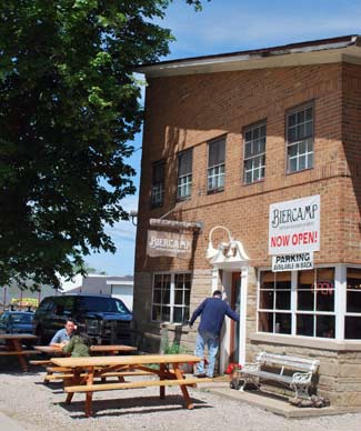
Biercamp at 1643 S. State St., near the north end of the South State Street corridor studied by the planning commission and planning staff.
Recommendations are organized into categories of the city’s recently adopted sustainability framework: Land use and access, community, climate and energy, and resource management. Among the recommendations are: (1) Evaluate use of vacant parcels for alternative energy generation; (2) Evaluate integrating public art along the corridor; (3) Evaluate use of open land for community gardens; (4) Assess and improve high crash areas along the corridor; (5) create boulevard on State Street between Eisenhower and I‐94 to enable safer automobile, bicycle, and pedestrian movement; (6) Consider utilizing vacant parcels for athletic fields and recreation facilities; (7) Develop a pedestrian and bicycle path along the Ann Arbor railroad that will connect the planned Allen Creek bikeway to Pittsfield Township through the corridor; and (8) Resurface roads in the corridor.
Each recommendation includes several related action items. The report also provides a section that organizes the recommendations into each of three distinct sections of the corridor: (1) from Stimson on the north to Eisenhower Parkway; (2) from Eisenhower south to the I-94 interchange; and (3) from I-94 to Ellsworth. In addition, there are nine site-specific recommendations for areas including Briarwood Mall, the complex of hotels near Victors Way and Broadway, and the research park development near the corridor’s south end.
At the planning commission’s May 21 meeting, two resolutions were on the agenda: (1) a vote to add the South State Street corridor plan to the city’s master plan, as an amendment to the plan’s land use element; and (2) a recommendation that the city council also adopt the plan into the master plan’s land use element. By state law, elements of the master plan must be approved by both the planning commission and the city council.
No one spoke during a public hearing on this item. Joe Upton – a former city councilmember who is vice president of sales and marketing at Edwards Brothers Malloy, a book manufacturer based on South State – attended the meeting but did not address the commission.
Master Plan: South State Corridor – Commission Discussion
Discussion was brief. Bonnie Bona said she was very proud to have participated in developing this plan. “It’s a beautiful document, and I think it thoroughly captures what’s unique and challenging about South State Street.”
Bona said she assumed that when the transit connector study is finished, the commission might need to revisit the South State Street corridor plan. [The connector study, being done by the consultant URS Corp., is focused on the possibility of developing a transportation connector – for the corridor running from US-23 and Plymouth southward along Plymouth to State Street and south along State Street to I-94.]
Bona asked city planner Jeff Kahan for an update on the connector study. Kahan noted that the South State corridor plan includes a section on transportation-related issues, including the connector study. Here’s the relevant paragraph:
Connector Feasibility Study (2012) – This study explores multiple scenarios for high capacity transportation service along major activity centers in the Plymouth Road and State Street corridors identified in the Transportation Plan Update. The study area included the Plymouth Road corridor in northeastern Ann Arbor, downtown, and major activity centers on the south side. It included the University of Michigan’s north campus, medical center campus, central campus, and athletic campus, as well as downtown Ann Arbor and employment centers near I-94. The State Street Corridor was identified as one of three possible routes for the south end of the study area (the other two: S. Main/Ann Arbor Saline and the Ann Arbor Railroad).
Kahan noted that if the South State Street corridor is chosen as the southern leg of the transit connector, then the city would need to revisit the land use recommendations for that corridor, to better dovetail with the transit system.
Ken Clein thanked the city staff for its work developing the corridor plan. He noted that it’s the first city plan that incorporates the new sustainability framework. He hoped people would look at it. “Even though planning documents can be a little bit dry, I think there are a lot of interesting things in here.” The plan had also received a lot of input and support from businesses and others along the corridor, he said.
Tony Derezinski said he had noted “with a bit of glee” that a picture of his favorite sausage shop was posted prominently in the report. [A photo of Biercamp, located at 1643 S. State, is included on page 19 of the plan.]
Sabra Briere reported that she sometimes hears from people who say that public input doesn’t matter, and that those involved in local government only listen to insiders. She pointed out that eight people responded to the survey on A2 Open City Hall about the corridor plan, but 86 people read the topic. That’s pretty good, she said, given that A2 Open City Hall is still novel. Briere highlighted A2 Open City Hall as a tool for feedback, saying it’s something that city staff and others who are interested in the topic read. She’s grateful to the staff for coming up with this approach, and she hopes to see it used constantly.
Kirk Westphal said that A2 Open City Hall is a new tool, but the city also got input from public forums and interviews with the business community and others along South State.
Outcome: In two separate unanimous votes, commissioners added the corridor plan to the master plan, and recommended that the city council do the same.
Rezoning for 2271 S. State
In another item related to South State Street, the commission considered a rezoning request for 2271 S. State St., where owners would like to sell cars. Also on the agenda was a resolution to waive an area plan requirement for the site. An area plan is more conceptual than a site plan, and indicates generally how a site will be developed.
The project had previously been on the commission’s Dec. 18, 2012 agenda, when action was postponed.
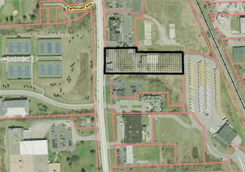
Aerial view showing 2271 South State Street. Most recently, Pilar’s Tamales had been located in a building at the front of the site. The large lot on the right side of this image is a parking lot for Ann Arbor Public Schools buses. The property on the left of the image is the University of Michigan tennis facility. On the bottom left is a portion of the Edwards Brothers Malloy book manufacturing business.
The 2.24-acre site is located on the east side of South State, across the street from a University of Michigan tennis facility. Most recently, Pilar’s Tamales restaurant was located there, though that building is now vacant. The owner, Capital Investment Co., requested rezoning from M1 (limited industrial) to M1A (limited light industrial) so that an auto dealership could be located there. The plan calls for renovating an existing 1,868-square-foot building that fronts South State, to use as a sales office, while using the rear warehouse as an auto repair shop. Repaired cars would be stored and sold in the front parking lot.
The city’s master plan discourages commercial uses along South State, except for the sites adjacent to the Stimson and South Industrial commercial area. The master plan calls for research and industrial uses, and a new corridor plan for South State recommends a mix of office and residential uses for that area. Earlier in the May 21 meeting, commissioners had voted to recommend adding the South State Street corridor plan to the city’s master plan, as an amendment to the plan’s land use element. The city council must also approve adding the plan, before it official becomes part of the master plan.
In giving the staff report, city planner Jeff Kahan also noted that an auto dealership is not the type of use that would support improved public transit along the South State Street corridor, and the parking lot lighting would not be consistent with existing and future mixed-use development. City staff did not support rezoning the site, but did support approval of the area plan waiver.
According to a staff memo, regardless of the outcome of the rezoning request, the owner still needs to resolve several compliance issues related to the existing site plan, including lack of required landscaping, an unfinished building foundation, deteriorated driveways, and stormwater drainage problems. Owners also need to submit a re-occupancy permit that would require approval by the city’s building department, and the site would need to be brought into compliance before a new business could open there. The property is located in Ward 4.
Not mentioned at the meeting is the fact that the property is apparently for sale, with an asking price of $1.6 million.
Rezoning for 2271 S. State: Public Hearing
The only speaker at the public hearing was local attorney Scott Munzel, representing the owner. Capital Investments wants to renovate the existing warehouse in the middle of the site. Their business is to buy vehicles at auctions, repair them, then ship the vehicles overseas. They’d like to renovate the roughly 3,500-square-foot warehouse, and sell some of the repaired autos on the State Street frontage.
Munzel said the site is fairly narrow, with significant grade drop-off to the east. This affects the type of uses that could be developed on the site, he said. The maximum number of cars that could be parked on the site near State Street would be about 16. It would not be like the Honda dealership further south on State Street, he said.
To the immediate east is the Ann Arbor Public Schools bus storage facility, with dozens of buses parked there. Immediately to the west – across State Street – is the UM tennis facility, and commercial-type office uses are located on the north and south of the site. There are no residential uses on the near vicinity of the site, he said.
Munzel noted that the proposal is consistent with the existing master plan, which calls for industrial uses. There are a variety of M1A sites already in the area, he noted. The planning staff is concerned about auto sales on that site, but Munzel said there’s no way the topography would allow for the site to be turned into a conventional dealership. “It’s a theoretical concern, but in reality it’s not a practical issue,” he said.
Other elements of the master plan include economic development, employment opportunities, activating State Street frontage – all of these things could be done with the proposed rezoning, he said. Munzel also felt the lighting issue wouldn’t be a problem.
Regarding the South State Street corridor plan, Munzel thought it was unfair to evaluate the rezoning request against that plan, given that the city council hasn’t yet adopted it into the master plan. He said the city needs to strive to create plans that optimize the outcomes that the city seeks, “but it doesn’t happen in a vacuum.” There are financial and market demand issues, as well as logistical issues for the site, that also should factor into the commission’s decision. “That site is just not going to be developed according to the draft [corridor] plan, at least for some time,” he said.
Munzel said his clients don’t object to the corridor plan, because in the long run, they’d like to use the site for its “highest and best use.” They view their current proposal as a limited investment, and when demand develops, they’re planning to develop it in a way that’s more consistent with what the city desires, Munzel said. They want to use the site better now, in a way that preserves the ability to use it better in the future, too, he concluded.
Rezoning for 2271 S. State: Commission Discussion – Rezoning
Bonnie Bona said the project is simple from a site plan perspective, but not from a policy perspective. She appreciated the staff explanation related to the appropriateness of the proposal. She also appreciated Scott Munzel’s comments about the reality that the South State corridor goals will take some time to achieve. The parcel has been highly underutilized for a long time, she noted, and she was strongly leaning toward approval so that there would be some activity on the site. If the owners were making a major investment, she’d feel differently. But she was sure that when the transit connector comes in or when other corridor improvements are made, the property will become valuable enough for a higher use.
Eric Mahler also was leaning toward support. Having some activity on the site is better than nothing. Also, moving from M1 to M1A isn’t significant, he said, and there’s only a slim chance of the site becoming a full-fledged auto dealership. The owner is looking for a fairly reasonable step up to put a business, Mahler said. He didn’t think it was an unreasonable request. “I don’t have any misgivings about it, even though the master plan tells me I should,” he said.
Ken Clein had some concerns. The proposal is not what the city is trying to achieve for that area, he noted, and it might set a precedent for other rezoning requests from South State property owners. In the case of 2271 S. State, there’s no guarantee that the property won’t be sold after it’s rezoned, he said.
City planner Jeff Kahan confirmed that the zoning stays with the property if it’s sold. That’s a staff concern too, Kahan said. Zoning to allow for an auto dealership has considerable value, he added, and it has the risk of becoming a long-term use. This is a corridor that’s been identified as having potential for active uses, to encourage more pedestrians, residents and jobs. Dealerships tend not to have a lot of jobs, he noted.
The staff uses the city’s master plan for guidance, Kahan said, and the master plan doesn’t support this kind of zoning or use on that site.
Clein clarified with Kahan that the owners would need to bring forward a site plan, before significant changes would be made to the site. Planning manager Wendy Rampson noted that a site plan is already in place – approved prior to Capital Investments buying the property. That site plan was started, but never completed. “We’re going to have to unravel that at some point,” she said. The parking lot off of South State was paved, but the landscaping and other improvements that are required by the site plan were never completed. A building was started but never finished, she said. That’s an enforcement issue that needs to be handled.
Rampson noted that if the rezoning doesn’t get approved, the property can still be used for office space and auto repair. But if rezoning is approved to allow a new use, she added, pressure will be removed to develop the site in a way that’s more consistent with the South State Street corridor plan that the commission adopted earlier in the meeting.
Responding to a question from Diane Giannola, Kahan said that the main difference between M1 and M1A is that M1A allows for auto sales. It doesn’t differentiate between indoor and outdoor sales, he said.
Tony Derezinski said one of the concerns is that the site has been vacant for a long time, and needs a lot of work. There are substantial compliance issues too. The owners “tantalize” the city with the possibility of changing the site’s use in the future, he noted, but he wondered if the site could be put to a better use now, other than auto sales and repair. “I’m really torn on this one,” he said.
Clein agreed that activating the site and strengthening the tax base are important, but he didn’t sense a commitment from the owners to fix up the site. He felt there’s a desire to do as little as possible on their part, while they’re asking for a rezoning that goes in a direction counter to the city’s goal.
Wendy Woods described the site as looking a little “unloved.” The owners are saying they’ll make further improvements if they get this rezoning, she noted, but that’s asking the city to trust them, and she wasn’t sure about that. She also highlighted the citizens participation meeting, which only drew two people – who owned adjoining property. Those people are in favor of the project, but they raised the concern about drainage. Woods had a concern about trusting the property owner, especially when environmental issues are at stake.

Exposed rebar in an unfinished foundation for a building at the lower level of 2271 S. State, toward the middle of the property.
Kirk Westphal said rezoning would be contrary to the master plan as well as to all the public feedback that had been given in developing the South State corridor plan. He also was concerned about setting a precedent in rezoning.
Bona noted that she agreed with other commissioners, and that the timing of the owners might just be bad regarding the new corridor plan.
Munzel asked if he could respond, and though it’s not the commission’s usual habit or protocol to do that, Westphal allowed it, after checking with other commissioners. Munzel called it a difficult site to develop, and said the owner “is not like the guy who bought 413 E. Huron.” [That reference is to a controversial residential project that was approved by the city council on May 13, 2013.]
The owner of 2271 S. State is very nervous about dealing with the city, Munzel said, and has been reluctant to spend much money because it’s unclear what the city would allow on that property. Some of the improvements that the owner would need to do now will benefit the site for a future use, he said – like putting in a new stormwater drainage facility. If the owner is allowed to pursue this temporary use through rezoning, Munzel said, then the owner might be able to carry the site and wait for a much better use, like residential. But if the rezoning doesn’t occur, there might be a less desirable longer-term use there, Munzel said.
Woods asked Kahan to show a slide from the staff report that displayed a portion of the site overgrown with weeds, with a partially-built structure and exposed rebar. She called it “close to an eyesore,” and wondered when the current owner bought the property. Munzel replied that Capital Investments bought the site in 2010. He noted that the picture showed the foundation and rebar from the existing site plan started by the previous owner, and it would be removed.
Outcome on rezoning: Commissioners denied the recommendation for rezoning on a 1-8 vote, with support only from Eric Mahler. It would be possible for the owner to bring the rezoning request to the city council, even though it did not receive a recommendation of approval by the planning commission.
Rezoning for 2271 S. State: Commission Discussion – Area Plan Waiver
Wendy Rampson explained that even without a recommendation of approval from the planning commission, the owner could decide to take the rezoning request directly to city council for consideration. If the council decides to approve the rezoning, the owner would need to submit an area plan – or the area plan would need to be waived by the planning commission. The planning staff felt there’s no benefit to having an area plan at this point, because there’s a previously approved site plan that can be used for enforcement purposes, she said.
If the commission waives the area plan requirement and the council approves the rezoning, then the owner could proceed directly to seeking building permits, Rampson explained. If the council denies the rezoning, nothing new happens on the site.
If the commission does not waive the area plan and the council does approve the rezoning, then the owner would need to develop an area plan that would also require approval.
Rampson said it’s tricky, because the existing site plan was never completed. The current owner has a continuing obligation to comply with that site plan. At some point, the city needs to determine what aspects of that site plan have been completed – like the upper lot – then make sure that other elements of the site plan are finished, too, she said. The other possibility is to make an administrative amendment to tailor the site plan for the current situation. “A new site plan is not required to occupy these buildings,” Rampson explained. But this is separate from the area plan issue, she noted.
Kirk Westphal said he wasn’t inclined to approve the waiver. Ken Clein had the opposite view, citing staff’s recommendation. He didn’t have a problem with the waiver, as long as he knew the site plan would be completed.
Sabra Briere said “I think this comes down to do we ask the petitioner to spend more money.” If the commission requires that an area plan is created before asking city council for the rezoning, then that means the petitioner must spend the time, energy and expense on it, before gambling on what the council will do, she said. That almost makes it too onerous for the petitioner to bring the request to the council, so Briere wanted to waive the requirement.
Bonnie Bona asked when the South State corridor plan would go to the council. City plan Jeff Kahan noted that the staff hadn’t known what action the planning commission would take regarding the corridor plan, so it hasn’t been put on the council’s agenda yet. Kahan guessed it would go before the council within the next month or so.
Bona said it would be unfortunate if the 2271 S. State project went before council prior to the South State corridor plan. She wondered why the site plan wasn’t required to be updated. Rampson replied that the updates are required if the site plan hasn’t been implemented. In this case, the problem is that work on the site plan is already underway, and the current owner isn’t proposing to do anything differently, she said – and the plan is to leave the existing buildings in the same location.
Bona thought it would be worth looking at the city’s requirements, and possibly changing them so that regular progress is required on implementing site plans. “The thought of completing a plan today that doesn’t meet our current requirements seems a little odd – and unfortunate,” she said.
Rampson clarified that if the rezoning request moves on to the city council, it would potentially be on the same council agenda as the South State corridor plan.
Westphal felt that waiving the area plan sent a message that the rezoning request should move forward to the council, even though it didn’t receive a recommendation of approval from the commission.
Outcome on area plan waiver: Commissioners voted 7-2 to waive an area plan requirement for the site, with dissent from Kirk Westphal and Wendy Woods.
Communications & Commentary
During the meeting there were several opportunities for communications from staff and commissioners, as well as two general public commentary times. Here are some highlights.
Communications & Commentary: Southeast Ann Arbor
During the time for general public commentary, people associated with the Forest Hills Cooperative – located on the north side of Ellsworth, east of Stone School Road – spoke to commissioners. Some of these residents have previously addressed the commission, expressing concerns about the Summit Townhomes development at 2081 E. Ellsworth Road, which the city council approved on May 6, 2013. Concerns had related to increased density in the area, and a lack of city services.
Aiji Pipho said she represented Forest Hills Cooperative. In that general area, which she described as very densely populated, the services are inadequate, she said. There’s only a very small community center, she noted – Bryant Community Center. It does a fantastic job of distributing food, she said, but it really doesn’t have the capacity to serve more than the 200 or so homes in the Bryant neighborhood. None of the existing large townhome developments – Forest Hills, University Townhouses, and Colonial Square – have a community center. That’s something that residents are interested in, she said, to serve the area from Stone School along the Ellsworth corridor.
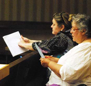
From left: Claudia Myszke and Aiji Pipho of the Forest Hills Cooperative spoke during public commentary at the planning commission’s May 21 meeting.
Pipho said that some of the residents are designing a survey to ascertain needs. They hope to return with strong information about what that side of town needs. In the meantime, she added, they were asking for a moratorium on any zoning changes or high-density housing in that area.
Claudia Myszke, managing agent of Forest Hills Cooperative, said people who live in the area have formed a task force – with the tentative name of Southeast Area Task Force – to address these types of issues, including the master plan. From Platt Road to Stone School along Ellsworth, there are about 1,300 units of multi-family housing, she noted. The density is extreme. In a five-mile radius of Forest Hills, there are over 4,000 units of multi-family housing, she added. Continuing west on Ellsworth to State Street, you’ll see light industrial areas with very large open spaces and setbacks. However, only the businesses can take advantage of that open space. For residents, the main open space in that area is a toxic former landfill, she said. The task force is asking the commission to consider giving some attention to the Ellsworth Road corridor – much like the city has done for other corridors. [Ongoing efforts for corridor improvements in Ann Arbor are focused on North Main, South State and Washtenaw Avenue.]
Myszke concluded by saying that for a long time, the southeast area of Ann Arbor has been designated as an area for low- to moderate-income residents with no services from the city.
Another resident from the southeast area emphasized the same points that Pipho and Myszke had made about density. She noted that there are new businesses along Ellsworth, like Costco, in addition to new housing, and traffic is bad on that road. She hoped the city would consider widening Ellsworth, as well as a moratorium on development until a plan can be developed for that area.
Communications & Commentary: Downtown Housing
During general public commentary at the start of the meeting, Barbara Tucker said she wanted to reinforce something that city councilmember Sabra Briere was quoted as saying in the media recently. [Briere, who represents Ward 1 on council, also serves on the planning commission.] Briere had said that there seems to be consideration for affordable housing and high-end housing, Tucker reported, but there also might be people in their 50s and 60s who’d like to move closer to downtown. Tucker said she’s heard that because of the economics of new construction, it’s not feasible to create housing that’s affordable for middle-class people – housing between $250,000 and $300,000. She wanted to reinforce Briere’s observation, and hoped that the planning commission would give some consideration to that.
Communications & Commentary: North Main-Huron River Task Force
Bonnie Bona reported that the city’s North Main-Huron River Vision task force would be hosting public forums on May 22 and May 29, to present some initial ideas and get feedback from residents about possible changes along that corridor.
The May 29 public forum will be held at city hall, 301 E. Huron, from 5-7 p.m. The task force then will incorporate the feedback into recommendations that will be presented to the community on Wednesday, June 12, from 6:30-8:30 p.m. at the Ann Arbor Community Center, 625 N. Main. After that, the task force will meet again to finalize their recommendations – on Wednesday, June 19 from 5-7 p.m. at the NEW Center, 1100 N. Main. The final recommendations will be sent to the city council for consideration.
Bona suggested getting more information online at the task force website. A survey on A2 Open City Hall is also posted, where residents can provide feedback by responding to open-ended questions.
Communications & Commentary: Planning Manager Updates
Wendy Rampson highlighted four upcoming meetings of the Washtenaw Avenue corridor project, known as Reimagine Washtenaw. The format will be identical for each meeting, held on different days at different locations along the corridor:
- Tuesday, May 28 from 6-8 p.m. at the Washtenaw County Learning Resource Center (near the county jail complex), 4135 Washtenaw Ave.
- Wednesday, May 29 from 8-10 p.m. at the Washtenaw County Learning Resource Center (near the county jail complex), 4135 Washtenaw Ave.
- Thursday, May 30 from 7-9 p.m. at Carpenter Elementary’s multi-purpose room, 4250 Central Blvd., Ann Arbor.
- Friday, May 31 from 2-4 p.m. at Eastern Michigan University’s McKenny Union Room 330.
Input is being solicited for a corridor right-of-way study that’s funded by the federal Dept. of Housing & Urban Development (HUD). Forums will include a 30-minute presentation on the concept of Complete Streets, followed by time to give feedback on pedestrian crossings, adding bike lanes, transit stops, and sidewalks to the corridor, and providing input on a vision for the future of mass transit along the corridor.
Rampson also highlighted a public meeting regarding proposed sign ordinance amendments for digital signs and billboards. That meeting will be held on Wednesday, May 29 at 7 p.m. in the basement conference room of city hall, 301 E. Huron.
In other updates, Rampson noted that the city council had appointed Paras Parekh to replace Eric Mahler on the planning commission. The council confirmed Parekh at its May 20, 2013 meeting, and he will be joining the commission after July 1, she said. [Parekh is currently director of marketing and membership for the University of Michigan alumni association. His undergrad degree in economics is from UM. He has worked in marketing for a bit more than a decade, and spent two years as a legislative aide in the U.S. House of Representatives working for Congresswoman Lynn Rivers. Mahler has served two terms on the planning commission, and was recently appointed by the council to serve on the Ann Arbor Transportation Authority board.]
Communications & Commentary: Environmental Commission
Kirk Westphal, who serves as the planning commission’s representative on the city’s environmental commission, reported on work that’s being done in several areas. Issues that the environmental commission is looking at include (1) tree planting on private land, (2) energy efficiency and private businesses, (3) strengthening ties with neighborhood groups, (4) turf grass, (5) “green streets,” (6) the city’s Huron River Impoundment Management Plan (HRIMP), and (7) an “interactive widget” that helps consumers make decisions about buying a car or home based on commutes, transit access and heating/cooling costs.
Westphal suggested that commissioners contact him or Matt Naud, the city’s environmental coordinator, for more details on any of these topics.
Present: Eleanore Adenekan, Bonnie Bona, Sabra Briere, Ken Clein, Tony Derezinski, Diane Giannola, Eric Mahler, Kirk Westphal, Wendy Woods.
Next regular meeting: Tuesday, June 4, 2013 at 7 p.m. in the second-floor council chambers at city hall, 301 E. Huron St., Ann Arbor. [Check Chronicle event listings to confirm date]
The Chronicle survives in part through regular voluntary subscriptions to support our coverage of publicly-funded entities like the city’s planning commission. If you’re already supporting The Chronicle, please encourage your friends, neighbors and coworkers to do the same. Click this link for details: Subscribe to The Chronicle.



You have done a fine job of consistently misspelling Jeff Hayner’s name in at least three articles. He is our neighbor, and it is spelled Hayner. Also, thanks to him for speaking up about the master plan, it does indeed misrepresent our neighborhood.
We’ve corrected the spelling of Jeff Hayner’s name in this article and have noted the error as a Missed Tick – thanks for alerting us. You mentioned three articles in which his name is misspelled, but I’m not able to find any other articles with that misspelling. We reported on his public commentary during a May 9, 2012 meeting of the Ann Arbor Public Schools board, but in that article his name is spelled correctly. If you could point us to the other misspellings, we would be able to make the corrections. Thanks.
Try this one it is spelled Hanyer in this article: [link]
I hate to be that guy, but isn’t the Edwards Brothers property at the bottom left of the image, not bottom right? Or am I turned around (quite possible)?
Re: [4] I think you’re correct; possibly an error introduced on editing. Will confirm and rectify.
Re. location of Edwards Brothers property on the aerial image – you’re right, Rod. Thanks for pointing it out. I’ve made the fix. (Our formatting for captions doesn’t allow for our typical correction approach, though, so the text is simply revised.)