


North Main & River Task Force Created
At its May 7, 2012 meeting, the Ann Arbor city council passed a resolution establishing a task force to study the corridor along North Main Street and the Huron River.
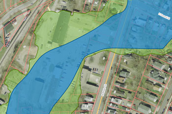
The creation of the task force comes in the context of the city’s application to the Federal Emergency Management Agency for funds to demolish two former maintenance yard buildings on the city-owned 721 N. Main parcel. The application has been approved by FEMA, but is pending the update of the city’s All-Hazard plan, which had expired and is being updated. FEMA is willing to help fund the demolition, because the two buildings are located in the floodway. The city council’s eventual acceptance of the FEMA grant will require a deed restriction on development in the floodway portion of the parcel.
At the most recent meeting of the Ann Arbor Downtown Development Authority, on May 2, 2012, mayor John Hieftje expressed his view that the 721 N. Main property should become a city park as part of an Allen Creek greenway. At that meeting, he spoke of a possible grant from the state’s Natural Resources Trust Fund and matching funds from Washtenaw County Parks and Recreation to support the construction of such a park, with connections to the Border-to-Border Trail, which runs along the Huron River, on the opposite side of Main Street from the 721 N. Main property.
The memo accompanying the resolution includes the MichCon property – between the Amtrak station and the Huron River – as part of the task force’s scope: “This task force’s efforts should create/complete/enhance pedestrian and bike connection from downtown to Bandemer and Huron River Drive, increased public access to the river-side amenities of existing park in the North Main-Huron River corridor, ease traffic congestion at Main and Depot at certain times of a day and recommend use for MichCon property at Broadway.” [For discussion of MichCon's planned environmental cleanup work on the site, see previous Chronicle coverage of the March 20, 2012 meeting of the city's park advisory commission.]
The task force is supposed to conduct a series of public workshops, and consult with independent professionals and city staff. By July 31, 2013, the task force is supposed to provide a report. The task force is also supposed to provide a recommendation on the use of the 721 N. Main parcel by Dec. 31, 2012. That earlier deadline is there to facilitate the city’s application to the state for the Natural Resources Trust Fund, which has a deadline of April 2013.
The city’s 2007 Non-Motorized Plan shows a long-term vision for pedestrian and cycling amenities on the west side of the Huron River, including an underpass for the railroad tracks that would essentially extend a shared-use path from Fifth Avenue at Depot Street under the tracks across Riverside Park the MichCon property, where it could eventually connect with the Border-to-Border trail. [.pdf of map from 2007 Non-Motorized Plan] Responding to an emailed query, transportation program manager Eli Cooper wrote to The Chronicle that the Non-Motorized Plan is currently being reviewed for its regular update.
The specific members of the North Main Huron River task force have not been named, but the makeup of the group set forth in the resolution is as follows: one member of the park advisory commission, one member of the planning commission, one resident representing the Water Hill neighborhood, one resident representing the North Central neighborhood, one resident from the Old Fourth Ward, one resident representing the Broadway/Pontiac neighborhood, two business and property owners from the affected area, and one member of the Huron River Watershed Council.
This brief was filed from the city council’s chambers on the second floor of city hall, located at 301 E. Huron. A more detailed report will follow: [link]