


Washtenaw Water Office to Study Ann Arbor
A study of possible infrastructure improvements to ameliorate flooding risk in the southwestern part of Ann Arbor will be undertaken at a cost of $200,000, to be paid for with city funds already held by the Washtenaw County water resources commissioner’s office.
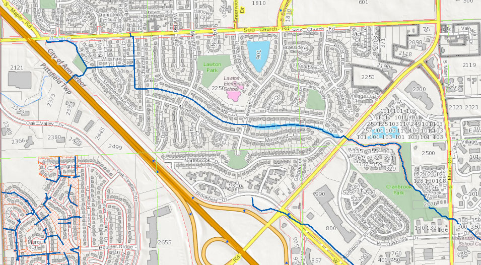
The Ann Arbor city council authorized the arrangement at its Oct. 15, 2012 meeting. The area to be studied includes part of the Malletts Creek drainage district, bounded by Ann Arbor-Saline Road, I-94 and Scio Church Road. The area includes the Churchill Downs and Lansdowne sub-creekshed drainage areas. [.jpg of partial area map] Potential improvements include detention, pipe upsizing, and green infrastructure.
A staff memo accompanying the resolution mentions the heavy rains on March 15, 2012, which resulted in street flooding in that part of the city. The city council heard complaints from the public at its meetings after the flooding. A map of historical flooding in the city – obtained by The Chronicle through appeal of an initially denied request made under Michigan’s Freedom of Information Act – shows that respondents to a survey conducted in the mid-1990s reported they’d experienced street flooding in the same areas that the flooding occurred earlier this year.
A resolution passed by the council at its Aug. 9, 2012 meeting had directed city staff to start negotiations with the Washtenaw County water resources commissioner to conduct the study.
This brief was filed from the city council’s chambers on the second floor of city hall located at 301 E. Huron. A more detailed report will follow: [link]