Stories indexed with the term ‘City of Ann Arbor Environmental Indicators’

Environmental Indicators: Trees

Editor’s Note: This is the fourth in a series of Chronicle pieces on the environmental indicators used by the city of Ann Arbor in its State of Our Environment Report. The report is developed by the city’s Environmental Commission and designed as a citizen’s reference tool on environmental issues and as an atlas of the management strategies underway that are intended to conserve and protect our environment. The report is organized around 10 Environmental Goals developed by the Environmental Commission and adopted by city council in 2007.

Ann Arbor Tree Town

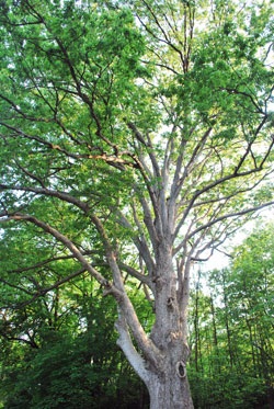
This is one of Ann Arbor's more significant trees. Some readers will undoubtedly recognize it and will know its location, type, and age – which they're invited to leave in the comment section.

This month’s report is also an invitation to all readers to participate in the development of Ann Arbor’s first comprehensive Urban Forest Management Plan. A public workshop to help kick off the planning effort is being held on June 1, 2010 from 7-9 p.m. at Forsythe Middle School, 1655 Newport Road.

This spring has been exceptional with both beautiful weather and ample rain. The trees seemed to have noticed, with their early bud break in April and full canopies by mid-May. While we worried for those tender emerging leaves when the temperature dipped below freezing, the trees handled the dips in temperatures just fine and are now flourishing.

That’s good news because the city receives exceptional benefits from our trees. A recent analysis of the publicly managed trees (i.e., trees along streets and mowed areas of parks) estimated that they provide $4.6 million in benefits each year. When you factor in the cost for management, the city receives $2.68 in benefits for every $1 it spends on the municipal forestry program. We think that’s a pretty good rate of return.

What are these benefits and how were they calculated? [Full Story]

Environmental Indicators: Phosphorus

Editor’s Note: This is the third in a series written by Ann Arbor city staff on the environmental indicators used by the city of Ann Arbor in its State of Our Environment Report.

The State of Our Environment Report is developed by the city’s environmental commission and designed as a citizen’s reference tool on environmental issues and as an atlas of the management strategies underway that are intended to conserve and protect our environment. The newest version of the report is organized around 10 environmental goals developed by the environmental commission and adopted by the city council in 2007.

Phosphorus periodic table

Phosphorus takes its place in the periodic table of elements with atomic number 15. Too much P is not good for the Huron River.

This installment focuses on phosphorus levels in our creeks and river. Adrienne Marino is a recent graduate of the University of Michigan School of Natural Resources and Environment and is an Environmental Programs Assistant with the city of Ann Arbor. Matthew Naud is the Environmental Coordinator at the city of Ann Arbor and can be reached at mnaud@a2gov.org.  Elizabeth Riggs with the Huron River Watershed Council and Molly Wade with the city of Ann Arbor provided additional input on the regulatory issues.

All installments of the series are available here: Environmental Indicator Series.

April showers will surely give way to May flowers and the start of lawn care season in southeast Michigan. As you tend to your lawn this spring and summer, you should know that your choices regarding lawn maintenance – especially fertilizer application – have large and measurable effects on the health of the Huron River and on the natural and human communities who depend on it.

How do we know this? The city of Ann Arbor’s ordinance regulating phosphorus-based lawn fertilizers took effect at the beginning of 2007. And sampling of Huron River phosphorus levels by University of Michigan scientists shows significant decreases in total phosphorus levels in 2008 and 2009. Huron River Watershed Council sampling of the creeksheds support these findings. [Full Story]

Environmental Indicators: Resource Use

Editor’s Note: This is the second in a series written by Ann Arbor city staff on the environmental indicators used by the city of Ann Arbor in its State of Our Environment Report.

Trash and Recycling in Ann Arbor

Recycling totes and a trash cart await collection in Ann Arbor. The totes will be replaced with bins similar to the blue trash cart in mid-2010. (Photo by The Chronicle.)

Although Matt Naud, the city’s environmental coordinator, is listed as the author of this piece, he received “a boxload of help” from Adrienne Marino, Tom McMurtrie, and Nancy Stone.

The SOE report is developed by the city’s environmental commission and designed as a citizen’s reference tool on environmental issues and as an atlas of the management strategies underway that are intended to conserve and protect our environment. The newest version of the report is organized around 10 environmental goals developed by the environmental commission and adopted by the city council in 2007. This installment focuses on responsible resource use.

All installments of the series are available here: Environmental Indicator Series.

With the closing of the 2009 holiday season, and many of us surrounded by lots of new “stuff” – including the associated boxes and packaging – and even a few of us with New Year’s resolutions to “simplify” our life in the coming new year, it seems like a good time to talk about all of the stuff we buy, use, reuse, recycle, and then throw out in Ann Arbor. [Full Story]

Environmental Indicators: Creeksheds

yellowlevel

Overall creekshed indicator for Ann Arbor: fair (yellow) and stable (level arrow).

Editor’s Note: This is the first of what The Chronicle intends to become a series of pieces on the environmental indicators used by the city of Ann Arbor in its State of Our Environment Report. The report is designed as a citizen’s reference tool on environmental issues and as an atlas of the management strategies underway that are intended to conserve and protect our environment. The newest version of the report is organized around 10 Environmental Goals developed by the city’s Environmental Commission and adopted by City Council in 2007.

The first in the series is an introduction to the creeksheds indicator by the city’s environmental coordinator, Matt Naud.

The overall creekshed indicator for the city is yellow (fair) and stable (level arrow). But that overall picture is composed of individual indicators for each of the creeksheds that drain into the Huron River – the central natural feature of Ann Arbor. More than 10 miles of the Huron are located within the city limits.

We assess individual creeksheds, not just the Huron River watershed as whole, because that allows us to focus on exactly the areas that need the most improvement.  Seven different creeks within the city of Ann Arbor flow into the Huron: Allen Creek, Fleming Creek, Honey Creek, Malletts Creek, Millers Creek, Swift Run Creek and Traver Creek. [Full Story]