


Planning Commission Postpones Parks Plan
Ann Arbor planning commission meeting (Feb. 8, 2011): After 90 minutes that included public commentary from three board members of the Allen Creek Greenway Conservancy, planning commissioners voted to postpone action on the city’s Parks and Recreation Open Space (PROS) plan until their Feb. 15 meeting.

Ray Fullerton, a board member of the Allen Creek Greenway Conservancy, passes out a letter to planning commissioners that makes suggestions for revising the city's Parks and Recreation Open Space (PROS) plan. In the background is planning commissioner Kirk Westphal. (Photos by the writer.)
The postponement coordinated with a similar move made last month by the Ann Arbor park advisory commission, which rescheduled its vote to its Feb. 15 meeting in order to allow for additional public input.
The PROS plan provides an inventory, needs assessment and action plan for the city’s parks system, and is updated every five years. The updated document is required by the state in order for the city to be eligible to apply for certain grants.
A public hearing on the PROS plan drew three board members of the Allen Creek Greenway Conservancy, a nonprofit dedicated to developing a park running through Ann Arbor from Stadium Boulevard to the Huron River, roughly following the course of the original Allen Creek. They advocated for stronger support of the greenway within the PROS plan.
PROS Plan Update
Updated every five years, the city’s Parks and Recreation Open Space (PROS) plan is a comprehensive look at current assets and future needs. The current update spans 2011 through 2015. It is reviewed by the park advisory commission (PAC) and the planning commission before being forwarded to city council for a final vote, then sent to the state.
The effort is being led by parks planner Amy Kuras. The planning commission has previously given Kuras feedback, most recently at its Jan. 11, 2011 working session. [The Chronicle's report on that working session provides a detailed look at the PROS plan draft.] Planning commissioners were originally scheduled to act on the PROS plan at their Feb. 1 meeting, which was canceled due to severe weather warnings. They pushed back the vote to Feb. 15, to coincide with the park advisory commission’s vote on that same day. PAC had pushed back action to allow time for additional public input.
Tuesday’s planning commission meeting included an update from Kuras on changes in the draft, a public hearing and more than an hour of commissioner questions and comments.
PROS Plan Update: Staff Report
Kuras began by summarizing changes that had been made to the draft PROS plan since she last met with planning commissioners. [.pdf file of changes to the draft]

Amy Kuras, the Ann Arbor parks planner, gave an update to the city's planning commission on the Parks and Recreation Open Space (PROS) plan, which is nearing completion.
She noted that the window for including public commentary had officially closed at the end of January, though additional feedback from public hearings and the parks and planning commissions could still be incorporated. In addition to input from the general public, the main feedback had been given by the Allen Creek Greenway Conservancy, the parks and planning commissions, and the Washtenaw Area Transportation Study (WATS), which advocated incorporation of more information about non-motorized transportation plans.
There had been a lot of feedback about the use of 2000 Census data – people thought the PROS plan should use the more recent 2010 data, she said, but it wasn’t yet available. As soon as it was provided, the plan would be updated with that information, she said.
Kuras gave a section-by-section report of changes that had been made to the draft. Here’s a sampling:
- Section I – Community Description: Information was added about the city’s updated transportation plan, including a description of issues with the railroad cutting off park access, and improvements to the Border-to-Border Trail along the front of Fuller Road, at the site of the proposed Fuller Road Station. A paragraph was added to explain that any proposed sale of parkland must be placed on the ballot for a vote by the general public, as required by city charter. A sentence was added about the process of rezoning parkland parcels, noting that questions have been raised as to whether parkland is sufficiently protected and whether zoning should include more restrictive language for parks.
- Section II – Administrative Structure: Information was added about facilities that are owned by the city, but are run by private nonprofits – including the Leslie Science & Nature Center, and the Community Action Network, which manages the city’s Bryant and Northside community centers.
- Section III – Budget & Funding: Following the suggestion of planning commissioners at their January working session, Kuras said she moved the FY 2011 budget information from this section into an appendix, and included more information about general budget trends. More explanatory text was added to make the budget-related charts clearer, she said.
- Section IV – Inventory of the Park, Recreation and Open Space System: The parks maps will be replaced with maps that have easier-to-read text and legends.
- Section V – Land Use Planning & Acquisition: A map will be replaced with a larger one showing the location of properties protected by the greenbelt millage. An explanation was added to distinguish between criteria for acquiring greenbelt property and city parkland.
- Section VI – Planning Process for the PROS Plan: In the section that summarizes feedback from the planning commission, these sentences were added: “Staff should explore all opportunities to generate revenue, including public/private partnerships. A balanced view must include all possible risks inherent with acceptance of private funding.” In the section regarding the Huron River Impoundment Management Plan (HRIMP), an explanation was added, noting that one of the plan’s consensus points was that certain types of limited commercial development should be encouraged along the Huron River, especially in the Argo/Broadway area.
- Section VII – Goals & Objectives: A goal was added to explore public/private partnerships, while considering their long-term effects. Several objectives were removed that did not specifically relate to parks and recreation.
- Section VIII – Infrastructure Needs Assessment: Several additions were made that related to the Allen Creek Greenway, including information related to the history of the proposed project and recommendations of the city’s Allen Creek Greenway Task Force.
- Section VIX – Action Plan: The capital projects criteria section was updated to align more closely with the city’s capital improvements plan (CIP) rating system. Also, an explanation was added that these criteria have been tailored to park projects. And a sentence was added that states: “The Allen Creek Greenway is not listed under a specific year as the construction of new trails and park areas are contingent upon both land acquisition, master plan approval and an implementation plan.”
PROS Plan Update: Public Hearing
Four people spoke during the PROS plan public hearing, including three board members of the Allen Creek Greenway Conservancy.
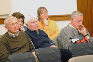
Front row, from left: Joe O'Neal, Ray Fullerton, and Jonathan Bulkley, board members of the Allen Creek Greenway Conservancy. Back row: Gwen Nystuen, an Ann Arbor park advisory commissioner, and Rita Mitchell. All but Nystuen spoke during the planning commission's public hearing on the Parks and Recreation Open Space plan.
Jonathan Bulkley, chair of the conservancy’s board, told commissioners that if it is designed properly and if zoning changes are made carefully in conjunction with that design, then the greenway will provide a return to the city that will exceed its costs. It’s not an overnight project, he said – the earliest reference that they could find to it is in the 1981 PROS plan. But now is the time to act, and each passing day of inaction makes the project more difficult, he said. “It’s an opportune time to move forward, and it’s a time for action.”
Bulkley said the conservancy has held talks with officials from the University of Michigan, the Ann Arbor Railroad and potential donors. A solid backing in the updated PROS plan would provide a catalyst to these entities, he said. The major change to the plan requested by the conservancy is to give the greenway a separate subsection in Section VIII (Infrastructure Needs Assessment). The greenway is currently an item listed in the subsection on potential new recreational facilities and parks amenities.
Board member Ray Fullerton continued this thread, inviting commissioners to check out the conservancy’s website for more information, including a video with remarks from supporters. The greenway trail would be for a variety of users, including bicyclists, runners, and people with baby strollers. The idea is to make the three-mile stretch as lively as possible. The railroad is only running two trains a day, he said – the conservancy hopes to secure the railroad’s right-of-way for the greenway. He noted that they’ve looked at similar projects in 18 other cities, including Flint, Kalamazoo and Grand Rapids. The best greenway is in Seoul, South Korea – a project that Fullerton described as breathtaking. The conservancy hopes to take the lead in the greenway project, he concluded, much like a lead sled dog is needed on a team.
Joe O’Neal, who’s also a conservancy board member, began by apologizing to commissioners – “we don’t mean to be ganging up on you tonight.” They weren’t asking for money or land at this point, he said. But they do need the city’s support. One donor told them, “When the city’s behind you, I’m behind you, but not until.” O’Neal then reviewed three of the requests they were making for revisions to the PROS plan:
- Adding a bullet point in the parkland acquisition subsection of Section VIII (Infrastructure Needs Assessment): “Designate the floodway portions of city-owned First & William, 415 West Washington and 721 North Main as parkland.”
- Adding a bullet point in the neighborhood parks & urban plazas subsection of Section VIII (Infrastructure Needs Assessment): “Begin the process of developing a Master Plan for the Allen Creek Greenway showing potential alignment and its relationship with all neighborhoods along the route, the Downtown, the University of Michigan (more specifically, the Athletic Campus), the Huron River Greenway (Border to Border Trail), the Ann Arbor neighborhoods south of Stadium Boulevard, and the opportunities to the south through Pittsfield Township to Saline.”
- Labeling the Allen Creek Greenway on two of the maps.
O’Neal concluded by noting that the properties along the proposed greenway will never again be as available as they are now, given current market conditions.
Rita Mitchell raised concerns about information on a chart in Section I (Community Description), which included data on parkland acreage per 1,000 residents in different parts of the city. The lowest by far is in the central district, which includes downtown, at 3.7 acres per 1,000 residents. She noted that if there’s an effort to increase residential density in this area, there should be a commensurate effort to increase parkland there. Mitchell said she opposed the Fuller Road Station project – a large parking structure, bus depot and possible train station that’s proposed on city-owned land now designated as parkland – and supports the greenway. There’s a lot of community support for the greenway, she said.
PROS Plan Update: Commissioner Deliberations
Several commissioners thanked Kuras for her work, and praised her efforts over the past year in getting input for the PROS update. They also offered a wide range of comments and questions. For this report, their discussion is organized by topic.
PROS Deliberations: Density, Parkland Acreage
Bonnie Bona asked Kuras to discuss how they should be viewing the downtown area, with regard to density and parkland. Have other communities come up with formulas to calculate density? Perhaps quantity isn’t the best way to look at it, she offered.
There’s been a lot of dissent on this topic, Kuras said. Many people feel that downtown is a different animal regarding parks and open space, she said. People living downtown aren’t looking for soccer fields – people are recreating differently, and that recreation includes public as well as private areas, like sidewalk cafes. Creating plazas and other hardscape areas are more of a priority. Kuras also noted that there are several parks that are peripheral – but within walking distance – to the downtown, including West Park and Wheeler Park.
Bona said that assuming they accepted this description, there’s nothing in the PROS plan that would give guidance about this issue to the planning commission or residents. She suggested adding some description to articulate these characteristics of the downtown area.

Among other things, this chart of census data shows the amount of parkland acreage per 1,000 residents for different areas of the city. (Links to larger image)
Evan Pratt clarified that the calculations of acreage didn’t include land on the University of Michigan, the public school system or parkland owned by Washtenaw County. He noted that because of that, the statistics end up looking skewed – not all of the city’s open space and parkland is reflected in those calculations. Kuras noted that although the chart doesn’t reflect it, there are maps with that information indicated, and the non-city parkland is described in narrative form elsewhere in the plan.
Jean Carlberg observed that the chart is the kind of thing that will be used by people in the future to justify certain actions. For that reason, it would be helpful to include data on parkland and open space owned by the county, UM and others for each district, she said, because it greatly changes the picture. For example, she said she lives in the south sector, which has the second-lowest amount of city-owned park acreage per 1,000 residents. Yet there’s a lot of school-owned land that’s well-used in that area, she said. The 141-acre County Farm Park is also in that area, but it’s not factored into the chart because it’s owned by Washtenaw County Parks & Recreation, not the city.
PROS Deliberations: Allen Creek Greenway
Bona noted that some of the requested revisions from the Allen Creek Greenway Conservancy are very specific. They asked that specific city-owned properties – First & William, 415 W. Washington and 721 N. Main – be designated as parkland, for example, and requested that the city begin developing a master plan for the greenway that includes specific areas. She expressed concern that specifics for the greenway are being added to the PROS plan just because the project is getting a lot of attention, whereas that level of detail isn’t included for other projects. She felt the plan should be consistent, not reactive or based on the most current popular topic. The plan shouldn’t just plug in directives simply because someone asked for them.
Wendy Woods asked Kuras if she was changing the plan every time she got input – what’s the process for doing that? Some changes can actually have broad implications, Woods noted. Giving the greenway a separate section, for example, could have an impact on future funding.
Kuras replied that it’s an issue she has struggled with – do you give a project a special section, just because people are lobbying for it? It’s a question of fairness, she said. Regarding the greenway, Kuras noted that it’s already mentioned multiple times in the PROS plan. Because it’s in the plan in a significant way, it’s not clear that it needs a special section, she said.

From left: planning commissioners Bonnie Bona, Wendy Woods, Diane Giannola and Erica Briggs.
Kirk Westphal said he echoed the concerns expressed by Bona and Woods, about singling out the greenway. Evan Pratt agreed that it didn’t need a separate section. He noted that the greenway’s history goes back even further than 1981, to at least the late 1960s and early 1970s. Greenway discussions began after a major flood in 1968, he said, when Ann Arbor’s west side in particular was hit hard. A greenway was one idea to address the flooding problem.
Diane Giannola said that creating a separate subsection for the greenway elevates it in importance – it isn’t clear that city council has decided that. She also suggested that reference to the greenway be removed from the section on existing parks and facilities – that section doesn’t include other proposed projects, she noted, like the skatepark.
PROS Deliberations: Budget Issues
Tony Derezinski, referring to the action plan, noted that some projects indicate they’ll be privately funded, like the skatepark. He wondered if there are any projects that might be funded in part through revenues, rather than the general fund – perhaps the canoe liveries could be funded this way? Kuras said that none of the major capital projects are funded through revenues. The exceptions would be projects in the two “enterprise” funds – for the public market, and the golf courses – that might be partially funded by revenues generated from their operations.
Derezinski followed up by asking if the staff considered raising fees. That’s a challenge, Kuras said. They re-evaluate fees each year, but are cautious about making them too high. Part of their mission as a public entity is to provide parks and recreation for all residents, regardless of their ability to pay, she noted.
Eric Mahler thanked Kuras for including projections for 2012-2013 as part of the budget information – even more projections and trends would be helpful, he added. Mahler noted that the parks maintenance and capital improvements millage expires in 2012. He assumed the budget projections are based on a continuation of the millage, but that needs to be clarified in the plan. Part of the section also mentions the guidelines that city council approved in 2006, prior to the millage vote. The implication is that those guidelines are still observed, he said, but that should be clarified too. References to FY 2007-08 should also be updated, he said.
These are the guidelines, as stated in the PROS plan draft:
Annual allocation for maintenance is to be between 60% and 80% and for capital improvements between 20% and 40%, with a total annual allocation being 100%.
Originally, the Natural Area Preservation Program budget received a minimum 3% annual increase to enhance the stewardship of increased acreage of natural park areas. As part of the FY2011 budget process, and as recognition that the revenue generated by the millage was decreasing, this guideline was amended to provide equality between all City units receiving funding from this millage.
If future reductions are necessary in the City’s general fund budget, not including the budget for Safety Services, during any of the six years of this millage, beginning in the fiscal year of 2007-2008, the general fund budget supporting the Parks and Recreation System, after subtracting the revenue obtained from fees for parks and recreation, will be reduced no greater than the average percentage reduction, for each particular year, of the rest of the City general fund budget, not including the budget for Safety Services, for each of the applicable six years of this millage.
If future increases occur in the City’s general fund budget, not including the budget for Safety Services, during any of the six years of this millage, beginning in the fiscal year of 2007-2008, the general fund budget supporting the parks and recreation system, after subtracting the revenue obtained from fees for parks and recreation, will be increased at the same rate as the average percentage increase, for each particular year, of the rest of the City general fund budget, not including the budget for Safety Services, for each of the applicable six years of this millage.
The millage is not subject to a municipal service charge, but is subject to appropriate information technology and fleet charges.
PROS Deliberations: Misc. Comments
Park security: Westphal asked whether Kuras had information about the incidence of crime in various parks – do some parks have more crime than others? The downtown parks are more problematic, Kuras said, with higher incidence of drug use, panhandling and other crimes. Since the city’s park ranger program was dismantled several years ago, the parks staff have worked with police to monitor the parks, and identify which ones need more police presence. That’s difficult, she noted, since there have been cutbacks in the police force, too. Westphal suggested including some information about that – it could alert them to which parks are working well, and which ones might need help. They might then be able to address problems in part through other means, like zoning decisions, for example.
Collaborations: Derezinski said he was especially interested in efforts to collaborate with other entities. He wondered how much the city currently partnered with the Ann Arbor Public Schools Rec & Ed program, for example? Kuras said the city parks staff works with them closely. For one thing, Rec & Ed uses a lot of the city’s parks for its programs, but it hasn’t gone the other way – there’s hasn’t been much effort on the city’s part to use the schools’ property. She said she wasn’t personally involved in those collaborations, so she couldn’t talk about it in detail, but said she knew there was a lot of dialogue between the two entities.
Electronic vs. print versions: Erica Briggs said the graphs and other images in the plan’s electronic version were sometimes difficult to read. For example, sometimes the page breaks bump the legend for a chart into the next page, causing the reader to scroll back and forth. As more people use the electronic version rather than a printed copy, it’s worth considering how to make it more readable, she said. Perhaps displaying it in landscape mode, rather than vertically, would be helpful.
Outcome: The planning commission voted unanimously to postpone action on the PROS plan until their Feb. 15, 2011 meeting.
Misc. Communications, Updates
Wendy Rampson, head of the city’s planning staff, briefed commissioners on several items during the Feb. 8 meeting.

Wendy Rampson, head of the city's planning staff.
Arbor Dog Daycare
At its Dec. 21, 2010 meeting, the planning commission approved a special exception use for Arbor Dog Daycare, a business located at 2856 S. Main St., near the corner of Eisenhower. Rampson reported that the staff had received a call last month from one of the neighbors, Tim Thieme, who was upset because he hadn’t been notified of the meeting. [The project had come before the planning commission multiple times, including an Oct. 19, 2010 meeting during which Thieme spoke against the special exception use.]
At the Oct. 19 meeting, Thieme had not signed up to be notified of future meetings on the issue, Rampson reported. However, he had subsequently emailed the planning staff asking to be notified, she said – they somehow didn’t see the email, and he hadn’t been notified of the December meeting. He was very upset, she said, and they apologized and offered him the opportunity to speak to the commission during public commentary.
He also sent an email to the staff, which was included in the Feb. 8 meeting packet. [.pdf of Tim Thieme email] It reads, in part:
I am very disappointed that I received no notification of this hearing as the City Code requires. Because there was no notification of the topic being discussed I question the legality of the decision. Perhaps you could try to give me an answer as to why the granting of the Special Exemption is legal before I consult my own attorneys for their help in obtaining an answer.
Commissioner Bonnie Bona asked Rampson to clarify what is required by city code. The code requires that the city notify neighbors of a public hearing, Rampson said. If it’s postponed for more than six months, they’re required to re-notify. However, if the project comes back within that six-month timeframe, there’s no obligation to do direct notification again, she said. They do alert the public in other ways, she said, including by publishing their agenda in the Washtenaw Legal News, through email alerts and by posting it on the city’s Legistar system. There are also sign-up forms at planning commission meetings.
Erica Briggs clarified that although it didn’t work in this instance, the public can still email or call the planning staff and asked to be notified about upcoming projects. That’s true, Rampson said – and they will work to avoid situations in the future like the one that occurred with Thieme.
Updates from Council: Medical Marijuana, Heritage Row, Design Guidelines
Rampson and Tony Derezinski, a planning commissioner who also serves on city council representing Ward 2, gave several planning-related updates from the Feb. 7 city council meeting.
Derezinski said the council spent considerable time fine-tuning the medical marijuana licensing proposal, and worked through about three-quarters of the proposed amendments before voting to postpone additional action.
He also reported that council, on a 9-2 vote, agreed to waive a portion of development fees for the Heritage Row project. Though the original resolution – sponsored by Derezinski and Sandi Smith (Ward 1) – proposed eliminating the fees entirely, they compromised and will charge $2,000. Derezinski said they hope the residential project, proposed for a stretch along South Fifth Avenue, will move forward “in a fairly expeditious time period.”
Rampson added that the expedited process relates primarily to staff review – they will not abbreviate any of the public input pieces, she said. The developer would be required to hold a citizen participation meeting prior to filing a site plan, she said, and there would be public hearings at both planning commission and city council. She said the project could come before the planning commission in March, with council addressing it in April.
In other action, council approved the A2D2 design guidelines, Rampson reported. It will ultimately be a mandatory review, with voluntary compliance. The council resolution directs the planning commission to put in place a design review process, to be conducted prior to a project’s mandatory citizen participation meeting.
An interim design review committee was also appointed by council – Rampson said it’s expected that they’ll transition to become the official committee. Members are: Chet Hill (landscape architect); Mary Jukari (landscape architect); Dick Mitchell (architect); Tamara Burns (architect); Paul Fontaine (planner); William Kinley (developer); and Geoff Perkins (contractor).
The planning commission’s ordinance review committee will tackle the project first, Rampson said.
Derezinski noted that the council meeting included a tribute to Peter Pollack, a local landscape architect who died late last year. Pollack had served on the design guidelines task force, and was instrumental in that effort. Pollack’s widow, Eleanor Pollack, was on hand to accept the tribute, and received a standing ovation, Derezinski said.
Washtenaw Corridor Improvement Authority
Rampson told commissioners that two public forums have been scheduled regarding a possible Washtenaw Corridor Improvement Authority (CIA), for a stretch of Washtenaw Avenue between Ann Arbor and Ypsilanti. The first one, on Feb. 23, will be geared toward business owners and held at 7:30 a.m. at Paesano Restaurant, 3411 Washtenaw Ave. The second meeting, on March 2, will be primarily for residents. That meeting begins at 7 p.m. at Cobblestone Farm, 2781 Packard Road. There will also be a public hearing on the issue at the city council’s March 7 meeting.
Present: Bonnie Bona, Erica Briggs, Jean Carlberg, Tony Derezinski, Diane Giannola, Eric Mahler, Evan Pratt, Kirk Westphal, Wendy Woods.
Next regular meeting: The planning commission next meets on Tuesday, Feb. 15 at 7 p.m. in the Washtenaw County administration building boardroom, 220 N. Main St., Ann Arbor. [confirm date]